Lyons in Rice County, Kansas — The American Midwest (Upper Plains)
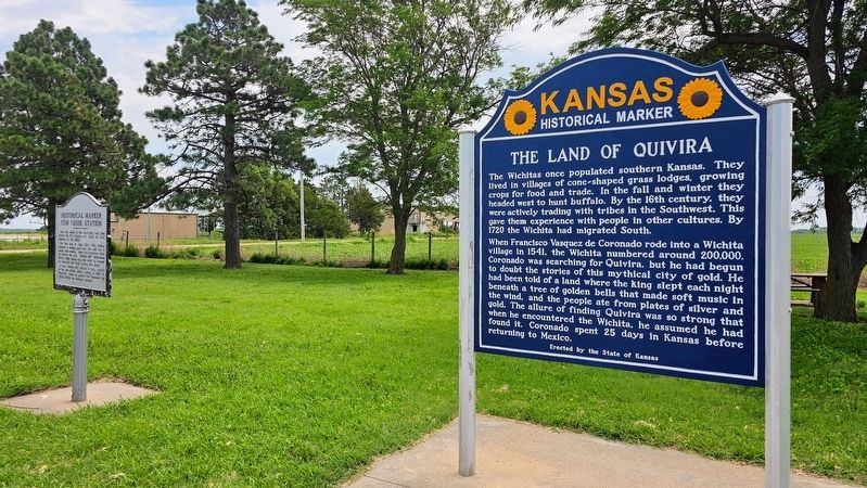
The Land of Quivira

Photographed by Ian Lefkowitz, June 28, 2023
1. The Land of Quivira Marker
The Wichitas once populated southern Kansas. They lived in villages of cone-shaped grass lodges, growing crops for food and trade. In the fall and winter they headed west to hunt buffalo. By the 16th century, they were actively trading with tribes in the Southwest. This gave them experience with people in other cultures. By 1720 the Wichita had migrated South.
When Francisco Vasquez de Coronado rode into a Wichita village in 1541, the Wichita numbered around 200,000. Coronado was searching for Quivira, but he had begun to doubt the stories of this mythical city of gold. He had been told of a land where the king slept each night beneath a tree of golden bells that made soft music in the wind, and the people ate from plates of silver and gold. The allure of finding Quivira was so strong that when he encountered the Wichita, he assumed he had found it. Coronado spent 25 days in Kansas before returning to Mexico.
Erected by State of Kansas.
Topics and series. This historical marker is listed in these topic lists: Colonial Era • Indigenous Peoples and Communities • Religion & Religious Structures. In
this page online
Location. 38° 20.854′ N, 98° 16.571′ W. Marker is in Lyons, Kansas, in Rice County. It is on Avenue M near 12th Road. The marker is at a roadside rest area about three miles west of Lyons. Touch for map. Marker is in this post office area: Lyons KS 67554, United States of America. Touch for directions.

Regionally, this marker is in Central Kansas. It is also in the American Midwest, in the Corn Belt, on the prairies, on the Southern Plains, and on the Santa Fe Trail Corridor. Globally, it is in North America, the Western Hemisphere, the Western World, and the Anglosphere. Historically, it finds itself in what was once the Louisiana Purchase.
Other nearby markers. At least 8 other markers are within 10 miles of this marker, measured as the crow flies: Cow Creek Station (a few steps from this marker); Fray Juan de Padilla (within shouting distance of this marker); Rice County Historical Mural (approx. 3.9 miles away); Civil War and Veterans Memorial (approx. 3.9 miles away); Workman Park (approx. 4.1 miles away);

Photographed by Ian Lefkowitz, June 28, 2023
2. Father Padilla Cross
This cross marks the northernmost point of Coronado's expedition.
Another marker is no longer nearby. Coronado and Quivira (was here, next to this marker but has been permanently removed).
Photographed by Ian Lefkowitz, June 28, 2023
3. The Land of Quivira Marker
Credits. This page was last revised on July 6, 2025. It was originally submitted on March 26, 2025, by Ian Lefkowitz of New York, New York. This page has been viewed 335 times since then and 63 times this year. Photos: 1, 2, 3. submitted on March 26, 2025, by Ian Lefkowitz of New York, New York. • J. Makali Bruton was the editor who published this page.
