
Old Port of Montreal in Montréal, Québec — Central Canada (French-Canadian)
Porte d'entrée d'une autre époque
Vieux-Port
⎯⎯⎯
Gateway to a Different Time
Old Port

Photographed by Cosmos Mariner, May 21, 2024
1. Porte d'entrée d'une autre époque/Gateway to a Different Time Marker (north side)

Indispensables à cette époque, les remorqueurs sont ces petits bateaux puissants qui servent à guider, tirer, pousser et amarrer les navires qui entrent et sortent du port.
Gardez l'œil ouvert !
Fermé en novembre 1970, l'environnement du canal offre depuis sa réouverture à la navigation de plaisance en 2002 diverses aires de repos et d'appréciation de la vie urbaine!
Présent au Vieux-Port, le Daniel McAllister est le plus gros remorqueur conservé au Canada, ainsi que le deuxième plus ancien remorqueur de mer conservé dans le monde.
Symbols of their era, tugboats are small and powerful watercraft that helped guide, tug, push, and moor ships that transited through the port.
Keep an eye out!
The Canal was closed to shipping in November 1970 but reopened for pleasure boating in 2002 and now features rest areas from which to take in scenes of urban living.
The Daniel McAllister is the largest conserved tugboat in Canada and the second-oldest conserved oceangoing tugboat in the world. It calls the Old Port home.
Topics.
this page online
Location. 45° 30.073′ N, 73° 33.159′ W. Marker is in Montréal, Québec. It is in Old Port of Montreal. It can be reached from Rue Quai Alexandra just east of Rue de la Commune Ouest, on the right when traveling east. The marker is located on the Promenade du Vieux-Port, on the south side of the Grand Quay of the Port of Montréal. Touch for map. Marker is at or near this postal address: 200 Rue de la Commune Ouest, Montréal QC H2Y 4B2, Canada. Touch for directions.

Regionally, this marker is in Central Canada. Globally, it is in North America, the Western Hemisphere, and the Western World. Historically, it finds itself in what was once a British colony, the Viceroyalty of New France, the Haudenosaunee (Iroquois) Confederacy, and Rupert’s Land.
Other nearby markers. At least 8 other markers are within walking distance of this marker: Naissance du port moderne / Birth of a Modern Port (here, next to this marker); Luttes contre l'eau et la glace / Battle with Waters and Ice

Photographed by Cosmos Mariner, May 21, 2024
2. Porte d'entrée d'une autre époque/Gateway to a Different Time Marker (south side)
Related markers. Click here for a list of markers that are related to this marker. Vieux-Port/Old Port
Also see . . . Lachine Canal National Historic Site of Canada.
Excerpt: Lachine Canal National Historic Site of Canada is an early 19th-century canal, 14 kilometres in length, built to circumvent five kilometres of white water on the St. Lawrence River between Lachine and the old port on Montréal Island, at the level of(Submitted on March 29, 2025, by Cosmos Mariner of Cape Canaveral, Florida.)McGill street. It is now a recreational waterway running through the south-central part of the city of Montréal. In the 19th and 20th centuries, it played a role as the head of a canal network linking the heart of the continent to the Atlantic Ocean through the Great Lakes and St. Lawrence route. Predating the revolution of transportation at the beginning of the 19th century and associated with the first tentative attempts at canal building in the French Regime, the Lachine Canal also played a role in determining the industrial and commercial development of Montréal. It was one of the principal manufacturing centres in Canada from the beginning of the industrial revolution in the middle of the 19th century to the Second World War.Courtesy Musée McCord Museum3. Marker detail: Harbour view, from canal locks, Montréal, QC, about 1875Vue du port depuis les écluses, Montréal, QC, vers 1875
Photographer (copyist): Wm. Notman & Son Ltd. (1919-1954)


Courtesy Old Port of Montréal Corporation
4. Marker detail: Port view, from canal locks, 2023
Vue du port depuis les écluses, 2023
Provenance : Société du Vieux-Port de Montréal
Provenance : Société du Vieux-Port de Montréal

5. Marker detail: Western sector, near Silo 5
Secteur ouest, près du Silo 5
Source/Provenance :The Growth of a Great Port, 1927 — Port de Montréal
Source/Provenance :The Growth of a Great Port, 1927 — Port de Montréal
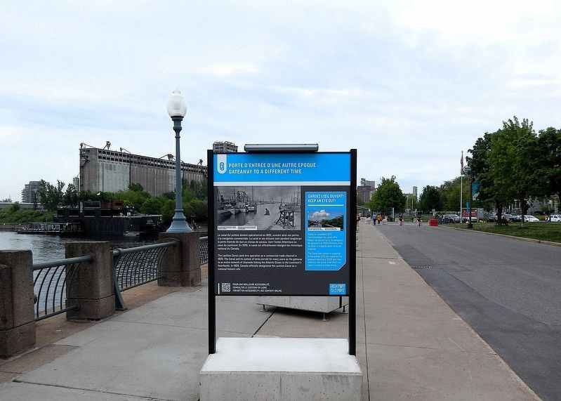
Photographed by Cosmos Mariner, May 21, 2024
6. Porte d'entrée d'une autre époque/Gateway to a Different Time Marker
Looking south along the Promenade du Vieux-Port.

Photographed by Cosmos Mariner, May 21, 2024
7. Porte d'entrée d'une autre époque/Gateway to a Different Time Marker
Looking north along the Promenade du Vieux-Port.

Photographed by Cosmos Mariner, May 21, 2024
8. Tugboat Daniel McAllister, Lachine Canal National Historic Site
It is on exhibit along the Promenade du Vieux-Port, about 350 meters south of this "Gateway to a Different Time" interpretive panel.
Credits. This page was last revised on April 5, 2025. It was originally submitted on March 27, 2025, by Cosmos Mariner of Cape Canaveral, Florida. This page has been viewed 124 times since then and 17 times this year. Photos: 1. submitted on March 28, 2025, by Cosmos Mariner of Cape Canaveral, Florida. 2, 3, 4, 5, 6, 7, 8. submitted on March 29, 2025, by Cosmos Mariner of Cape Canaveral, Florida.
