Menands in Albany County, New York — The American Northeast (Mid-Atlantic)
Schuyler Flatts in the French & Indian War
New York State French & Indian War Commemoration.
| — | Schuyler Flatts Cultural Park | — |

Photographed by Steve Stoessel, March 22, 2025
1. Schuyler Flatts in the French & Indian War Marker
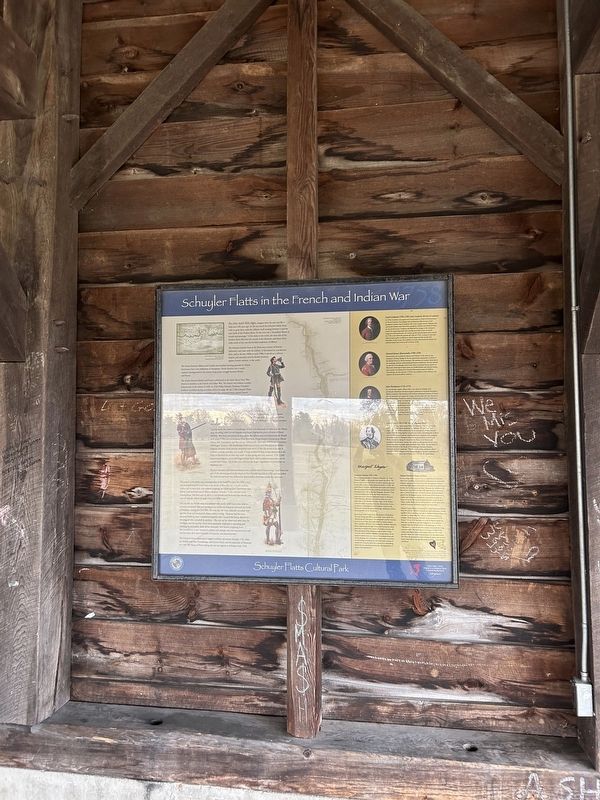
As you read this sign, imagine what the area was like a little over 250 years ago. To the east stood the Schuyler family home with its great barn, with the military road running between it and the west bank of the Hudson River. To the west was a "boundless liberty of woods and pasturage." A few miles to the north, the west side of the Hudson River flats met the mouth of the Mohawk, and about three miles south of you was the fortified settlement of Albany. The Schuyler family's farm at the Flatts was a center of frontier diplomacy and trade with the Indians. It functioned as a productive farm, and in the late 1600s to mid 1700s, it served as a military outpost and assembly area for British invasions against French territory to the north.
The forests between Albany and Canada were familiar hunting grounds for Native Americans, but a vast wilderness to Europeans. North America was a nearly constant battleground in the century-long power struggle between Britain and France. The rivalry between Britain and France culminated in the bitter Seven Years' War, known in America as the French and Indian War. The French and Indians
this page online
Both the British and the French recognized the Hudson River, Lake George and Lake Champlain as being a vital trade and military route. Situated between these two lakes was Fort Ticonderoga, which was critical to the control of the country. In March 1757. the French took control of Fort William Henry at the southern end of Lake George.
To prepare for the attack on Ticonderoga, Britain sent thousands of soldiers to the Albany area, including 5,000 British Regulars and Royal Highlanders plus a division of Royal Artillery. This force was quartered throughout the Albany area.
Photographed by Steve Stoessel, March 22, 2025
2. Schuyler Flatts in the French & Indian War Marker
The force headed north and assembled at the southern end of Lake George. Lord Howe led part of the advance guard in the attack on Fort Ticonderoga July 6, 1758, and was killed. The disheartened army was defeated in Abercromby's disastrous attack two days later.
The people at the Flatts were awaiting news of the battle. On July 7th 1758, a man was seen galloping furiously toward the house without his hat. A family
Photographed by Steve Stoessel, March 22, 2025
3. Schuyler Flatts in the French & Indian War Marker
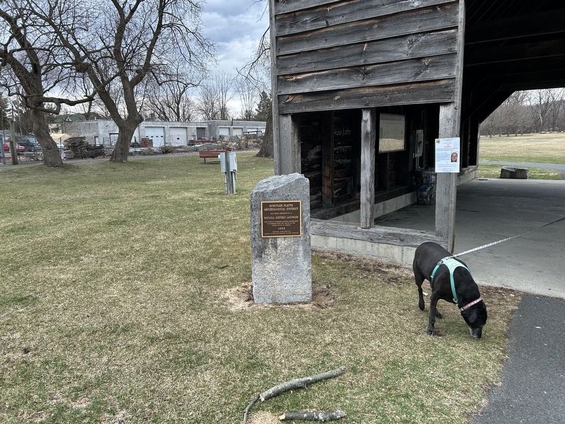
Marker is under the shelter.
On July 8th the British army was defeated with nearly 2,000 brave men dead or seriously wounded. This was the largest loss of life on American soil until the battle of Antietam during the Civil War. The next day, the most seriously wounded were put into boats and reached the Flatts before evening Madame had her barn instantly fitted up into a temporary hospital, and a room in her house allotted for the surgeon who attended the patients... She tore up her sheets and table linen for bandages, and she and her nieces were constantly employed in attending and cheering the wounded, while all her domestics were busied preparing food...." Her beneficence to the "wretched widows and orphans who had remained here and had lost their all in their husbands and parents, was beyond praise."
The Schuyler Flatts continued to support military operations through 1759, when the British took Fort Ticonderoga, and Crown Point, and the surrender of Montreal In 1760. The Treaty of Paris ending the war was signed on February 2nd, 1763.
Lord Loudoun 1705-1782 (John Campbell, 4th Earl of Loudoun)
In 1756, Loudoun was appointed Commander in Chief of British forces In North America. Proceeding with professional effectiveness, Lord Loudoun’s priority was to improve the army's supply system. Regular and provincial soldiers were better fed, equipped, clothed, and sheltered than in any previous year. Loudoun also applied his energy to the transport system by improving roads and creating specialized units of armed waggoneers and bateau men. As a result, goods and provisions were moved in 1758 at one third the expense per mile of 1756 -- a drop in costs that reflected great gains in efficiency, which improved the morale and discipline of the troops. His inability to work with provincial troops and colonial leaders led to his recall in March 1758.
General James Abercromby 1706-1781
Abercromby was Loudoun's deputy until March 1758, when at the insistence of King George II, he was appointed commander-in-chief of the British forces in North America. The ministry in London determined his campaign without understanding frontier conditions. He was ordered to take Fort Ticonderoga, and Crown Point to prepare for an assault on Montreal. Although he had a force of 15,000 British and colonial troops, Abercromby was defeated by General Montcalm's army of 3,600 at Ticonderoga. In late autumn 1758 he was recalled to Great Britain and replaced by General Jeffrey Amherst.
John Bradstreet 1714-1774
An unorthodox regular officer with a rare talent for dealing with provincials, Bradstreet served in support positions to Generals Braddock, Shirley, Loudoun, Abercromby, and Amherst enlisting hundreds of bateau men to transport and supply the troops. Just five days after the disaster at Fort Ticonderoga, Bradstreet induced Abercromby to detach 5,600 men to "distress the enemy' on Lake Ontario. In a daring attack, Bradstreet's force captured Fort Frontenac (present day Kingston, Ontario) on August 25th, thus cutting off French access to the Great Lakes. His strategic insight, persistence, and ingenuity helped to offset the disgrace of Fort Ticonderoga. Anne Grant said “The success of the expedition in Fort Frontenac, and the rising distinction of her nephew Philip, was some consolation to Madam Schuyler for the late disaster.”
Lord Howe 1725-1758 (George Augustus Howe)
The brave, young, and popular Brigadier Geneal, Lord Howe was the soul of the British force attacking Ticonderoga. He was loved and respected by his fellow soldiers and set an example of effective frontier warfare by forbidding displays of gold and scarlet, shortening bis uniform coat, blackening gun barrels, wearing protective loggings, and cropping his stylish long hair. Madame Schuyler was particularly fond of Lord Howe. On the morning the force left the Flatts, Lord Howe took breakfast with Madame stating, "he would not disappoint her, as it was hard to say when he might again breakfast with a lady." He was killed in the first skirmish at the Battle of Ticonderoga. Madame Schuyler mourned his death profusely. "The fall of this noble and brave officer" said Major Robert Roger of the famous Rangers. "Seemed to produce an almost general languor and consternation through the whole army."
Margarita Schuyler 1701-1782
She was known fondly as "Madame Schuyler" or 'Aunt Schuyler" to the many people who visited the Flatts. We have no known portrait of her; we have only her signature on her will, written shortly before her death in 1782. She spoke Dutch, English, and French and could read German. She was acquainted with the customs and opinions of the Mohawks and could speak their language. Because of her social and diplomatic skills, the Flatts remained an important center after her husband's death in February, 1758. She was well informed and her skills were very important to the British war effort. Most of the British military leaders, including Generals Abercromby, Howe, Loudoun, and Bradstreet, were frequent visitors at the Flatts and enjoyed the great knowledge, diplomacy, advice, and hospitality of the Schuylers.
Anne Grant said: *I came into the presence of Madame. She was sitting; and filled a great chair, from which she seldom moved. Her aspect was composed, and her manner such as was, at first, more calculated to inspire respect. than conciliate affection. Not having the smallest solicitude about what people thought of her, and having her mind generally occupied with matters of weighty concern, the first expression of her kindness seemed rather a lofty courtesy, than attractive affability; but she shone out by degrees; and she was sure eventually to please every one worth pleasing, her conversation was so rich, so various, so informing everything she said bore such a stamp of reality: her character had such a grasp in it. Everything about her was calculated to increase the impression of respect and admiration."
Madam Schuyler's Home and Barn
*It was a large brick house of two, or rather three stories (for there were excellent attics) besides a sunk story, finished with exactest neatness. The lower floor had no spacious rooms, with large light closets (windows); on the first there, were three rooms, and in the upper one four. Through the middle of the house was a very wide passage with opposite front and back doors, which in summer admitted a stream of air peculiarly grateful to the languid senses. At the back of the house was a smaller and lower one (addition), so joined as to make the form of a cross. The house fronted the river, on the brink of which, under shades of cim and sycamore, ran the great road towards Saratoga, Stillwater, and the northern lakes..."
Schuyler's great barn is mentioned in several book and diaries from the period. The barn housed not only cattle and a threshing floor, but it was large enough to shelter visiting Indians and was used to shelter families who survived the massacre at German Flatts along the Mohawk in the summer of 1757.
From 1755 to 1759 the barn was used to shelter troops on their way to the front, and for religious services and as a hospital after the British defeat at Ticonderoga in 1758. *This barn [...] was of vast size, at least a hundred feet long and sixty wide. The roof rose to a very great height in the midst, and sloped down till it came within ten feet of the ground, when the walls commenced(…) It was raised three feet from the ground by beams resting on stones and on these beams were laid in the middle of the building, a very massive oak floor."
Much of the information here has been taken from Anne Grant’s book “Memoir of an American Lady” first printed in London in 1808. For several years as a young child she lived at the Flatts with Margarita Schuyler, more commonly called Madam Schuyler.”
Erected by Town of Colonie.
Topics. This historical marker is listed in these topic lists: Colonial Era • War, French and Indian. A significant historical date for this entry is February 2, 1763.
Location. 42° 42.399′ N, 73° 42.622′ W. Marker is in Menands, New York, in Albany County. It can be reached from the intersection of Schuyler lane and Second Avenue, on the right when traveling south. Marker is under the shelter at the parking for Schuyler Flatts Park which a short distance off of Broadway. Touch for map. Marker is in this post office area: Watervliet NY 12189, United States of America. Touch for directions.

Regionally, this marker is in Upstate New York, in the Capital District, and in the Albany Metropolitan Area. It is also in the American Northeast and in the Mid-Atlantic. Globally, it is in North America, the Western Hemisphere, the Western World, and the Anglosphere. Historically, it finds itself in what was once New Netherland and also one of the original Thirteen Colonies.
Other nearby markers. At least 8 other markers are within walking distance of this marker: Schuyler Flatts Cultural Park (a few steps from this marker); Schuyler Flatts (a few steps from this marker); The Old Schuyler Burying Ground (about 400 feet away, measured in a direct line); Meneely Bell From St. Brigid's Church (about 500 feet away); The Colonial & Revolutionary Wars (about 500 feet away); Arent van Curler & Fr. Isaac Jogues at the Flatts in 1643 (about 500 feet away); a different marker also named Schuyler Flatts (about 700 feet away); The Native People (approx. 0.2 miles away). Touch for a list and map of all markers in Menands.
Also see . . . French & Indian War (Wikipedia). (Submitted on March 29, 2025, by Steve Stoessel of Niskayuna, New York.)
Credits. This page was last revised on July 15, 2025. It was originally submitted on March 29, 2025, by Steve Stoessel of Niskayuna, New York. This page has been viewed 251 times since then and 38 times this year. Photos: 1, 2, 3. submitted on March 29, 2025, by Steve Stoessel of Niskayuna, New York.
