Coolidge in Pinal County, Arizona — The American Mountains (Southwest)
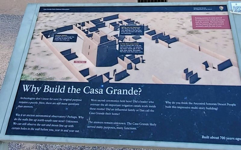
Why Build the Casa Grande?
Casa Grande Ruins National Monument
Photographed by Ian Lefkowitz, August 31, 2022
1. Why Build the Casa Grande? Marker
Was it an ancient astronomical observatory? Perhaps. Why do the walls line up north-south-east-west? Unknown. We can still observe the sun and moon line up with certain holes in the wall before you, year in and year out.
Were sacred ceremonies held here? Did a leader who oversaw the all-important irrigation canals work inside these rooms? Did an influential family or clan call the Casa Grande their home?
The answers remain unknown. The Casa Grande likely served many purposes, many functions.
Why do you think the Ancestral Sonoran Desert People built this impressive multi-story building?
Built about 700 years ago
Erected by National Park Service/U.S. Department of the Interior.
Topics. This historical marker is listed in these topic lists: Anthropology & Archaeology • Architecture • Indigenous Peoples and Communities.
Location. 32° 59.661′ N, 111° 32.267′ W. Marker is in Coolidge, Arizona, in Pinal County. It is on West
this page online

Regionally, this marker is in the Sonoran Desert, in the Phoenix Metropolitan Area, in the San Carlos Apache Nation, and specifically in the Tohono O’odham Nation. It is also in the American Southwest. Globally, it is in North America, the Western Hemisphere, the Western World, and the Anglosphere. Historically, it finds itself in what was once New Spain and also Mexico’s Alta California.
Other nearby markers. At least 8 other markers are within 9 miles of this marker, measured as the crow flies: Disrespected, Then Protected (within shouting distance of this marker); Stephen Tyng Mather (about 400 feet away, measured in a direct line); Those Who Are Gone (approx. one mile away); The Coolidge Woman's Club (approx. 1½ miles away); Ghost Town of Adamsville (approx. 5½ miles away); Granville H. Oury (approx. 7.8 miles away); Chas. D. Poston (approx. 8.6 miles away); George-Brockway House (approx. 8.8 miles away). Touch for a list and map of all markers in Coolidge.
Photographed by Ian Lefkowitz, August 31, 2022
2. The Casa Grande
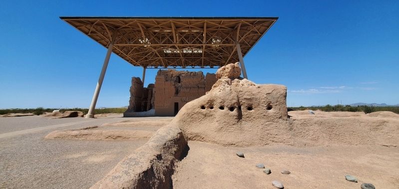
The Casa Grande, or Siwan Wa'a Ki, was built by the Ancestral Sonoran Desert People known today as the Hohokam.
Credits. This page was last revised on April 1, 2025. It was originally submitted on March 29, 2025, by Ian Lefkowitz of New York, New York. This page has been viewed 176 times since then and 45 times this year. Photos: 1. submitted on March 29, 2025, by Ian Lefkowitz of New York, New York. 2. submitted on March 30, 2025, by Ian Lefkowitz of New York, New York. • Andrew Ruppenstein was the editor who published this page.
