
Eagle Pass in Maverick County, Texas — The American South (West South Central)
Fort Duncan

Photographed by Mansfieldphoto.com, February 9, 2025
1. Fort Duncan Marker
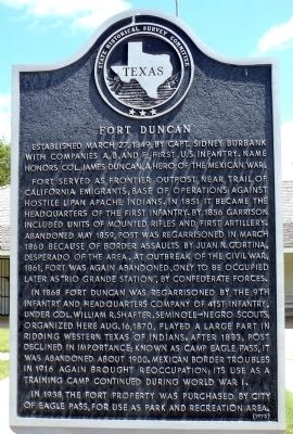
Established March 27, 1849, by Capt. Sidney Burbank with companies A, B, and F, First U.S. Infantry. Name honors Col. James Duncan, a hero of the Mexican War.
Fort served as frontier outpost near trail of California emigrants; base of operations against hostile Lipan Apache Indians. In 1851 it became the headquarters of the First Infantry. By 1856 garrison included units of Mounted Rifles and First Artillery. Abandoned May 1859, post was regarrisoned in March 1860 because of border assaults by Juan N. Cortina, desperado of the area. At outbreak of the Civil War, 1861, fort was again abandoned, only to be occupied later as “Rio Grande Station,” by Confederate forces.
In 1868 Fort Duncan was regarrisoned by the 9th Infantry and Headquarters Company of 41st Infantry, under Col. William R. Shafter. Seminole-Negro Scouts, organized here Aug. 16, 1870, played a large part in ridding western Texas of Indians. After 1883, post declined in importance; known as Camp Eagle Pass, it was abandoned about 1900. Mexican border troubles in 1916 again brought reoccupation; its use as a training camp continued during World War I.
In 1938 the fort property was purchased by City of Eagle Pass, for use as park and recreation area.
Erected 1970 by State Historical Survey Committee. (Marker Number 14217.)
Topics. This historical marker is listed in these topic lists: African Americans • Forts and Castles • Hispanic Americans • Indigenous Peoples and Communities. A significant historical date for this entry is March 27, 1849.
Location. 28° 42.148′ N, 100° 30.173′ W. Marker is in Eagle Pass, Texas, in Maverick County. It is at the intersection of Bliss Street and Shafter St, on the left when traveling east on Bliss Street. The marker is directly in front of the post headquarters building and museum. Touch for map.
this page online

Regionally, this marker is in the Hill Country. Globally, it is in North America, a Gulf of Mexico state, the Western Hemisphere, the Western World, and the Anglosphere. Historically, it finds itself in what was once New Spain, the Republic of Texas, and one of the Confederate States of America.
Other nearby markers. At least 7 other markers are within 4 miles of this marker, measured as the crow flies: A different marker also named Fort Duncan (about 400 feet away, measured in a direct line); Fort Duncan Infantry Barracks (about 800 feet away); Eagle Pass C.S.A. (approx. 0.4 miles away); Maverick County (approx. 0.4 miles away); Maverick County Courthouse (approx. 0.4 miles away); Eagle Pass Post Office (approx. 0.4 miles away); Eagle Pass Coal Mines (approx. 3.7 miles away).
Photographed by William F Haenn, June 8, 2012
2. Fort Duncan Marker
Photographed by William F Haenn, June 8, 2012
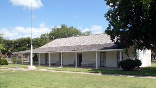
3. Fort Duncan Post Headquarters Building and Museum
Marker is directly in front of this building.
Photographed by William F Haenn, June 8, 2012
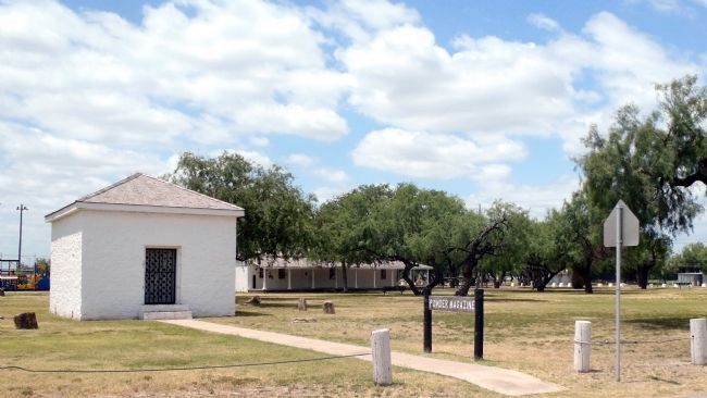
4. Fort Duncan Powder Magazine with the Commanding Officer's Qtrs in the distance
View is directly across the street from the marker location.
Photographed by William F Haenn, June 8, 2012
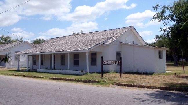
5. Fort Duncan Commissary Building
Clearly visible only 100 yds from the marker location.
Credits. This page was last revised on June 23, 2025. It was originally submitted on June 9, 2012, by William F Haenn of Fort Clark (Brackettville), Texas. This page has been viewed 1,079 times since then and 37 times this year. Last updated on March 29, 2025, by Jeff Leichsenring of Garland, Texas. Photos: 1. submitted on June 23, 2025, by James Hulse of Medina, Texas. 2, 3, 4, 5. submitted on June 9, 2012, by William F Haenn of Fort Clark (Brackettville), Texas. • James Hulse was the editor who published this page.
