Old Port of Montreal in Montréal, Québec — Central Canada (French-Canadian)
Transformation Vieux-Port en site récréotouristique
Vieux-Port
⎯⎯⎯
Old Port Transformed into Recreational Tourism
Old Port
Photographed by Cosmos Mariner, May 21, 2024
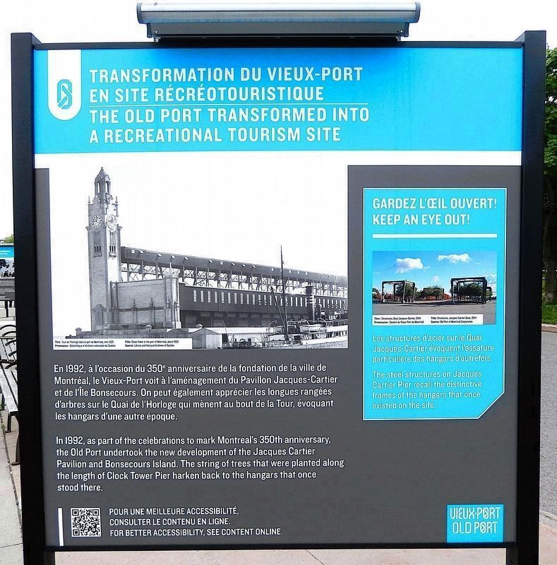
1. Transformation Vieux-Port en site récréotouristique/Port Transformed Marker (north side)

Gardez l'œil ouvert !
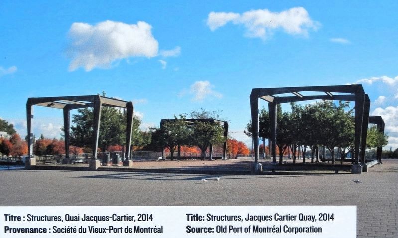
Les structures d'acier sur le Quai Jacques-Cartier évoquent l'ossature particulière des hangars d'autrefois.
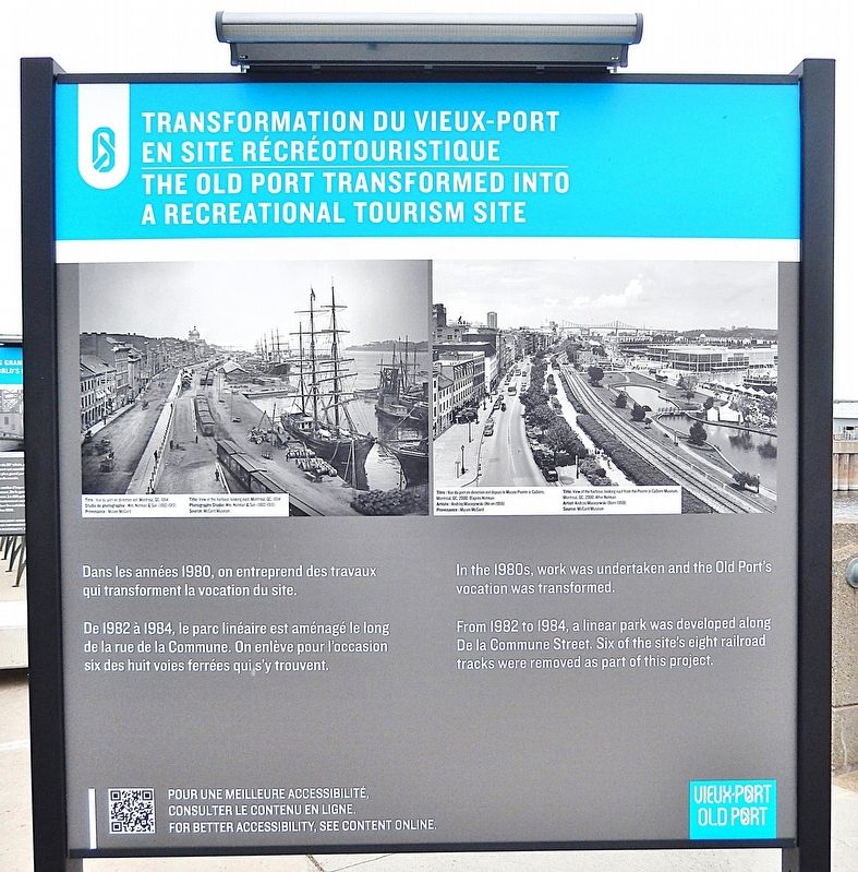
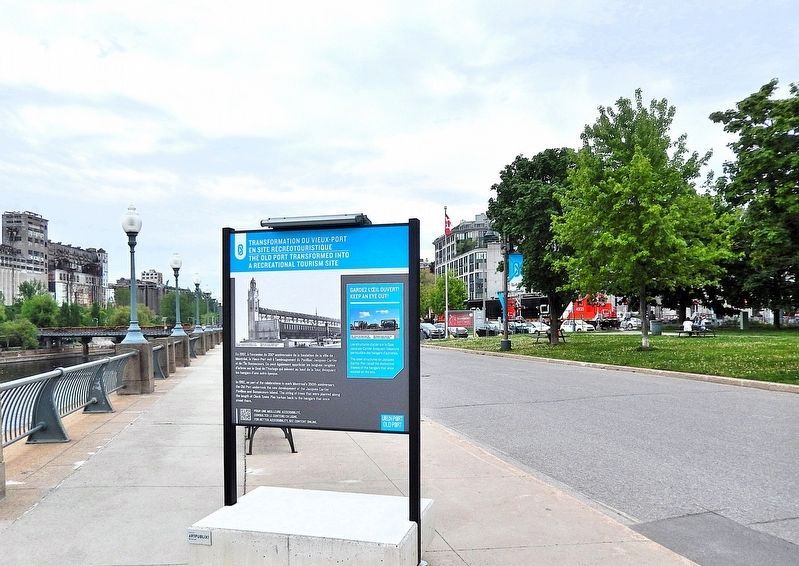
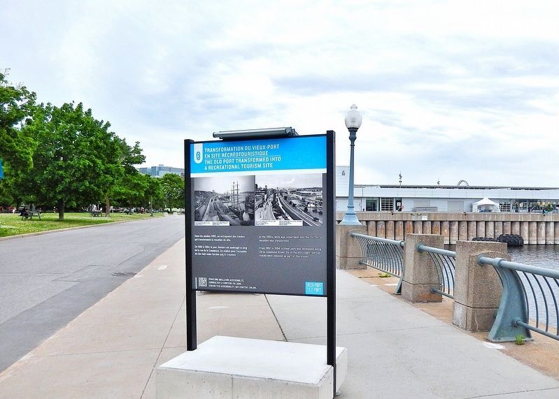
Dans les années 1980, on entreprend des travaux qui transforment la vocation du site.
De 1982 à 1984, le parc linéaire est aménagé le long de la rue de la Commune. On enlève pour l'occasion six des huit voies ferrées qui s'y trouvent.
Keep an eye out!
The steel structures on Jacques Cartier Pier recall the distinctive frames of the hangars that once existed
this page online
In the 1980s, work was undertaken and the Old Port's vocation was transformed.
From 1982 to 1984, a linear park was developed along De la Commune Street. Six of the site's eight railroad tracks were removed as part of this project.
Topics. This historical marker is listed in these topic lists: Architecture • Parks & Recreational Areas • Waterways & Vessels. A significant historical year for this entry is 1992.
Location. 45° 30.062′ N, 73° 33.156′ W. Marker is in Montréal, Québec. It is in Old Port of Montreal. It can be reached from Rue Quai Alexandra just east of Rue de la Commune Ouest, on the right when traveling east. The marker is located on the Promenade du Vieux-Port, on the south side of the Grand Quay of the Port of Montréal. Touch for map. Marker is at or near this postal address: 200 Rue de la Commune Ouest, Montréal QC H2Y 4B2, Canada. Touch for directions.

Regionally, this marker is in Central Canada. Globally, it is in North America, the Western Hemisphere, and the Western World. Historically, it finds itself in what was once a British colony, the Viceroyalty of New France, the Haudenosaunee
Photographed by Cosmos Mariner, May 21, 2024
2. Transformation Vieux-Port en site récréotouristique/Port Transformed Marker (south side)
Other nearby markers. At least 8 other markers are within walking distance of this marker: Le plus grand port céréalier du monde / The World's Largest Grain Port (here, next to this marker); Naissance du port moderne / Birth of a Modern Port (here, next to this marker); Lieu de commémoration / Commemorative Site (a few steps from this marker); a different marker also named Transformation Vieux-Port en site récréotouristique / Old Port Transformed into Recreational Tourism (a few steps from this marker); a different marker also named Naissance du port moderne / Birth of a Modern Port (a few steps from this marker); Arrondissement Historique / Historic District (a few steps from this marker); Porte d'entrée d'une autre époque / Gateway to a Different Time (a few steps from this marker); Luttes contre l'eau et la glace / Battle with Waters and Ice (within shouting distance of this marker). Touch for a list and map of all markers in Montréal.
Related markers. Click here for a list of markers that are related to this marker. Vieux-Port/Old Port
Library and National Archives of Québec
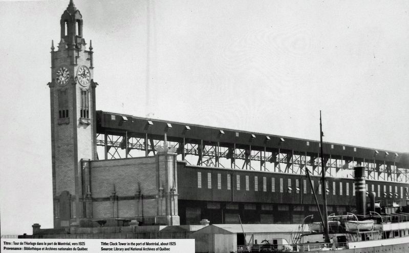
3. Marker detail: Clock Tower in the port of Montréal, about 1925
Tour de l'Horloge dans le port de Montréal, vers 1925
Provenance : Bibliotheque et Archives nationales du Québec
Provenance : Bibliotheque et Archives nationales du Québec
Courtesy OId Port of Montréal Corporation
4. Marker detail: Structures, Jacques Cartier Quay, 2014
Structures, Quai Jacques-Cartier, 2014
Provenance : Société du Vieux-Port de Montréal
Provenance : Société du Vieux-Port de Montréal
Courtesy Musée McCord Museum
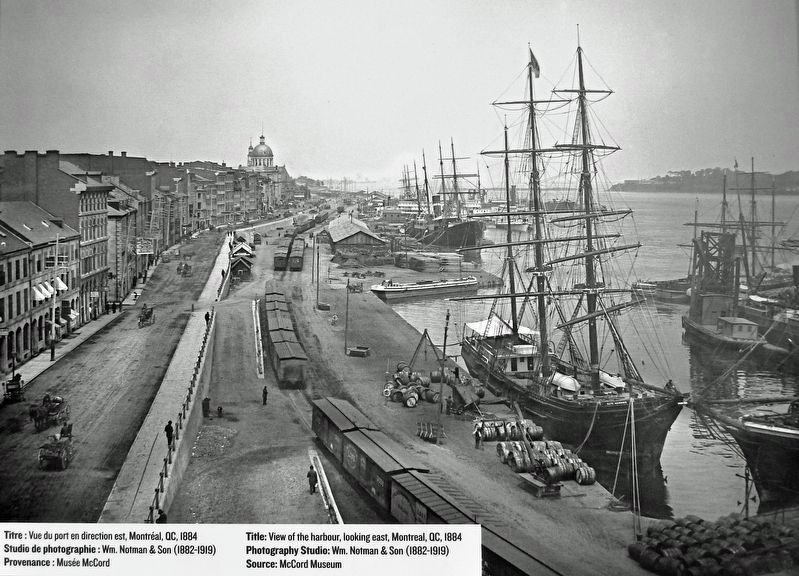
5. Marker detail: View of the harbour, looking east, Montreal, QC, 1884
Vue du port en direction est, Montréal, QC, 1884
Studio de photographie : Wm. Notman & Son (1882-1919)
Studio de photographie : Wm. Notman & Son (1882-1919)
Courtesy Musée McCord Museum
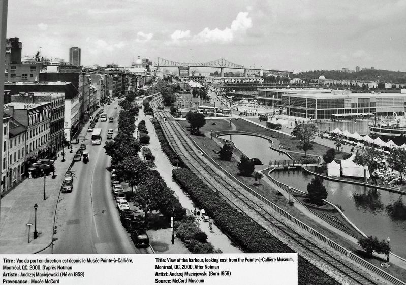
6. Marker detail: View of the harbour, looking east from Pointe-à-Callière Museum, Montréal, QC, 2000
Vue du port en direction est depuis le Musée Pointe-à-Callière, Montréal, QC, 2000.
Artist/Artiste : Andrzej Maciejewski (Born/Né en 1959)
Artist/Artiste : Andrzej Maciejewski (Born/Né en 1959)
Photographed by Cosmos Mariner, May 21, 2024
7. Transformation Vieux-Port en site récréotouristique/Port Transformed to Recreational Tourism Marker
Looking south along the Promenade du Vieux-Port.
Photographed by Cosmos Mariner, May 21, 2024
8. Transformation Vieux-Port en site récréotouristique/Port Transformed to Recreational Tourism Marker
Looking north along the Promenade du Vieux-Port.
Credits. This page was last revised on April 5, 2025. It was originally submitted on March 30, 2025, by Cosmos Mariner of Cape Canaveral, Florida. This page has been viewed 143 times since then and 32 times this year. Photos: 1, 2, 3, 4, 5, 6, 7, 8. submitted on April 1, 2025, by Cosmos Mariner of Cape Canaveral, Florida.
