
Charlottetown in Queens County, Prince Edward Island — The Atlantic Provinces (North America)
The Old Protestant Burying Ground
⎯⎯⎯
L'ancien cimetière protestant
1784-1873
Photographed by Cosmos Mariner, July 16, 2019
1. The Old Protestant Burying Ground / L'ancien cimetière protestant Marker

[English]
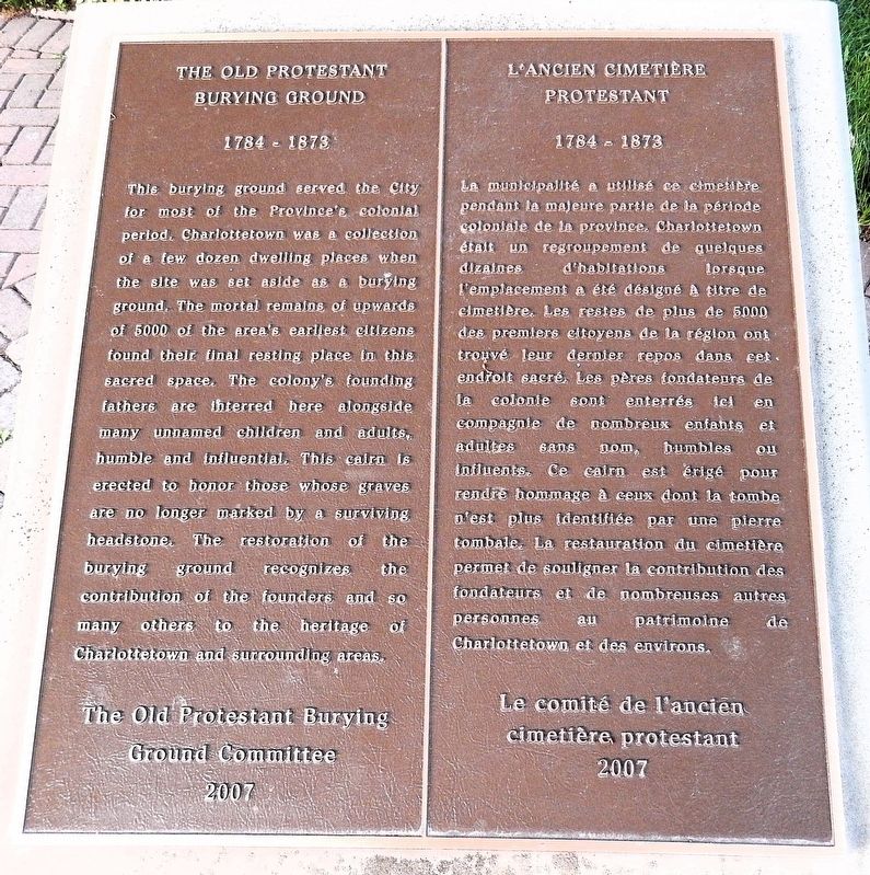
This burying ground served the City for most of the Province’s colonial period. Charlottetown was a collection of a few dozen dwelling places when the site was set aside as a burying ground. The mortal remains of upwards of 5000 of the area’s earliest citizens found their final resting place in this sacred space. The colony’s founding fathers are interred here alongside many unnamed children and adults, humble and influential. This cairn is erected to honor those whose graves are no longer marked by a surviving headstone. The restoration of the burying ground recognizes the contribution of the founders and so many others to the heritage of Charlottetown and surrounding areas.
La municipalité a utilisé ce cimetière pendant la majeure partie de la période coloniale de la province. Charlottetown était un regroupement de quelques dizaines d'habitations lorsque l’emplacement a été désigné à titre de cimetière. Les restes de plus de 5000 des premiers citoyens de la région ont trouvé leur dernier repos dans cet endroit sacré. Les pères fondateurs de la colonie sont enterrés ici en compagnie
this page online
Erected 2007 by The Old Protestant Burying Ground Committee / Le comité de l'ancien cimetière protestant.
Topics. This historical marker is listed in these topic lists: Cemeteries & Burial Sites • Colonial Era • Religion & Religious Structures • Settlements & Settlers. A significant historical year for this entry is 1784.
Location. 46° 14.398′ N, 63° 7.854′ W. Marker is in Charlottetown, Prince Edward Island, in Queens County. It is at the intersection of University Avenue and Douglas Street, on the right when traveling north on University Avenue. The marker is located just inside the wrought iron fence along University Avenue, on the west side of the cemetery. Touch for map. Marker is at or near this postal address: 260 University Avenue, Charlottetown PE C1A 4M1, Canada. Touch for directions.

Regionally,
Photographed by Cosmos Mariner, July 16, 2019
2. The Old Protestant Burying Ground / L'ancien cimetière protestant Marker
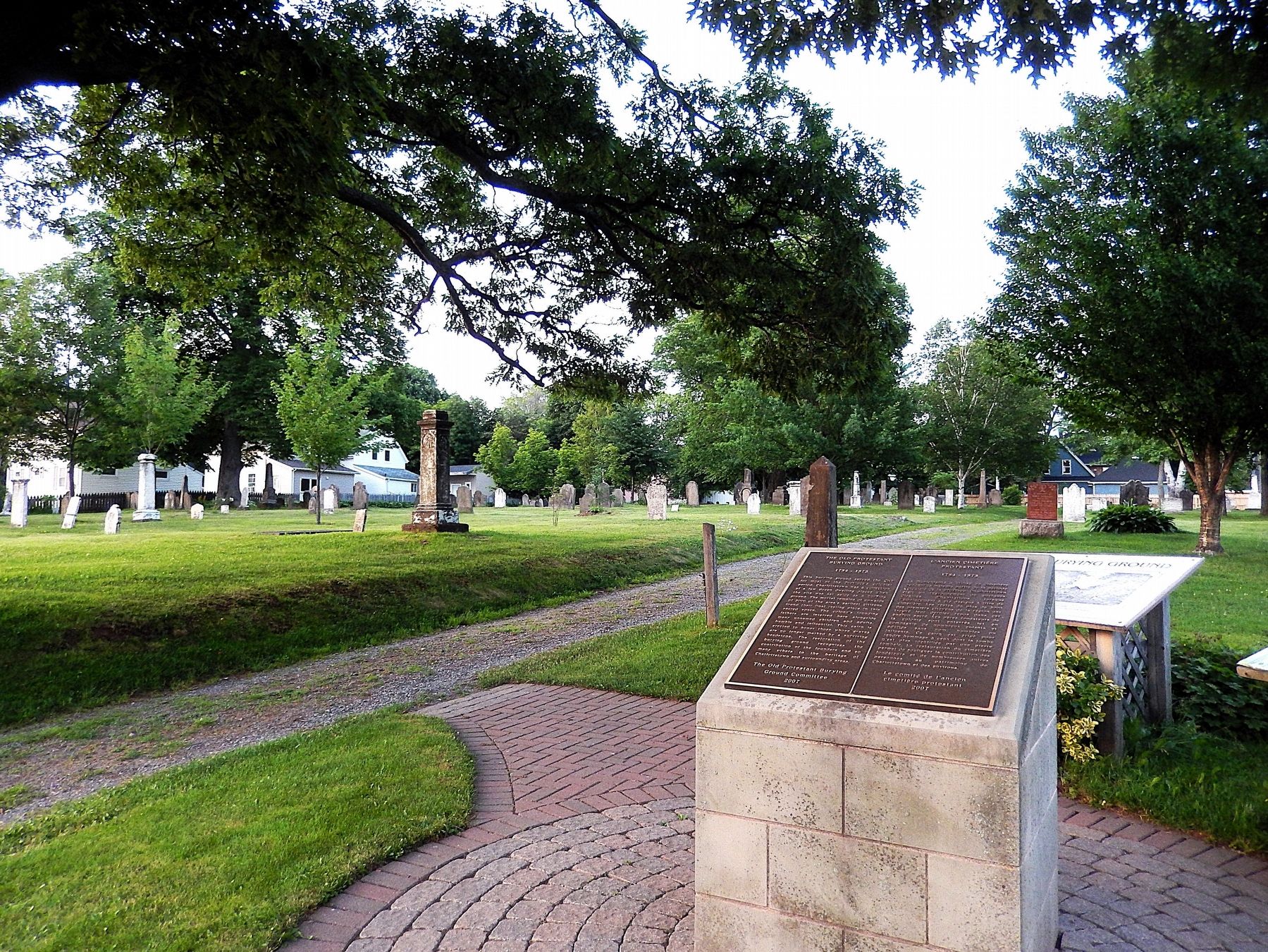
Looking northeast from University Avenue across the cemetery.
Other nearby markers. At least 8 other markers are within walking distance of this marker: The Old Protestant Burying Ground (here, next to this marker); Fairholm (approx. 0.4 kilometers away); Charlottetown City Hall (approx. half a kilometer away); Big Donald (approx. 0.6 kilometers away); Charlottetown (approx. 0.6 kilometers away); Canadian National Hotels (approx. 0.6 kilometers away); The Prince Edward Island Memorial Fountain / Fontaine Commémorative de l'Île-du-Prince-Èdouard (approx. 0.6 kilometers away); Prince Edward Island War Memorial (approx. 0.6 kilometers away). Touch for a list and map of all markers in Charlottetown.
Regarding The Old Protestant Burying Ground / L'ancien cimetière protestant.
Listed on the Canadian Register of Historic Places (1999/07/01). From the Canadian Register Statement of Significance:
A very old site, the cemetery holds the remains of some of Charlottetown's most prominent citizens. It is a valuable source of information about many of Charlottetown's early inhabitants - many of whom shaped the history of the City and the Province. The following character-defining elements contribute to the heritage value of the Old Protestant Burying Ground: the location of the graveyard on University Avenue; its size and borders; the size, placement, carvings and inscriptions of the grave markers; the road that runs down the centre of the graveyard; the treed lot and the decorative iron fence surrounding the grounds.
Related markers. Click here for a list of markers that are related to this marker. The Old Protestant Burying Ground
Also see . . . Old Protestant Burying Ground (Canada Register of Historic Places).
Excerpt: Although consecrated and deeded to St Paul's Anglican Church in 1826, the Old Protestant Burying Ground was used by a number of Protestant denominations, as it was the only cemetery in operation at the time, apart from the Roman Catholic Cemetery. The first known burial in 1789 was of Isabella Bell, the wife of Sergeant George Bell of the 21st Grenadiers. This head stone remains today. The last burial was that of Mrs. Archibald MacNeill, who was placed in the sepulcher in December 1872. Approximately one year later, 1 January 1874, the cemetery was ordered closed by law.(Submitted on April 4, 2025, by Cosmos Mariner of Cape Canaveral, Florida.)It has been estimated that the Old Protestant Burying Ground holds the remains of up to 4000 people. Vandalism, years of neglect and the ravages of time have been hard on the site and sadly, original markers were lost. However, in recent years, a local group has painstakingly restored the old cemetery as a millennium preservation project. It was rededicated in a service held in August 2000. Improvements made to the site include: the location and repair of grave markers; the addition of a beautiful iron fence; and the erection of signage. The area is now well maintained and has become a park like place which encourages visitors to learn local history by reading the interpretive signage.
Credits. This page was last revised on November 9, 2025. It was originally submitted on April 3, 2025, by Cosmos Mariner of Cape Canaveral, Florida. This page has been viewed 130 times since then and 25 times this year. Photos: 1, 2. submitted on April 4, 2025, by Cosmos Mariner of Cape Canaveral, Florida.
