Orangeburg in Orangeburg County, South Carolina — The American South (South Atlantic)
Pioneer Graveyard
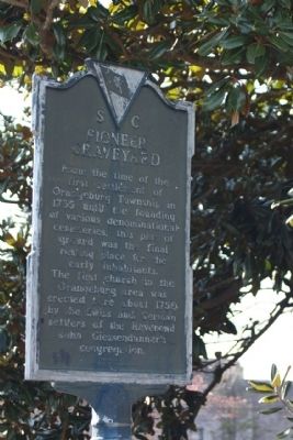
Photographed by Mike Stroud, 2010
1. Pioneer Graveyard Marker
Erected 1970 by South Carolina Department of Archives and History, sponsored by The City of Orangeburg. (Marker Number 38-11.)
Topics and series. This historical marker is listed in these topic lists: Cemeteries & Burial Sites • Colonial Era • Settlements & Settlers. In addition, it is included in the South Carolina Historical Markers series list. A significant historical year for this entry is 1735.
Location. 33° 29.538′ N, 80° 52.08′ W. Marker is in Orangeburg, South Carolina, in Orangeburg County. It is on Bull Street (State Road 38-1061), on the right when traveling west. Located between Middleton Street and Broughton Street (US 21, US 178), on the grounds of the "Old Dixie Club Library". Touch for map. Marker is in this post office area: Orangeburg SC 29115, United States of America. Touch for directions.

Regionally, this marker is in the Lowcountry and in Santee Cooper Country. It is also in the American South and specifically in the Deep South. Globally, it is in North America, the Western Hemisphere, the Western World, and the Anglosphere. Historically, it finds itself in what was once the territory of the Mississippian Culture, one of the original Thirteen Colonies, one of the Confederate States of America, and the Antebellum South.
Other nearby markers. At least 8 other markers are within walking distance of this marker: Old Dixie Club Library (within shouting distance of this marker); Jewish Merchants / Jewish Life (approx.
this page online
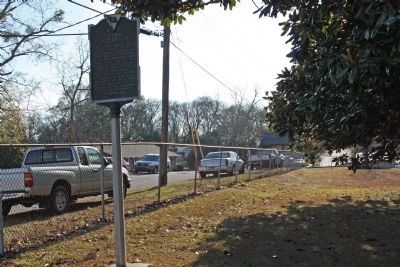
Photographed by Mike Stroud, January 3, 2010
2. Pioneer Graveyard Marker, as seen along Bull Street, looking southwest
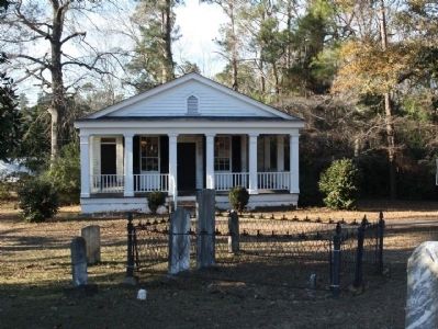
Photographed by Mike Stroud, January 3, 2010
3. Pioneer Graveyard , shares location with "The Old Dixie Club Library"
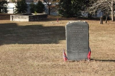
Photographed by Mike Stroud, January 3, 2010
4. Pioneer Graveyard - U.D.C. Memorial
The Confederate Dead
Buried In This Plot
Lieut. George Elliott
Thomas A. Elliott
Drury Gardner
Joseph Larey
George Larey
Marsden Larey
W. Fordham McKewn
J.Wesley Smoak
Daniel Joyner
William Corror
Several Texans and Other
Unknown Heroes
— • —
Erected by Paul McMichael
Chapter, U.D.C.
1928
Photographed by Mike Stroud, January 3, 2010
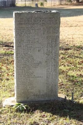
5. Pioneer Graveyard
and other Death Records of
unmarked graves in this plot
[ List of 41 Names from
Dorothy Moorer Feb. 24, 1749
thru
Agnus Roth Mar. 25, 1758 ]
Photographed by Mike Stroud, January 3, 2010
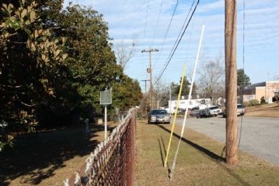
6. Pioneer Graveyard Marker, looking Northeast along Bull Street
Credits. This page was last revised on January 25, 2026. It was originally submitted on January 28, 2010, by Mike Stroud of Bluffton, South Carolina. This page has been viewed 2,053 times since then and 92 times this year. Photos: 1, 2, 3, 4, 5, 6. submitted on January 28, 2010, by Mike Stroud of Bluffton, South Carolina. • Bill Pfingsten was the editor who published this page.
