Split Rock Lighthouse State Park near Beaver Bay in Lake County, Minnesota — The American Midwest (Upper Plains)
Welcome to Split Rock River Wayside Rest
Photographed by McGhiever, January 26, 2025
1. Welcome to Split Rock River Wayside Rest Marker
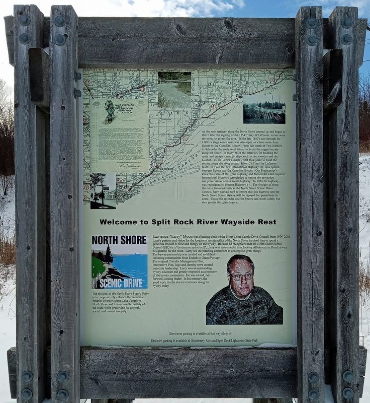
As the new territory along the North Shore opened up and began to thrive after the signing of the 1854 Treaty of LaPointe, so too were the needs to access the area. In the late 1880's and through the 1890's a stage coach road was developed as a land route from Duluth to the Canadian Border. From just north of Two Harbors to Schroeder the route went inland to avoid the rugged terrain along the shore. In many cases the materials for building the roads and bridges came by ships such as the America and the Goldish. In the 1920's a major effort took place to build the section along the shore around Silver Cliff and the Lafayette bluff. In 1926 the new International Highway, #1, was opened between Duluth and the Canadian Border. Our Predecessor's [sic] knew the value of this great highway and formed the Lake Superior International Highway Association to ensure the protection and preservation of this scenic highway. In 1934 the highway was redesigned to become Highway 61. The forsight [sic] of those that have followed, such as the North Shore Scenic Drive Council, have worked hard to ensure that this highway and the North Shore
this page online
Lawrence "Larry" Moon was founding chair of the North Shore Scenic Drive Council from 1999-2005. Larry's passion and vision for the long term sustainability of the North Shore inspired him to spend a generous amount of time and energy on the byway. Because he recognized that the North Shore Scenic Drive (NSSD) is a "destination unto itself", Larry was instrumental in achieving All-American Road byway designation for the route. Larry led the planning committee to accomplish great things. The byway partnership was created and solidified including communities from Duluth to Grand Portage. The original Corridor Management Plan, Interpretive Plan, logo and identity were created under his leadership. Larry was an outstanding byway advocate and greatly respected as a member of the byway community. He was a kind, fair, forward-looking leader. In his memory, the good work that he started continues along the byway today.
The mission of the North Shore Scenic Drive is to cooperatively enhance the
Photographed by McGhiever, January 26, 2025
2. Welcome to Split Rock River Wayside Rest Marker
Extended parking is available at Gooseberry Falls and Split Rock Lighthouse State Park
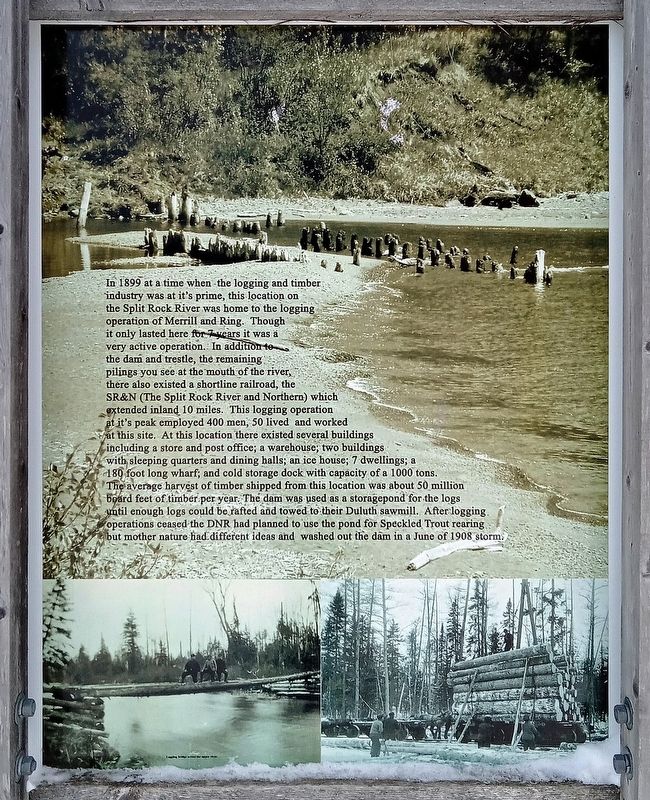
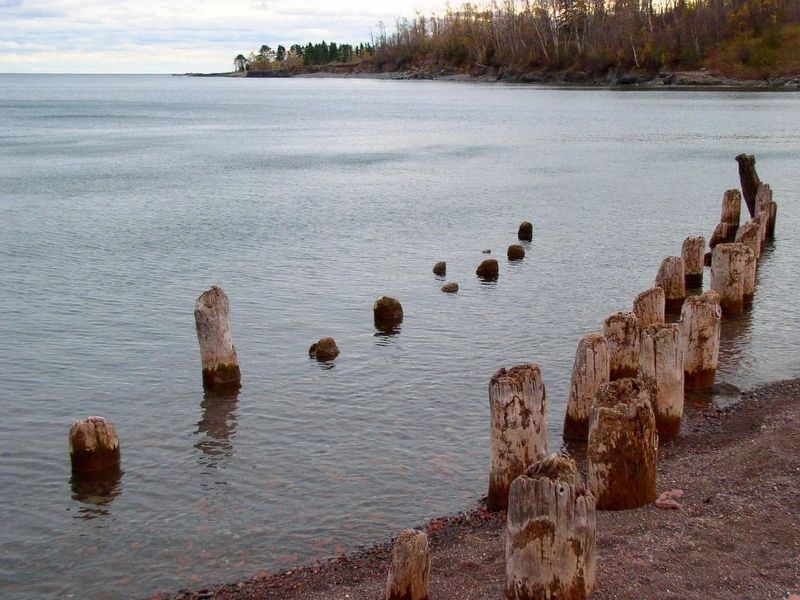
In 1899 at a time when the logging and timber industry was at it's [sic] prime, this location on the Split Rock River was home to the logging operation of Merrill and Ring. Though it only lasted here for 7 years it was a very active operation. In addition to the dam and trestle, the remaining pilings you see at the mouth of the river, there also existed a shortline railroad, the SR&N (The Split Rock River and Northern) which extended inland 10 miles. This logging operation at it's [sic] peak employed 400 men, 50 lived and worked at this site. At this location there existed several buildings including a store and post office; a warehouse; two buildings with sleeping quarters and dining halls; an ice house; 7 dwellings; a 180 foot long wharf; and cold storage dock with capacity of a 1000 tons. The average harvest of timber shipped
Photographed by McGhiever, January 26, 2025
3. Marker at the Split Rock River Wayside Rest
Erected by North Shore Scenic Drive Council.
Topics. This historical marker is listed in these topic lists: Industry & Commerce • Parks & Recreational Areas • Railroads & Streetcars • Roads & Vehicles. A significant historical year for this entry is 1880.
Location. 47° 10.923′ N, 91° 24.57′ W. Marker is near Beaver Bay, Minnesota, in Lake County. It is in Split Rock Lighthouse State Park. It is on Minnesota Route 61, on the left when traveling north. Touch for map. Marker is at or near this postal address: 2437 Highway 61, Two Harbors MN 55616, United States of America. Touch for directions.

Regionally, this marker is in the Arrowhead Region, in the Iron Range, and in the North Shore. It is also in the American Midwest and in the Corn Belt. Globally,
Photographed by McGhiever, October 14, 2011
4. Remains of the pilings at the beach across the highway
Other nearby markers. At least 8 other markers are within 3 miles of this marker, measured as the crow flies: A Split Rock Mystery... (approx. 1.4 miles away); View of the Lighthouse (approx. 1.8 miles away); Geology of Minnesota (approx. 1.8 miles away); Dock Site and Pumphouse (approx. 2.2 miles away); Tramway (approx. 2.3 miles away); Little Two Harbors (approx. 2.3 miles away); Lighthouse (approx. 2.4 miles away); Fog Signal (approx. 2.4 miles away). Touch for a list and map of all markers in Beaver Bay.
Credits. This page was last revised on August 12, 2026. It was originally submitted on April 4, 2025, by McGhiever of Minneapolis, Minnesota. This page has been viewed 250 times since then and 73 times this year. Photos: 1, 2, 3, 4. submitted on April 4, 2025, by McGhiever of Minneapolis, Minnesota.
