Como in Minneapolis in Hennepin County, Minnesota — The American Midwest (Upper Plains)
About Como Neighborhood
| — | Minneapolis Diagonal Trail | — |
Photographed by McGhiever, February 7, 2025
1. About Como Neighborhood Marker obverse
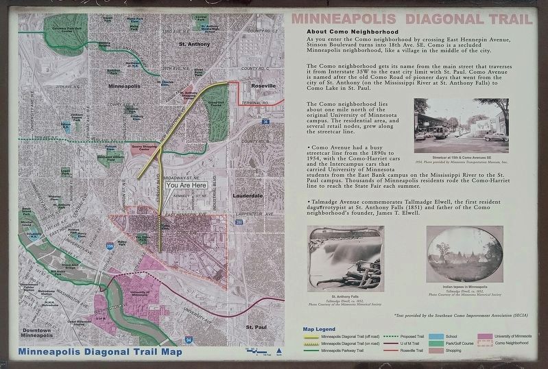
As you enter the Como neighborhood by crossing East Hennepin Avenue, Stinson Boulevard turns into 18th Ave. SE. Como is a secluded Minneapolis neighborhood, like a village in the middle of the city.
The Como neighborhood gets its name from the main street that traverses it from Interstate 35W to the east city limit with St. Paul. Como Avenue is named after the old Como Road of pioneer days that went from the city of St. Anthony (on the Mississippi River at St. Anthony Falls) to Como Lake in St. Paul.
The Como neighborhood lies about one mile north of the original University of Minnesota campus. The residential area, and several retail nodes, grew along the streetcar line.
1954, Photo provided by Minnesota Transportation Museum, Inc.
• Como Avenue had a busy streetcar line from the 1890s to 1954, with the Como-Harriet cars and the Intercampus cars that carried University of Minnesota students from the East Bank campus on the Mississippi River to the St. Paul campus. Thousands of Minneapolis residents rode the Como-Harriet line to reach the State Fair each summer.
• Talmadge
this page online
Tallmadge Elwell, ca. 1852.
Photo Courtesy of the Minnesota Historical Society
Indian tepees in Minneapolis
Tallmadge Elwell, ca. 1852.
Photo Courtesy of the Minnesota Historical Society
[reverse]
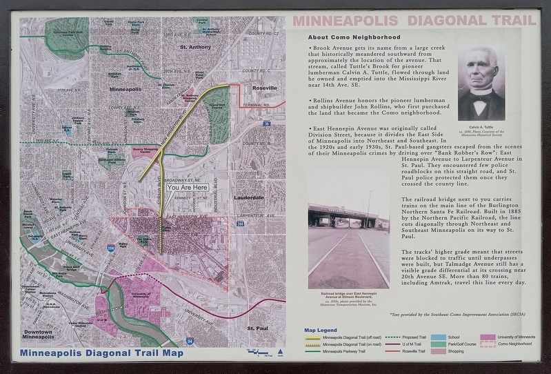
• Brook Avenue gets its name from a large creek that historically meandered southward from approximately the location of the avenue. That stream, called Tuttle's Brook for pioneer lumberman Calvin A. Tuttle, flowed through land he owned and emptied into the Mississippi River near 14th Ave SE.
ca. 1880, Photo Courtesy of the Minnesota Historical Society
• Rollins Avenue honors the pioneer lumberman and shipbuilder John Rollins, who first purchased the land that became the Como neighborhood.
• East Hennepin Avenue was originally called Division Street, because it divides the East Side of Minneapolis into Northeast and Southeast. In the 1920s and early 1930s, St. Paul-based gangsters escaped from the scenes of their Minneapolis
Photographed by McGhiever, February 7, 2025
2. About Como Neighborhood Marker reverse
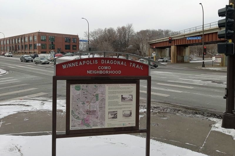
The railroad bridge next to you carries trains on the main line of the Burlington Northern Santa Fe Railroad. Built in 1885 by the Northern Pacific Railroad, the line cuts diagonally through Northeast and Southeast Minneapolis on its way to St. Paul.
The tracks' higher grade meant that streets were blocked to traffic until underpasses were built, but Talmadge Avenue still has a visible grade differential at its crossing near 20th Avenue SE. More than 80 trains, including Amtrak, travel this line every day.
ca. 1950s, photo provided by the Minnesota Transportation Museum, Inc.
*Text provided by the Southeast Como Improvement Association (SECIA)
Topics. This historical marker is listed in these topic lists: Law Enforcement • Railroads & Streetcars • Roads & Vehicles • Settlements & Settlers. A significant historical year for this entry is 1890.
Location. 44° 59.475′ N,
Photographed by McGhiever, February 7, 2025
3. About Como Neighborhood Marker at the southeast corner of Hennepin & Stinson

Regionally, this marker is in the Twin Cities Metropolitan Area. It is also in the American Midwest, in the Corn Belt, and in the Great River Road Region. Globally, it is in North America, the Western Hemisphere, the Western World, and the Anglosphere. Historically, it finds itself in what was once Rupert’s Land, the territory of the Mississippian Culture, and the Louisiana Purchase.
Other nearby markers. At least 8 other markers are within one mile of this marker, measured as the crow flies: About Mid-City Industrial Area (within shouting distance of this marker); Minneapolis Diagonal Trail (approx. 0.6 miles away); Northeast Park Neighborhood (approx. 0.9 miles away); Home of Alpha Phi (approx. 0.9 miles away); Beltrami Park (approx. one mile away); Maple Hill Cemetery (approx. one mile away); The Quarry (approx. one mile away); University of Minnesota Spanish-American War Memorial (approx. one mile away). Touch for a list and map of all markers in Minneapolis.
Credits. This page was last revised on April 5, 2025. It was originally submitted on April 5, 2025, by McGhiever of Minneapolis, Minnesota. This page has been viewed 228 times since then and 62 times this year. Photos: 1, 2, 3. submitted on April 5, 2025, by McGhiever of Minneapolis, Minnesota.
