Adamana in Apache County, Arizona — The American Mountains (Southwest)
Jasper Forest
Photographed by Denise Boose, September 2, 2013
1. Jasper Forest Marker
Photo Caption:
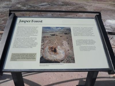
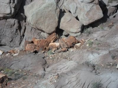
Logs of red jasper have tumbled from the bluffs to rest in Jasper Forest.
Logs of red jasper have tumbled from the bluffs to rest in Jasper Forest.
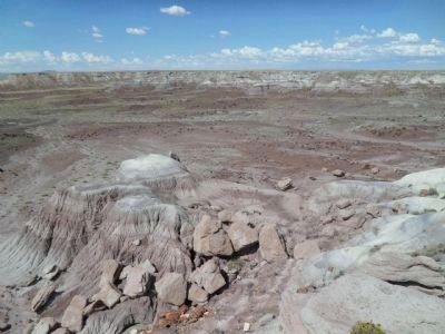
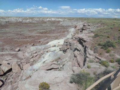
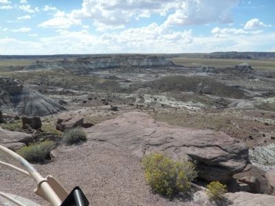
The petrified wood strewn in the valley below was once encased in the bluffs around you. When erosional forces removed the softer rocks, the petrified wood tumbled and accumulated on the valley floor. Once filled with fallen logs, Jasper Forest was plundered in the late 19th and early 20th centuries by commercial collectors seeking petrified wood to sell as souvenirs.
Completion of the nearby railway line in 1882 provided early travelers – and relic hunters – easy access to Jasper Forest. Many tons of Jasper Forest’s petrified wood were carried away, piece by piece, in railway cars. Outrage against Jasper Forest’s devastation contributed to the establishment of Petrified Forest as a National Monument in 1906.
“Wood thieves” once carried out petrified wood by wagon, buggy, and cart, sometimes using dynamite to break large logs into smaller pieces to expose hidden crystals. A mill to grind petrified wood for abrasives was built at the nearby railroad settlement of Adamana in 1892. Though the mill never operated, the appetite for commercial spoils remained.
“…we had filled our hats with chips….Reached Forest #1 [Jasper] about noon, resorted our collections…Oh such a time as we did have deciding which part of the forest to leave and which part to pack out.”
-fromthe diary of Grace Spradling, 1917, recording her hike from Adamana through the petrified forests. Although these areas were then protected by Petrified Forest National Monument, travelers continued to remove petrified wood.
Click or scan to see
this page online
Federal law prohibits the removal of any petrified wood, other fossils, or artifacts from these protected lands. Stiff penalties will be imposed upon violators.
Erected by National Park Service, U.S. Department of the Interior.
Topics. This historical marker is listed in these topic lists: Natural Features • Natural Resources • Notable Events. A significant historical year for this entry is 1882.
Location. Marker has been reported permanently removed. It was located near 34° 53.335′ N, 109° 48.447′ W. Marker was in Adamana, Arizona, in Apache County. It could be reached from Jasper Forest Road, on the left when traveling west. Turn left onto Jasper Forest Road from Petrified Forest Road. Touch for map. Marker was in this post office area: Petrified Forest Natl Pk AZ 86028, United States of America.
We have been informed that this marker is no longer there and will not be replaced. This page is an archival view of what was.
Regionally,
Photographed by Denise Boose, September 2, 2013
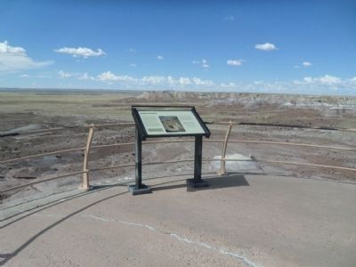
2. Jasper Forest Marker

Other nearby markers. At least 8 other markers are within 5 miles of this location, measured as the crow flies: First Impressions (here, next to this marker); Agate Bridge (approx. 0.8 miles away); From Wood to Stone (approx. 1.9 miles away); When Crystal Forest Was a Forest (approx. 2 miles away); Pioneers of Paleontology (approx. 4.1 miles away); a different marker also named Pioneers of Paleontology (approx. 4.2 miles away); Metoposaur Genesis Supreme (approx. 4.6 miles away); The Funky Worm (approx. 4.7 miles away). Touch for a list and map of all markers in Adamana.
Another marker is no longer nearby. Triassic Landscape (was approx. 2 miles away but has been replaced with another marker now near it).
Photographed by Denise Boose, September 2, 2013
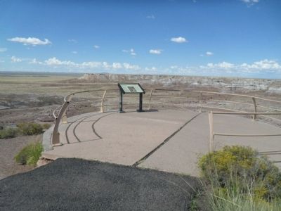
3. Jasper Forest Marker
Photographed by Denise Boose, September 2, 2013
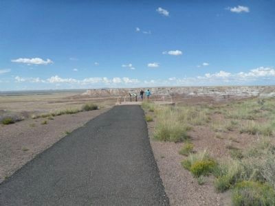
4. Trail to the Marker
Photographed by Denise Boose, September 2, 2013
5. The Valley Below the Marker
Photographed by Denise Boose, September 2, 2013
6. Valley Below the Marker
Photographed by Denise Boose, September 2, 2013
7. Valley Below the Marker
Photographed by Denise Boose, September 2, 2013
8. Petrified Wood
Credits. This page was last revised on April 8, 2025. It was originally submitted on September 28, 2013, by Denise Boose of Tehachapi, California. This page has been viewed 996 times since then and 52 times this year. Last updated on April 6, 2025, by Ian Lefkowitz of New York, New York. Photos: 1, 2, 3, 4, 5, 6, 7, 8. submitted on September 28, 2013, by Denise Boose of Tehachapi, California. • Devry Becker Jones was the editor who published this page.
