Dublin's Docklands in County Dublin, Leinster, Ireland — Mid-East (and Dublin)
Dublin Docklands Landmarks

Photographed by William Fischer, Jr., April 3, 2025
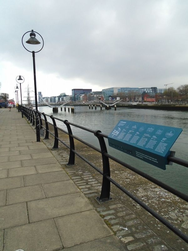
1. Dublin Docklands Landmarks Marker
The Dublin Docklands comprises 520 hectares of land on the north and south banks of the River Liffey.
THE DIVING BELL
①950m←
Just a short walk from here stands the recently refurbished Diving Bell. Designed by prestigious engineer Bindon Blood Stoney (1828-1907), The Diving Bell was a ground-breaking piece of engineering innovation used in the building of Dublin Port's quay walls from the Victorian era right up until 1958. Today, visitors can walk through the structure's interior to learn about its history.
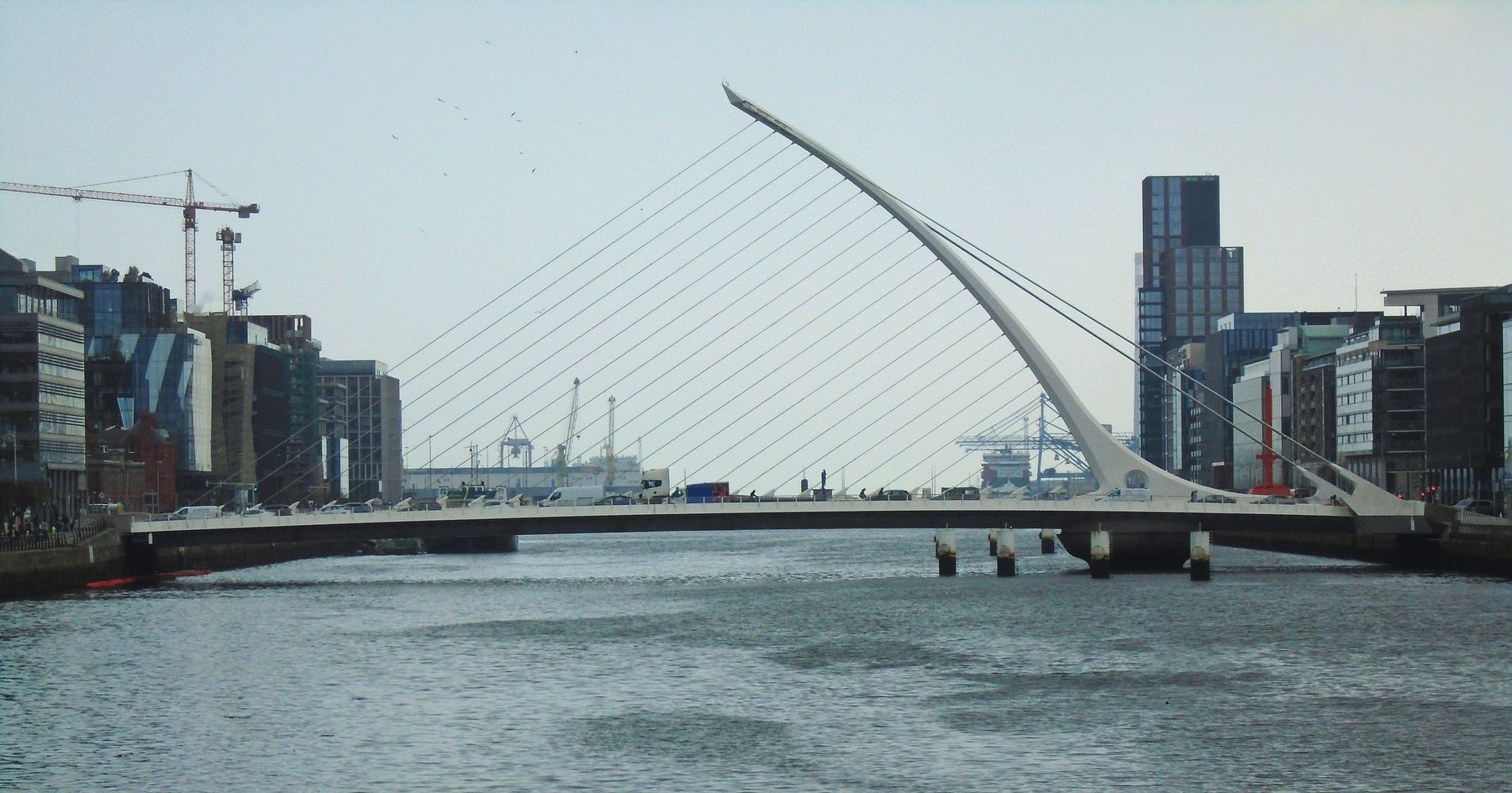
SAMUEL BECKETT BRIDGE
②650m←
Designed by the internationally acclaimed architect and engineer Santiago Calatrava, the Samuel Beckett Bridge has become an iconic feature of the Dublin skyline. The cable stay bridge is capable of rotating a full 90 degrees to accommodate maritime traffic on the River Liffey. Its curved pylon produces a dramatic shape giving the appearance of a harp lying on its side.
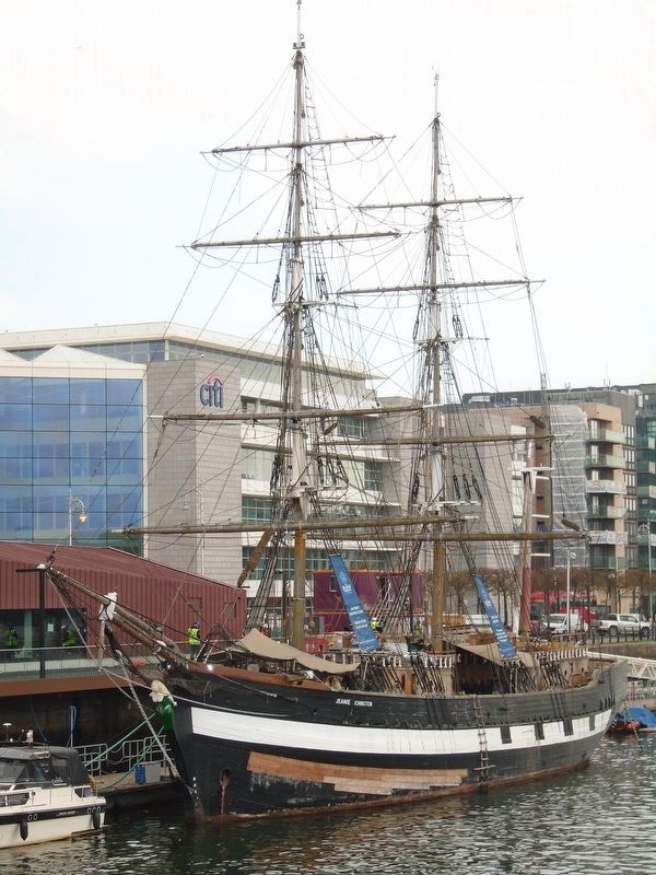
JEANIE JOHNSTON
③260m←
Berthed just beyond The chq Building and open daily for guided tours, the Jeanie Johnston is a replica famine ship. The original Jeanie Johnston built
this page online
EPIC THE IRISH EMIGRATION MUSEUM
④130m←
Designed by Scottish engineer John Rennie, The chq Building was built in 1817 to store valuable cargoes of tobacco, tea and spirits. Today CHQ is a vibrant recreation hub and home to one of Dublin's top attractions - EPIC The Irish Emigration Museum. EPIC tells the moving and unforgettable stories of those who left the island of Ireland and how they influenced and shaped the world.
FAMINE MONUMENT [see HMdb 269528]
⑤You Are Here
Designed and crafted by Dublin sculptor Rowan Gillespie, the Famine statues commemorate the Great Famine of the mid 19th century during which 1 million people died and a million more emigrated from Ireland. No event in history has had a more profound effect on Ireland and the worldwide Irish community than that of the Great Irish Famine (1845-1849).
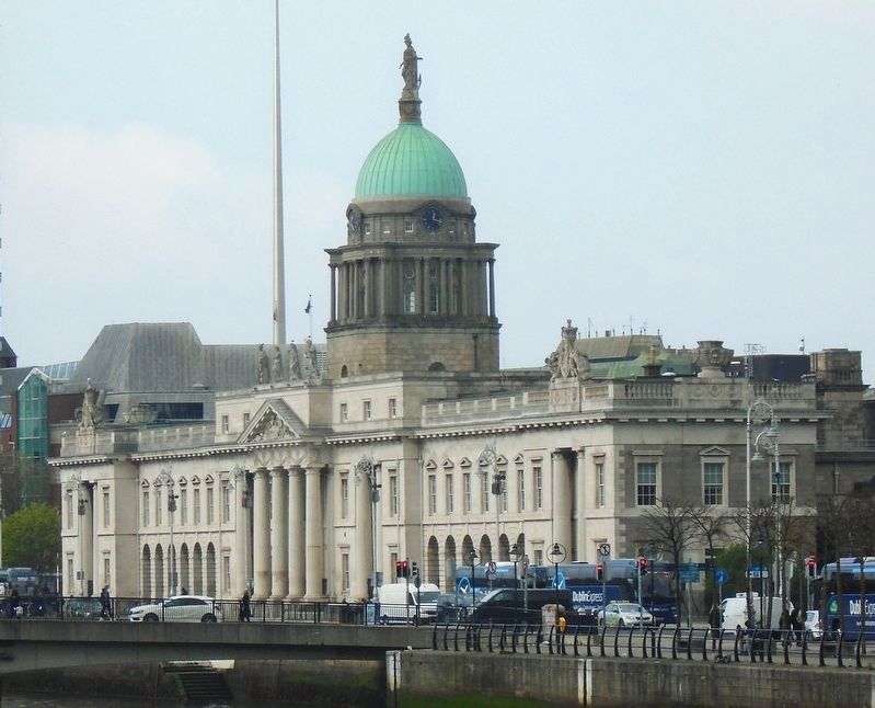
CUSTOM HOUSE
⑥200m→
Designed by James Gandon, it took 10 years
Photographed by William Fischer, Jr., April 3, 2025
2. Dublin Docklands Landmarks Marker
Explore this vibrant cultural landscape and discover stories of famine, trade, emigration and prosperity.
Topics. This historical marker is listed in these topic lists: Architecture • Immigration • Industry & Commerce • Waterways & Vessels. A significant historical year for this entry is 1847.
Location. 53° 20.879′ N, 6° 15.003′ W. Marker is in Dublin, Leinster, in County Dublin. It is in Dublin's Docklands. It is on Custom House Quay (Leinster Route 801) 0.2 kilometers west of the Sean O'Casey Bridge, on the left when traveling west. Touch for map. Marker is in this post office area: Dublin, Leinster D01 Y6C3, Ireland. Touch for directions.

Regionally, this marker is in the Ancient East. Globally, it is on the Atlantic Ocean, in the North Atlantic Region, in Europe, on the Island
Photographed by William Fischer, Jr., April 3, 2025
3. Samuel Beckett Bridge
Other nearby markers. At least 8 other markers are within walking distance of this marker: "Famine" (here, next to this marker); Great Irish Famine Victims and Their Canadian Descendants (here, next to this marker); National Famine Way (a few steps from this marker); Human Rights and Poverty Stone (within shouting distance of this marker); a different marker also named Human Rights and Poverty Stone (within shouting distance of this marker); Irish Seaman's National Memorial (about 180 meters away, measured in a direct line); Pairc Elizabeth O'Farrell Park (about 180 meters away); S.S. Adela (approx. 0.4 kilometers away). Touch for a list and map of all markers in Dublin.
Photographed by William Fischer, Jr., April 3, 2025
4. Famine Ship Jeanie Johnston (replica)
Photographed by William Fischer, Jr., April 3, 2025
5. Custom House
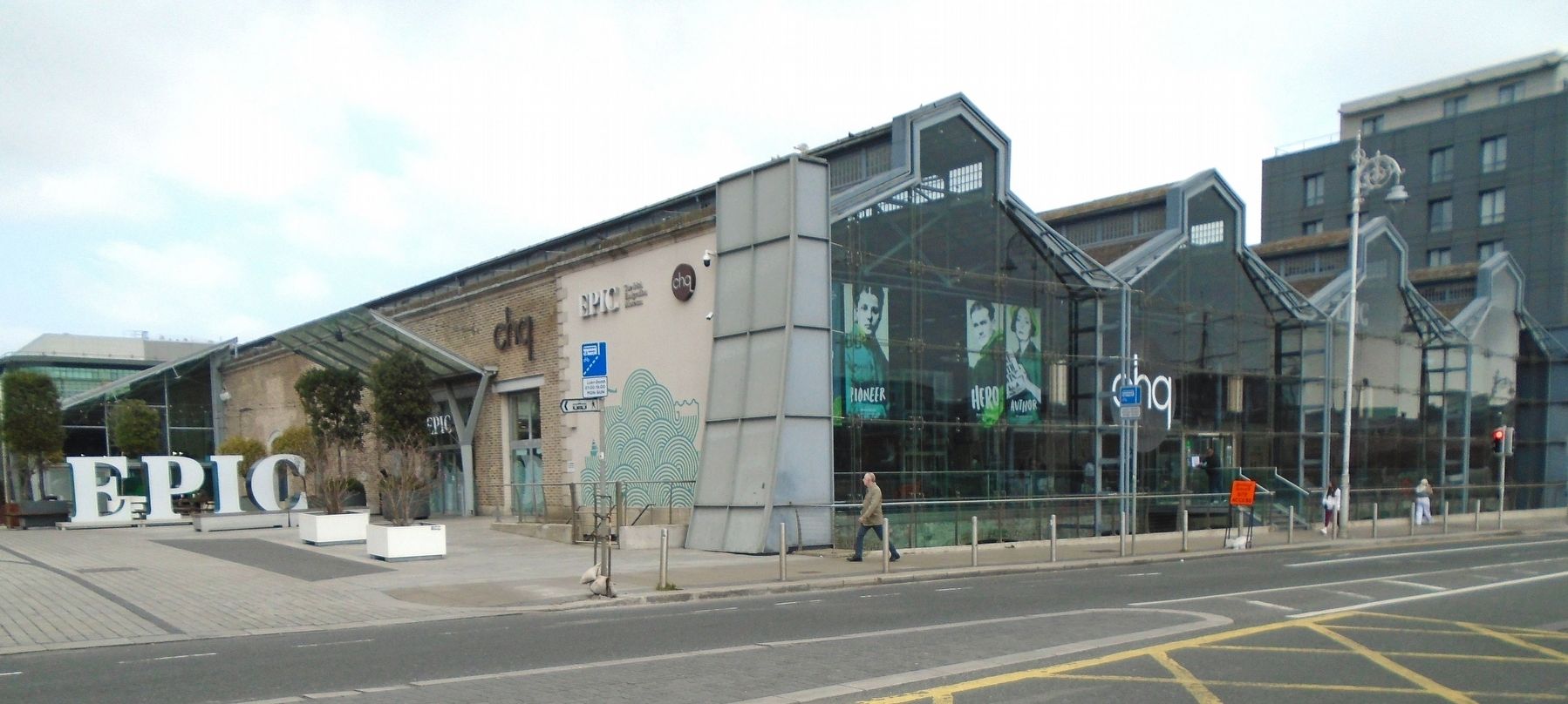
Photographed by William Fischer, Jr., April 3, 2025
6. EPIC Museum (chq Building)
Credits. This page was last revised on April 6, 2025. It was originally submitted on April 6, 2025, by William Fischer, Jr. of Reynoldsburg, Ohio. This page has been viewed 125 times since then and 36 times this year. Photos: 1, 2, 3, 4, 5, 6. submitted on April 6, 2025, by William Fischer, Jr. of Reynoldsburg, Ohio.
