Surfside Beach in Brazoria County, Texas — The American South (West South Central)
Old Velasco, CSA
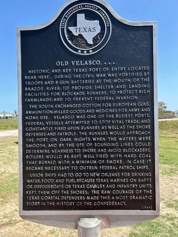
Photographed by Chris Kneupper, March 24, 2025
1. Old Velasco, CSA Marker
Historic and key Texas port of entry located near here. During the Civil War was fortified by troops and 8 gun batteries at the mouth of the Brazos River, to provide shelter and landing facilities for blockade runners; to protect rich farmlands; and to prevent Federal invasion.
The South exchanged cotton for European guns, ammunition, milled goods and medicines for army and home use. Velasco was one of the busiest ports. Federal vessels attempted to stop vital trade, and constantly fired upon runners as well as the shore defenses and patrols. The runners would approach the port on dark nights when the waters were smooth, and by the use of sounding lines could determine nearness to shore and avoid blockaders. Boilers would be kept well fired with hard coal that burned with a minimum of smoke, in case it became necessary to outrun Federal patrol ships.
Union ships had to go to New Orleans for drinking water, food and fuel, because Texas marines on rafts or dredgeboats or Texas cavalry and
this page online
Erected 1964 by Texas Historical Commission. (Marker Number 9607.)
Topics. This historical marker is listed in these topic lists: War, US Civil • Waterways & Vessels.
Location. 28° 56.518′ N, 95° 18.002′ W. Marker is in Surfside Beach, Texas, in Brazoria County. It is at the intersection of Monument Ave. and Parkview Road when traveling west on Monument Ave.. The marker is located just west of the southwest end of Monument Ave. in Surfside Beach, about 1 block southwest of Surfside city hall. Touch for map. Marker is at or near this postal address: 600 Parkview Road, Freeport TX 77541, United States of America. Touch for directions.

Regionally, this marker is in the Houston Metropolitan Area. It is also in the American South and on the Gulf Coast. Globally, it is in North America, a
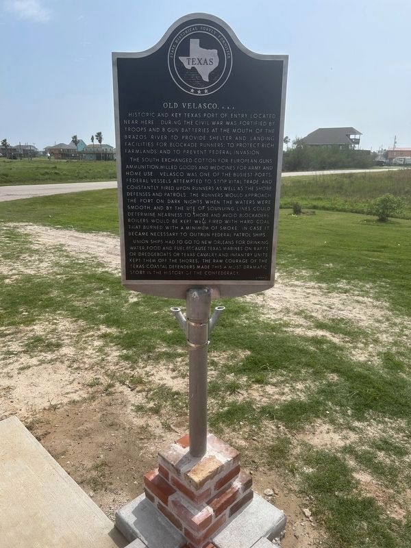
Photographed by Chris Kneupper, April 4, 2025
2. Old Velasco, CSA Marker
Other nearby markers. At least 8 other markers are within walking distance of this marker: Battle of Velasco Memorial (here, next to this marker); Velasco (a few steps from this marker); Historic Site of the Republic of Texas (a few steps from this marker); Brown-Hoskins Hotel and Tavern (within shouting distance of this marker); Santa Anna signed Treaties of Velasco (within shouting distance of this marker); First Republic of Texas Navy: 1835-1837 (within shouting distance of this marker); The Lively (about 300 feet away, measured in a direct line); Confederate Civil War Forts at Mouth of Brazos (about 400 feet away). Touch for a list and map of all markers in Surfside Beach.
More about this marker. This marker was removed from its prior location (GPS coordinates
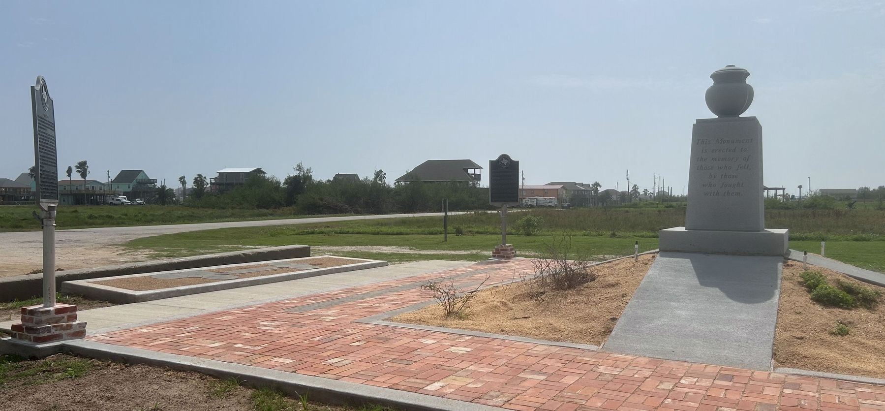
Photographed by Chris Kneupper, April 4, 2025
3. Old Velasco Marker (center) in proximity to Battle of Velasco Memorial and another marker (Velasco)
Regarding Old Velasco, CSA. This marker describes activities at the town of (old) Velasco during the Civil War.
Related markers. Click here for a list of markers that are related to this marker. To better understand the relationship, study each marker in the order shown.
Also see . . .
1. Velasco, TX. From the Texas State Historical Association’s “Handbook of Texas Online”. (Submitted on October 31, 2015, by Duane Hall of Abilene, Texas.)
2. The History of Old Velasco - Surfside Beach.
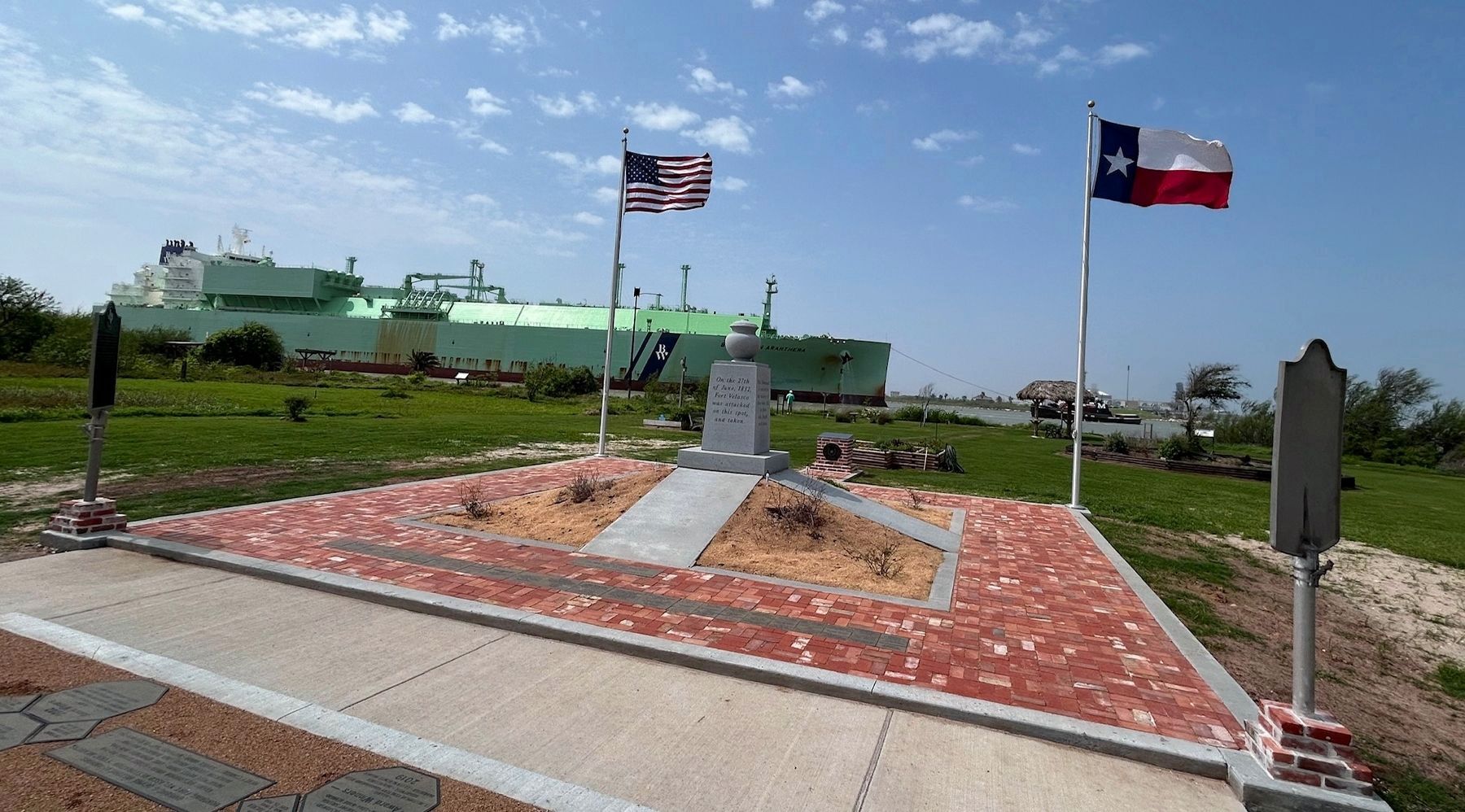
Photographed by Chris Kneupper, April 4, 2025
4. Old Velasco Marker (left) in proximity to the Battle of Velasco Memorial
LNG tanker in background is entering the old mouth of the Brazos River, now the entrance to Port Freeport.
3. Civil War Forts Velasco (1861-1865). (Submitted on April 6, 2025, by Chris Kneupper of Brazoria, Texas.)
Additional commentary.
1. Confederate Troops
From the book CONFEDERATES ON THE CANEY, Self-published by Bobby McKinney, the following partial list of Confederate and Texas State units stationed at Fort Velasco is taken.
2nd Texas Infantry Regt.
3rd Texas Infantry Regt.
13th Texas Infantry Regt.
Infantry Brigade Texas State Troops
Waul's Texas Legion
1st Texas State Cavalry
23rd Texas Cavalry Regt.
35th (Likens) Texas Cavalry Regt.
Jones' Texas Artillery Battery
Gibson's Texas Artillery Battery
Wilke's Texas Artillery Battery
Confederate Engineer Troops
— Submitted August 16, 2008, by Texmexfla of Houston, Texas.
U.S. National Archives, circa 1990
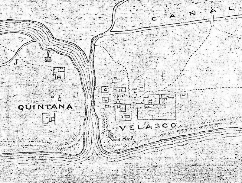
5. Detail from 1862 Tipton Walker Map at mouth of Brazos River
This image is a cropped detail from the second Tipton Walker map of a series of three maps (RG77, Z343) of the upper Texas Coast (circa 1862), found in the U. S. National Archives. It appears to show the area in the early part of the Civil War when an early fort had been constructed on the Velasco side. Other maps indicate it was named Fort Velasco, thus is the third such-named fort at the mouth of the Brazos on the Velasco side.
Gilmer Civil War Collection, University of North Carolina at Chapel Hill, 1864
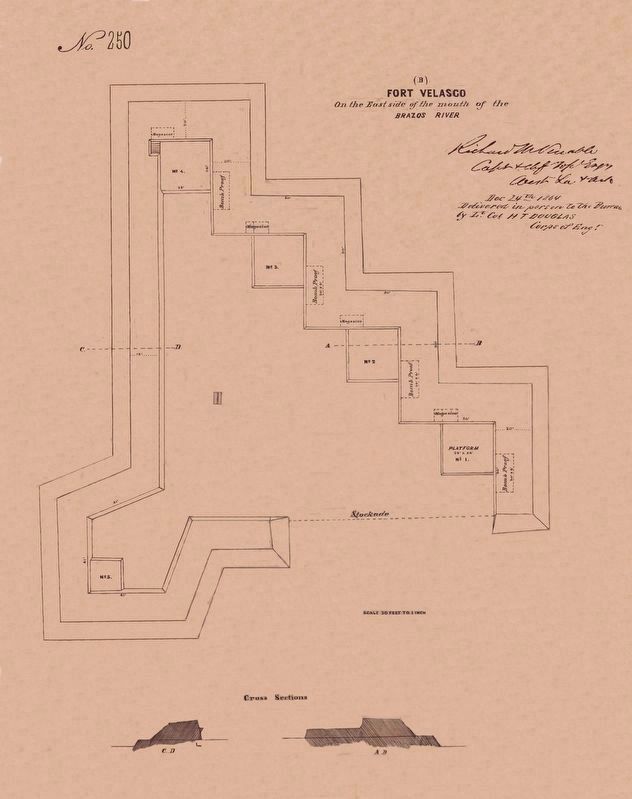
6. Civil War Fort Velasco
Click on image to enlarge. This detailed Engineering drawing is from the Gilmer Civil War Collection, and shows a more substantial fort built in late 1863 and completed in Jan-1864, at a location nearer the town of Velasco, as Fort Velasco #4.

Photographed by Texmexfla, August 15, 2008
7. Original Location of This Marker
They trio faced the parking lot. The marker on the left is this marker at its original location. Beside it is the Velasco marker and the large stone monument dedicated to the various jetties which have been built and lost near this site.
Photographed by Texmexfla, August 15, 2008
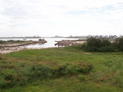
8. Looking Across the Brazos River
This is the site of part of the Confederate Fort Velasco. Notice the Brazos River. This mouth of the Brazos River is still a major commercial location, so the Army Corps of Engineers has done extensive work around this location. In fact, it is a great surprise to see this touristy area after driving through so many refineries and canals.
Photographed by Richard Denney, July 24, 2012
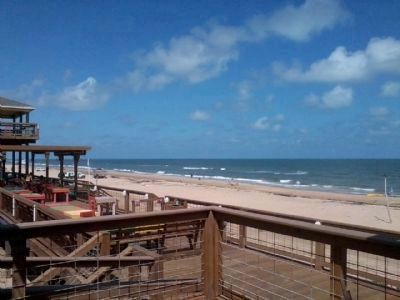
9. Surfside Beach
Marker is located in Surfside, Texas. View of the Surfside beach and Gulf of Mexico in general area of marker.
Credits. This page was last revised on April 8, 2025. It was originally submitted on August 16, 2008, by Texmexfla of Houston, Texas. This page has been viewed 3,105 times since then and 51 times this year. Last updated on April 6, 2025, by Chris Kneupper of Brazoria, Texas. Photos: 1, 2, 3. submitted on April 4, 2025, by Chris Kneupper of Brazoria, Texas. 4, 5, 6. submitted on April 6, 2025, by Chris Kneupper of Brazoria, Texas. 7, 8. submitted on August 16, 2008, by Texmexfla of Houston, Texas. 9. submitted on September 23, 2012, by Richard Denney of Austin, Texas. • James Hulse was the editor who published this page.
