
Pioneer Park in Kitchener in Waterloo Region, Ontario — Central Canada (North America)
Huron Road Bridge
Photographed by Tim Boyd, April 4, 2025
1. Huron Road Bridge Marker
Spanning the Generations
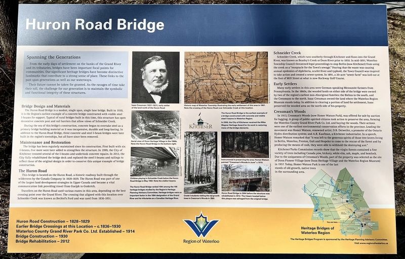
From the early days of settlement on the banks of the Grand River and its tributaries, bridges have been important focal points for communities. Our significant heritage bridges have become distinctive landmarks that contribute to a strong sense of place. These links to the past span generations as well as our waterways.
Their future cannot be taken for granted. As the ravages of time take their toll, the challenge for our generation is to maintain the symbolic and functional integrity of these structures.
Bridge Design and Materials
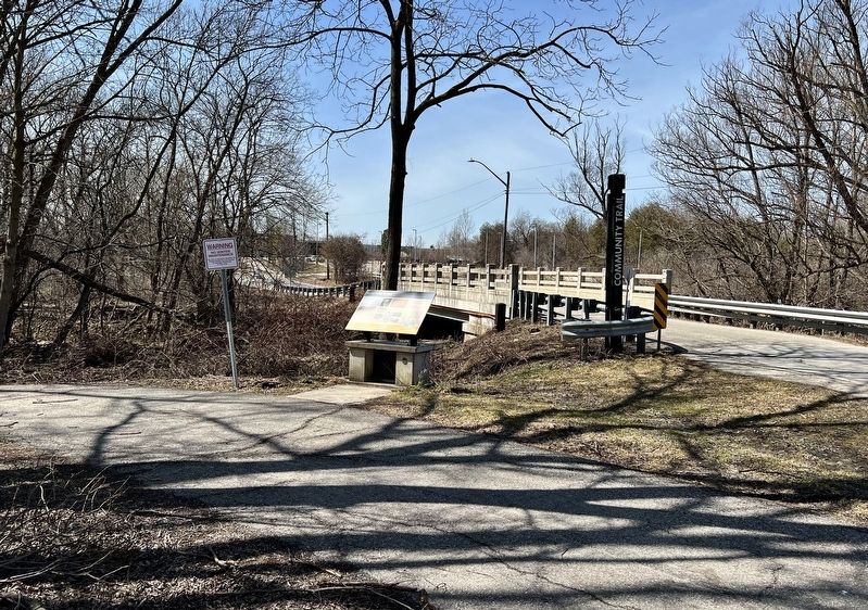
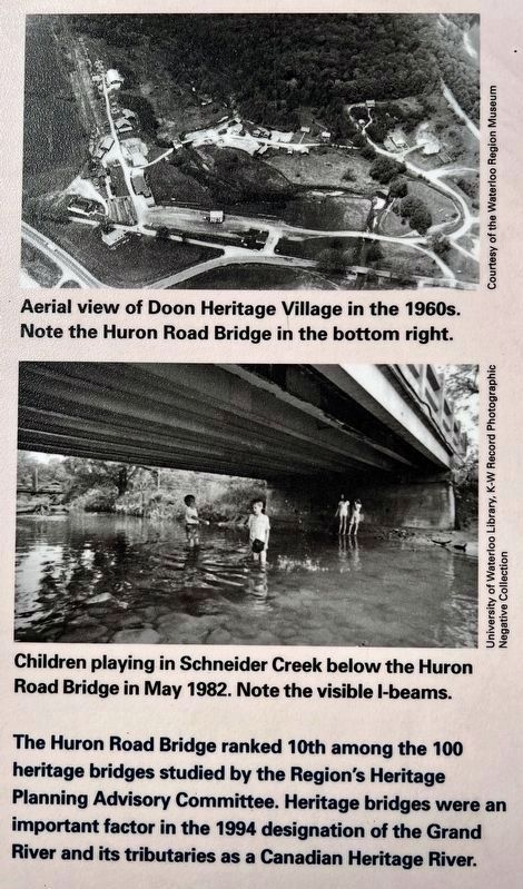
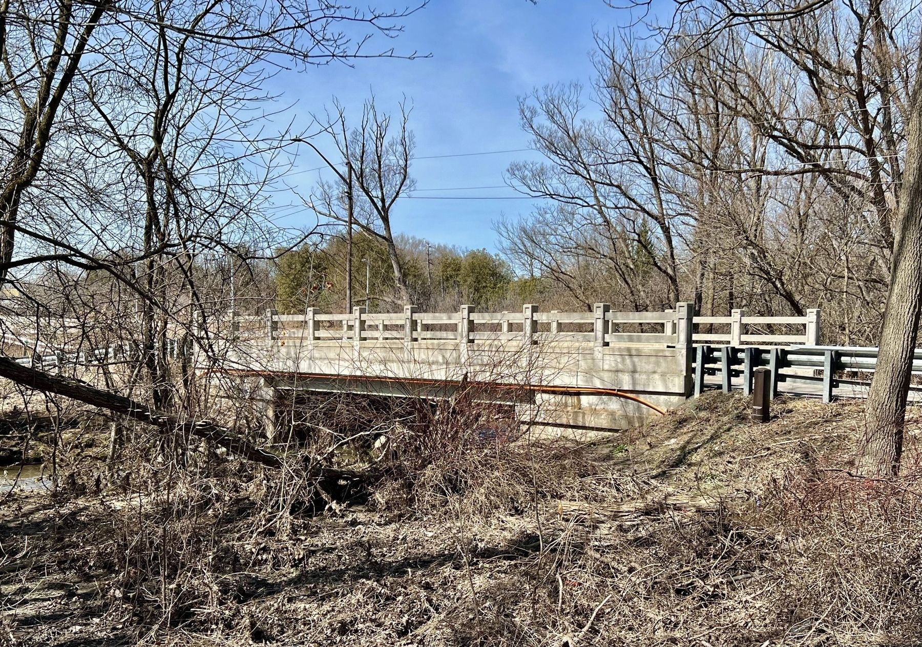
The Huron Road Bridge is a modest, single span, single lane bridge. Built in 1930, it is the Region's earliest example of a concrete bridge constructed with visible steel I-beams for support. Typical of rural bridges built in this time, this structure has open decorative concrete post and rail barriers that allow views of Schneider Creek.
During the era of this bridge's construction, concrete began to overtake steel as a primary bridge building material as it was inexpensive, durable and long-lasting. In addition to the Huron Road Bridge, three concrete and
this page online
Maintenance and Restoration
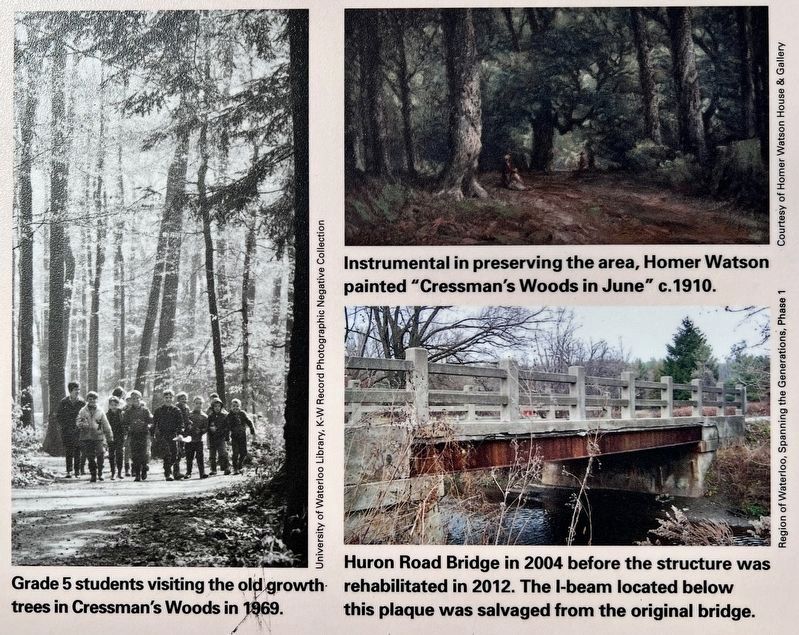
The bridge has been regularly maintained since its construction. First built with six I-beams, five more were later added to strengthen the structure. In 1999, the City of Kitchener restored several of the I-beams and undertook concrete repairs. In 2012, the City fully rehabilitated the bridge deck and replaced the steel I-beams and railings to reflect those of the original design in order to conserve this unique example of bridge construction.
The Huron Road
This bridge is located on the Huron Road, a historic roadway built through the wilderness by the Canada Company in 1828-1829. The Huron Road was part of one of the largest land development strategies in Upper Canada and became a vital communication link providing travel from Guelph to Goderich.
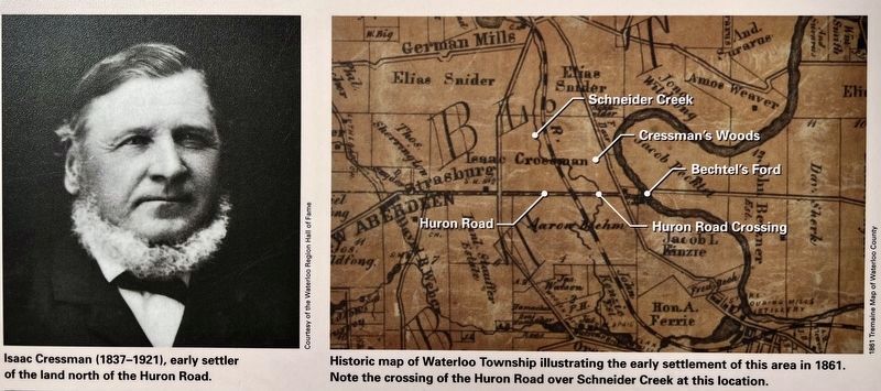
Travellers on the Huron Road used various routes in this area, depending on the best crossing point over the Grand River. The crossing that aligned with this location over Schneider Creek was known as Bechtel's Ford and was used from 1836-1851.
Schneider Creek
Schneider
Photographed by Tim Boyd, April 4, 2025
2. Huron Road Bridge Marker
Early Settlers
Many early settlers in this area were German-speaking Mennonite farmers from Pennsylvania. In the 1860s, the wooded lands on either side of the bridge were owned by two of the region's earliest non-Aboriginal families: the Biehns to the south, and the Cressmans to the north. Isaac Cressman owned the land where the Waterloo Region Museum stands today. In addition to clearing a portion of land for settlement, Isaac preserved the wooded area on the north side of his property.
Cressman's Woods
In 1913, Cressman's Woods (now Homer Watson Park), was offered
3. Huron Road Bridge marker photo detail and caption (top)
Kitchener Parks Commission records show that the virgin forests contained a fine variety of trees including Canada yew, hickory, white elm, ash, maple, and hemlock.
Due to the uniqueness of Cressman's Woods, part of the property was selected as the site of Doon Pioneer Village (now Doon Heritage Village and the Waterloo Region Museum) in 1957. Today, Homer Watson Park is one of the last stands of old growth, native trees in the
4. Huron Road Bridge marker photos and captions detail (lower left)
Erected by Region of Waterloo.
Topics. This historical marker is listed in these topic lists: Bridges & Viaducts • Parks & Recreational Areas • Settlements & Settlers • Waterways & Vessels. A significant historical year for this entry is 1930.
Location. 43° 24.052′ N, 80° 26.137′ W. Marker is in Kitchener, Ontario, in Waterloo Region. It is in Pioneer Park. It is on Huron Road 0.2 kilometers west of Mill Park Drive, on the left when traveling west. Touch for map. Marker is in this post office area: Kitchener ON N2P N2P, Canada. Touch for directions.

Regionally, this marker is in the Huron-Perth-Waterloo-Wellington Area and in Southwestern Ontario. It is also in Central Canada. Globally, it is in North America, the Western Hemisphere, the Western World, and the Anglosphere. Historically, it finds itself in what was once a British colony, the Viceroyalty of New France, the Haudenosaunee (Iroquois) Confederacy, and Rupert’s Land.
Other nearby markers. At least 8 other markers are within walking distance of this marker: The Huron Road (about 180 meters away, measured in a direct line);
5. Huron Road Bridge marker photos and captions detail (lower right)
Photographed by Tim Boyd, April 4, 2025
6. Huron Road Bridge, 2025
Credits. This page was last revised on April 11, 2025. It was originally submitted on April 6, 2025, by Tim Boyd of Hamilton, Ontario. This page has been viewed 104 times since then and 22 times this year. Photos: 1, 2, 3, 4, 5, 6. submitted on April 6, 2025, by Tim Boyd of Hamilton, Ontario. • Andrew Ruppenstein was the editor who published this page.
