Haute-Ville in Québec in Capitale-Nationale, — Central Canada (French-Canadian)
Un site de choix pour fonder Québec
⎯⎯⎯
An Ideal Site to Found Québec
Photographed by Cosmos Mariner, August 3, 2019
1. Un site de choix pour fonder Québec / An Ideal Site to Found Québec Marker

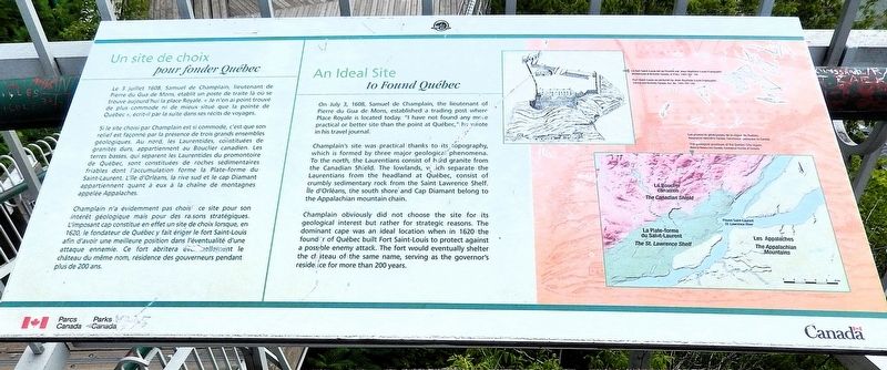
Si le site choisi par Champlain est si commode, c'est que son relief est façonné par la présence de trois grands ensembles géologiques. Au nord, les Laurentides, constituées de granités durs, appartiennent au Bouclier canadien. Les terres basses, qui séparent les Laurentides du promontoire de Québec, sont constituées de roches sédimentaires friables dont l'accumulation forme la Plate-forme du Saint-Laurent. L'île d'Orléans, la rive sud et le cap Diamant appartiennent quant à eux à la chaîne de montagnes appelée Appalaches.
Champlain n'a évidemment pas choisi ce site pour son intérêt géologique mais pour des raisons stratégiques. L'imposant cap constitue en effet un site de choix lorsque, en 1620, le fondateur de Québec y fait ériger le fort Saint-Louis afin d'avoir une meilleure position dans l'éventualité d'une attaque
this page online
Champlain's site was practical thanks to its topography, which is formed by three major geological phenomena. To the north, the Laurentians consist of hard granite from the Canadian Shield. The lowlands, which separate the Laurentians from the headland at Québec, consist of crumbly sedimentary rock from the Saint Lawrence Shelf. Isle Orléans, the south shore and Cap Diamant belong to the Appalachian mountain chain.
Champlain obviously did not choose the site for its geological interest but rather for strategic reasons. The dominant cape was an ideal location when in 1620 the founder of Quebec built Fort Saint-Louis to protect against a possible enemy attack. The fort would eventually shelter the chateau of the same name, serving as the governor's residence for
Library and Archives Canada, Acc. No. 1993-287-149
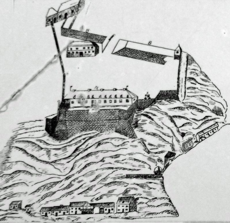
2. Marker detail: Fort Saint-Louis as pictured by Jean-Baptiste-Louis Franquelin
Le fort Saint-Louis tel qu'illustré par Jean-Baptiste-Louis Franquelin.
Erected by Parcs Canada / Parks Canada.
Topics. This historical marker is listed in these topic lists: Colonial Era • Forts and Castles • Settlements & Settlers • Waterways & Vessels. A significant historical date for this entry is July 3, 1608.
Location. 46° 48.531′ N, 71° 12.26′ W. Marker is in Québec, in Capitale-Nationale. It is in Haute-Ville. It is on Governors’ Promenade close to Dufferin Terrace. The marker is located at an overlook along the Governors’ Promenade, just north of the Citadelle of Québec. Touch for map. Marker is at or near this postal address: 10 Place Terrace Dufferin, Québec G1R 4N5, Canada. Touch for directions.

Regionally, this marker is in Central Canada. Globally, it is in North America, the Western Hemisphere, and the Western World. Historically, it finds itself in what was once a British colony, the Viceroyalty of New France, the Haudenosaunee (Iroquois) Confederacy, and Rupert’s Land.
Other nearby markers. At least 8 other markers are within walking distance of this marker: Une promenade pour le 350 ans de Québec / A walkway to commemorate Québec's 350 years

Courtesy Natural Resources Canada, Geological Survey of Canada
3. Marker detail: The geological provinces of the Quebec City region
Les provinces géologiques de la région de Québec.
Also see . . . History of Quebec City (Wikipedia).
Excerpt: French explorer Jacques Cartier was the first European to ascend the St. Lawrence Gulf, claiming "Canada" for France. In 1535, Cartier and his crew first visited an Iroquois settlement of 500 people named Stadacona, in a site located in present-day Quebec City.(Submitted on April 15, 2025, by Cosmos Mariner of Cape Canaveral, Florida.)After 1543 there were still fur trading activities in the area but it was only 60 years later, on 3 July 1608, that Quebec City (intended as a permanent trading post) was established, on the top and on the foot of Cape Diamant by Samuel de Champlain
and Pierre Dugua de Mons. By the time Champlain came to this site, the Iroquois population had disappeared and been replaced by Innu and Algonquins.Photographed by Cosmos Mariner, August 3, 20194. Un site de choix pour fonder Québec / An Ideal Site to Found Québec MarkerLooking northeast along the Saint Lawrence River from the Governors’ Promenade overlook.One of the strategic advantages of the site was its relative isolation from the competition of other traders active downstream, as well as its promontory from which could be observed any vessel going further upstream into the continent. The word "Kebec" is an Algonquin word meaning "where the river narrows." In 1620, Champlain built Fort Saint-Louis on the top of Cape Diamond, near the present location of the Chateau Frontenac.

Photographed by Cosmos Mariner, August 3, 2019
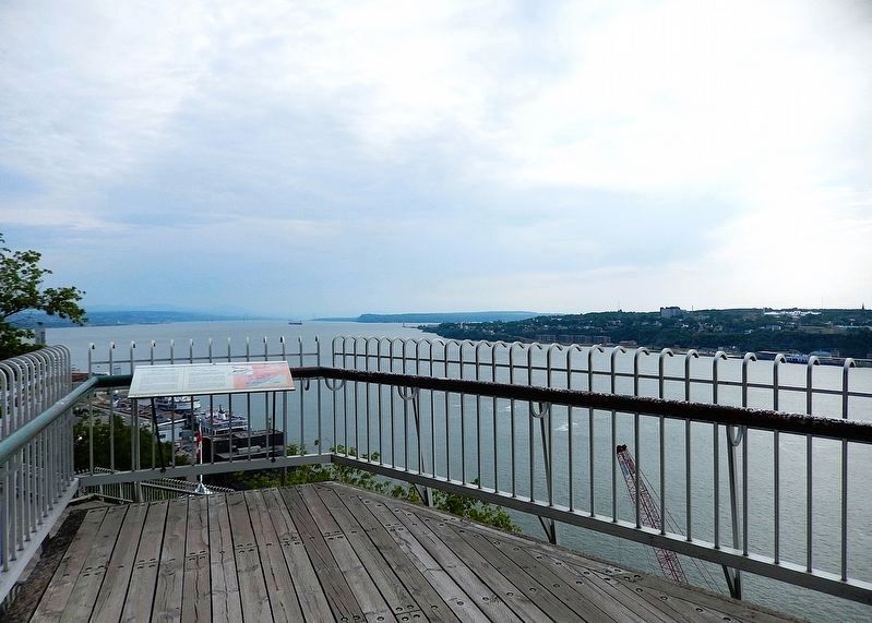
5. Saint Lawrence River
Looking northeast along the Saint Lawrence River from the marker.
Credits. This page was last revised on April 15, 2025. It was originally submitted on April 11, 2025, by Cosmos Mariner of Cape Canaveral, Florida. This page has been viewed 106 times since then and 12 times this year. Photos: 1, 2, 3, 4. submitted on April 14, 2025, by Cosmos Mariner of Cape Canaveral, Florida. 5. submitted on April 15, 2025, by Cosmos Mariner of Cape Canaveral, Florida.
