Near Robstown in Nueces County, Texas — The American South (West South Central)
Martha (Reagan) Rabb
(February 25, 1826-March 20, 1901)
Photographed by Brian Anderson, March 30, 2025
1. Martha (Reagan) Rabb Marker
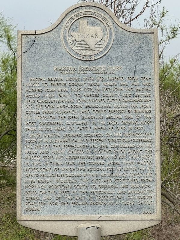
When Martha assumed control of the business, she took it in a dramatically different direction. Forseeing the end of the free-range era, she capitalized on the panic and flight caused by violent raids along the Nueces strip and aggressively began to buy land here in 1875. Within a year, she owned more than 43,000 acres, some of which she bought for as little as 37 cents per acre. Enclosed within 40 miles of fence, the Rabb Ranch included this site and stretched from north of Robstown south to Driscoll, and was bordered on the west by the Petronilla and Banquete Creeks and on the east by present-day Callicoate Road (FM 1694).
this page online
Erected 1992 by Texas Historical Commission. (Marker Number 6330.)
Topics. This historical marker is listed in these topic lists: Agriculture • Women.
Location. 27° 44.746′ N, 97° 41.746′ W. Marker is near Robstown, Texas, in Nueces County. It is on Interstate 69E Frontage Road 0.7 miles south of County Road 34, on the right. Touch for map. Marker is in this post office area: Robstown TX 78380, United States of America. Touch for directions.

Regionally, this marker is in the American South and on the Gulf Coast. Globally, it is in North America, a Gulf of Mexico state, the Western Hemisphere, the Western World, and the Anglosphere. Historically, it finds itself in what was once New Spain, the Republic of Texas, and one of the Confederate States of America.
Other nearby markers. At least 8 other markers are within 4 miles of this marker, measured as the crow flies: Stout Jackson & The Carpa Theaters (approx. 3.4 miles away); Robstown's Vegetable Growing and Railroad Shipping History (approx. 3½ miles away); Hotel Brendle
Photographed by Dave W, November 22, 2025
2. Martha (Reagan) Rabb Marker
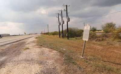
Looking south down US-77.
Credits. This page was last revised on December 30, 2025. It was originally submitted on April 12, 2025, by Brian Anderson of New Albany, Ohio. This page has been viewed 600 times since then and 212 times this year. Photos: 1. submitted on April 12, 2025, by Brian Anderson of New Albany, Ohio. 2. submitted on December 29, 2025, by Dave W of Co, Colorado.
