Fort Sumner in De Baca County, New Mexico — The American Mountains (Southwest)
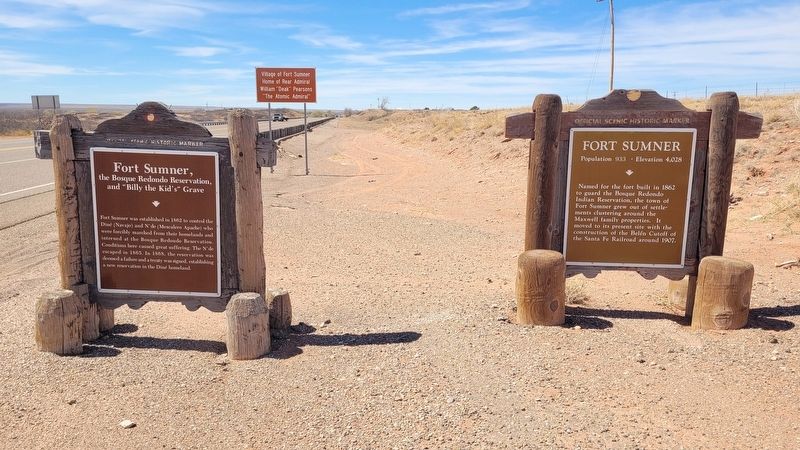
Fort Sumner, the Bosque Redondo Reservation, and "Billy the Kid's" Grave

Photographed by James Hulse, March 24, 2025
1. Fort Sumner, the Bosque Redondo Reservation, and "Billy the Kid's" Grave Marker
Reverse Side
(Continued)
The Fort was discontinued in 1869, and the buildings sold to Lucien B. Maxwell, who established the precursor to the town of Fort Sumner. William "Billy the Kid" Bonny was killed in the nearby former officer's quarters, now known as the "Maxwell House," by Sheriff Pat Garrett the night of July 14, 1881, and was buried in the former Fort cemetery.
Erected by New Mexico Historic Preservation Division.
Topics. This historical marker is listed in these topic lists: Cemeteries & Burial Sites • Forts and Castles • Indigenous Peoples and Communities. A significant historical date for this entry is July 14, 1881.
Location. 34° 27.306′ N, 104° 11.631′ W. Marker is in Fort Sumner, New Mexico, in De Baca County. It is at the intersection
this page online

Regionally, this marker is in Eastern New Mexico and in the Pecos Valley. It is also in the American Southwest, on the Great Plains, on the Southern Plains, and specifically on the High Plains. Globally, it is in North America, the Western Hemisphere, the Western World, and the Anglosphere. Historically, it finds itself in what was once New Spain, the Comanchería, the Dust Bowl, and the Republic of Texas.
Other nearby markers. At least 8 other markers are within 4 miles of this marker, measured as the crow flies: A different marker also named Fort Sumner (here, next to this marker); Bosque Redondo Memorial at Fort Sumner Historic Site (approx. 3½ miles away); a different marker also named Bosque Redondo Memorial at Fort Sumner Historic Site (approx. 3½ miles away); William "Billy the Kid" Bonney Grave 1859-1881 / Old Fort Sumner Cemetery (approx. 3½ miles away);
Photographed by James Hulse, March 24, 2025
2. Fort Sumner, the Bosque Redondo Reservation, and "Billy the Kid's" Grave Marker (left side)
Other markers no longer nearby. Bosque Redondo Indian Reservation (was a few steps from this marker but has been replaced with another marker now near it); a different marker also named Fort Sumner (was approx. 1.3 miles away but has been replaced with another marker now near it); Old Fort Sumner and “Billy the Kid’s” Grave (was approx. 3½ miles away but has been replaced with another marker now near it).
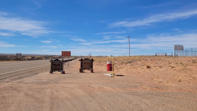
Photographed by James Hulse, March 24, 2025
3. The view of the markers along the street
Credits. This page was last revised on April 12, 2025. It was originally submitted on April 12, 2025, by James Hulse of Medina, Texas. This page has been viewed 201 times since then and 50 times this year. Photos: 1, 2, 3. submitted on April 12, 2025, by James Hulse of Medina, Texas.
