
Myrtle Beach in Horry County, South Carolina — The American South (South Atlantic)
The Great Quake
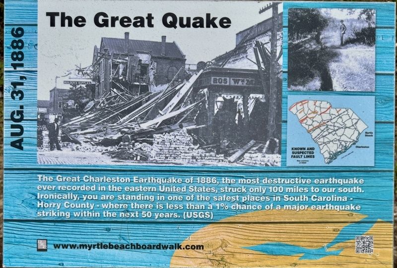
Photographed by Brandon D Cross
1. The Great Quake Marker
Erected 2021 by City of Myrtle Beach.
Topics. This historical marker is listed in these topic lists: Disasters • Environment • Notable Events. A significant historical date for this entry is August 31, 1886.
Location. 33° 41.381′ N, 78° 52.879′ W. Marker is in Myrtle Beach, South Carolina, in Horry County. It is at the intersection of North Ocean Boulevard and Seventh Avenue North, on the left when traveling south on North Ocean Boulevard. Marker is located along the Myrtle Beach Boardwalk. Touch for map. Marker is at or near this postal address: 700 North Ocean Boulevard, Myrtle Beach SC 29577, United States of America. Touch for directions.

Regionally, this marker is on South Carolina’s Grand Strand and in the Pee Dee. It is also in the American South, specifically
this page online
Other nearby markers. At least 8 other markers are within walking distance of this marker: Why Myrtle Beach? (about 600 feet away, measured in a direct line); The Pavilion (about 800 feet away); Myrtle Beach Pavilions (approx. 0.2 miles away); The Bowery (approx. 0.2 miles away); The King’s Highway (approx. 0.2 miles away); Hurricane Hazel (approx. 0.2 miles away); Marine Amphibious Assault (approx. ¼ mile away); Salt Works (approx. ¼ mile away). Touch for a list and map of all markers in Myrtle Beach.
Also see . . .
1. Photos of the week. (Submitted on April 13, 2025, by Brandon D Cross of Flagler Beach, Florida.)
2. The Great Charleston Earthquake of 1886: pictures, stories, facts, and quacks on display at the SC S. (Submitted on April 13, 2025, by Brandon D Cross of Flagler Beach, Florida.)
3. History & How the Myrtle Beach Boardwalk was Built.

Photographed by Brandon D Cross
2. The Great Quake Marker
Credits. This page was last revised on April 19, 2025. It was originally submitted on April 13, 2025, by Brandon D Cross of Flagler Beach, Florida. This page has been viewed 122 times since then and 11 times this year. Photos: 1, 2. submitted on April 13, 2025, by Brandon D Cross of Flagler Beach, Florida. • Andrew Ruppenstein was the editor who published this page.
