
Belle and Mayo Islands in Richmond, Virginia — The American South (Mid-Atlantic)
Old Dominion Iron and Steel
150 Years of Industry on Belle Isle

Photographed by Evan Dwyer, March 15, 2025
1. Old Dominion Iron and Steel Marker
The factory remains before you were owned by Old Dominion Iron & Steel (formerly Belle Isle Works) which operated on this site from 1814-1972. As people harnessed the power of the James River, what began as a mill race and small nail factory quickly became a much larger operation.
A partnership with the Richmond & Danville Railroad transported coal mined in nearby Chesterfield directly to the furnaces here on Belle Isle. Early owners claimed that coal could travel from the pit to the furnaces without being handled by men. This simplification of the process made business here very profitable. By the 1860's[SIC], Old Dominion Iron & Steel (ODIS) ran 48 nail factories, a granite quarry, a rolling mill, several sawmills, seven puddling furnaces, and three heating furnaces - all here on Belle Isle. ODIS was famous for its advanced metallurgy and casting abilities, which allowed it to produce nails, bar iron and boiler plates.
More than 200 men worked here to process over 5,000 tons of iron annually. The company used both paid workers and slave labor, both before and after the American Civil War. ODIS employed approximately
this page online
ODIS continued to flourish after the American Civil War, further developing its metallurgy and manufacturing techniques. From 1939-1945, metal hatches for tanks were forged here. The tanks were built by Chrysler Motors, and the structure became known as "The Chrysler Building."
Erected by Friends of the James River Park.
Topics. This historical marker is listed in these topic lists: African Americans • Industry & Commerce • War, US Civil • War, World II.
Location. 37° 31.878′ N, 77° 26.986′ W. Marker is in Richmond, Virginia. It is in Belle and Mayo Islands. It can be reached from Tredegar Street 0.3 miles west of South 5th Street. Touch for map. Marker is at or near this postal address: 470 Tredegar Street, Richmond VA 23219, United States of America. Touch for directions.

Regionally, this marker is in Central Virginia. It is also in the American South and specifically

Photographed by Evan Dwyer, March 15, 2025
2. Old Dominion Iron and Steel "Chrysler Building" Frame
Other nearby markers. At least 7 other markers are within walking distance of this marker: Welcome to Belle Isle (within shouting distance of this marker); Belle Isle Prison Camp Monument (about 300 feet away); James River Fall Line (about 400 feet away); The Civil War at Belle Isle (about 500 feet away); Ironworks Oil House (approx. 0.2 miles away); Robert E. Lee Bridge (approx. 0.2 miles away); Water Power (approx. 0.2 miles away). Touch for a list and map of all markers in Richmond.
Other markers no longer nearby. Old Dominion Iron & Steel Company (was here, next to this marker but has been replaced with another marker now near it); Historic Belle Isle (was within shouting distance of this marker but has been replaced with another marker now near it); Civil War POW Camp (was about 300 feet away, measured
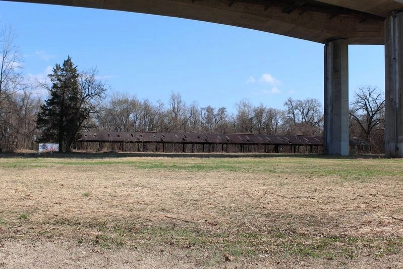
Photographed by Evan Dwyer, March 15, 2025
3. Old Dominion Iron and Steel Rolling Mill
More about this marker. This marker directly replaces 64044 and seemingly indirectly replaces 64043 and 64045, both of which described individual features of ODIS on Belle Isle.
Regarding Old Dominion Iron and Steel. Belle Isle Manufacturing Company was the predecessor to Old Dominion Nail Works, according to Virginia DHR. Ruins surviving on the island from that initial operation include an overgrown mill race between
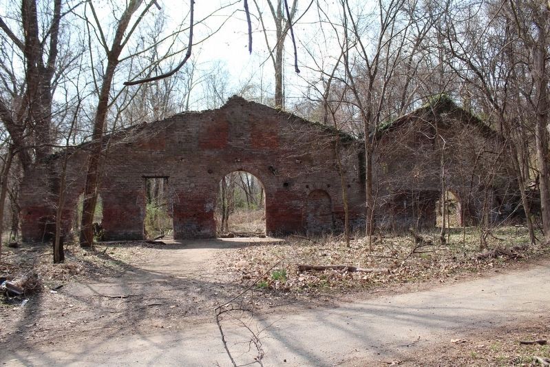
Photographed by Evan Dwyer, March 15, 2025
4. The 'Nailery'
This brick ruin may date to before 1836 as part of the Belle Isle Manufacturing Company, or may have been constructed after the formation of Old Dominion Nail. What is certain is that it is predates the Civil War and was part of the island during that conflict.
Traces on the island that are definitely left from ODIS' operations are the pavilion the west end (built for employees as a recreational area), multiple flat concrete foundations under and just east of the concrete Rt 301/Robert E. Lee Bridge, a long rolling mill with walls missing, and the framing of "The Chrysler Building" - which was leased by Chrysler during WWII, not WWI as the previous marker stated. There is also a concrete water reservoir on the low hill overlooking

Photographed by Evan Dwyer, March 15, 2025
5. Old Dominion Iron and Steel Oil Storage
The construction date of this building, used for holding oil and flammables, is contested. Fire insurance maps from 1876 show a similar sized structure in this location. Virginia DHR documentation for the island state this building predates the Civil War.

Photographed by Evan Dwyer, March 15, 2025
6. Old Dominion Iron and Steel Rail Bridge
ODIS constructed this rail bridge around the beginning of the 20th century to transport materials north into Richmond. The vehicle/pedestrian bridge linking the island to the southern bank of the James River is also partially an ODIS relic, with the stone piers supporting that structure being the remnants of a Richmond & Danville Railroad Spur that was built in the 1850s to support Old Dominion Nail.
Credits. This page was last revised on April 14, 2025. It was originally submitted on April 13, 2025, by Evan Dwyer of Richmond, Virginia. This page has been viewed 467 times since then and 71 times this year. Photos: 1, 2, 3, 4, 5, 6. submitted on April 13, 2025, by Evan Dwyer of Richmond, Virginia. • Devry Becker Jones was the editor who published this page.
