Belle and Mayo Islands in Richmond, Virginia — The American South (Mid-Atlantic)
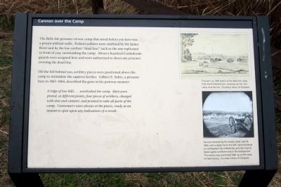
Cannon over the Camp
Photographed by Bernard Fisher, March 31, 2013
1. Cannon over the Camp Marker
The Belle Isle prisoner-of-war camp that stood before you here was a prison without walls. Federal soldiers were confined by the James River and by the low earthen "dead line," such as the one replicated in front of you, surrounding the camp. About a hundred Confederate guards were assigned here and were authorized to shoot any prisoner crossing the dead line.
On the hill behind you, artillery pieces were positioned above the camp to intimidate the captives further. Gilbert E. Sabre, a prisoner here in 1863-1864, described the guns in his postwar memoir:
A ridge of low hills…overlooked the camp. Here were posted, at different points, four pieces of artillery, charged with shot and canister, and pointed to rake all parts of the camp. Cannoneers were always at the pieces, ready at an instant to open upon any indication of a revolt.
(captions)
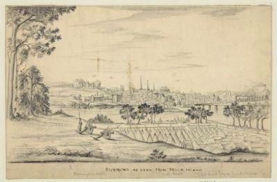
Prisoner's ca. 1863 sketch of the Belle Isle camp from the hill behind you, showing cannon, the camp, and the city. Courtesy Library of Congress.
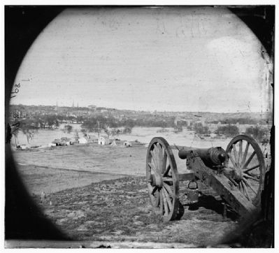
Cannon overlooking the empty camp, April 8, 1865, with a dead line to the left, camp buildings at the northeastern tip of Belle Isle, and the Virginia Sate Capitol and Richmond in the background. The cannon was positioned high up on the large hill behind you. Courtesy Library of Congress.
Topics.
this page online
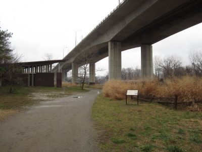
Location. This marker has been replaced by another marker nearby. It was located near 37° 31.773′ N, 77° 27.072′ W. Marker was in Richmond, Virginia. It was in Belle and Mayo Islands. It could be reached from Tredegar Street 0.3 miles west of South 5th Street. Located on Belle Isle which can be reached via a pedestrian bridge from the north bank of the river. Touch for map. Marker was at or near this postal address: 470 Tredegar Street, Richmond VA 23219, United States of America. Touch for directions.

Regionally, this marker was in Central Virginia. It was also in the American South and specifically in the Upper South. Globally, it was in North America, the Western Hemisphere, the Western World, and the Anglosphere. Historically, it found itself in what was once the territory of the Mississippian Culture, one of the original Thirteen Colonies, one of the Confederate States of America, and the Antebellum South.
Other nearby markers. At least 7 other markers are within walking distance of this location: Ironworks Oil House
Photographed by Bernard Fisher, March 31, 2013
2. Cannon over the Camp Marker
Other markers no longer nearby. Canons & Corpses (was within shouting distance of this marker but has been permanently removed); Belle Isle Rolling Milling and Slitting Manufactory (was about 300 feet away, measured in a direct line but has been replaced with another marker now near it); Historic Belle Isle (was about 600 feet away but has been replaced with another marker now near it); Native American Fishing (was about 600 feet away but has been confirmed missing); The Power of Moving Water (was about 600 feet away but has been replaced with another marker now near it); Civil War POW Camp (was about 700 feet away but has been replaced with another marker now near it); Hollywood Rapids (was about 700 feet away but has
Photographed by A Prisoner, 1863
3. Richmond as seen from Belle Island
Belle Island prison camp in foreground, detailed image of Richmond in background. Library of Congress [LC-DIG-ppmsca-22920]
Related marker. Click here for another marker that is related to this marker. Replacement Marker Near This Location titled "The Civil War At Belle Isle".
Photographed by Alexander Gardner, April 8, 1865
4. Richmond, Va. View of city from Belle Isle; gun in foreground
Library of Congress [LC-B811- 891]
Credits. This page was last revised on April 27, 2025. It was originally submitted on April 1, 2013, by Bernard Fisher of Richmond, Virginia. This page has been viewed 1,014 times since then and 30 times this year. Last updated on April 13, 2025, by Evan Dwyer of Richmond, Virginia. Photos: 1, 2, 3, 4. submitted on April 1, 2013, by Bernard Fisher of Richmond, Virginia. • Devry Becker Jones was the editor who published this page.
