Belle and Mayo Islands in Richmond, Virginia — The American South (Mid-Atlantic)
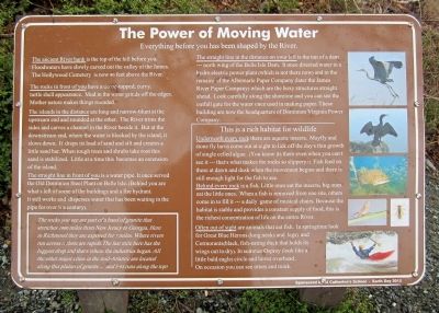
The Power of Moving Water
Everything before you has been shaped by the River.
Photographed by Bernard Fisher, March 31, 2013
1. The Power of Moving Water Marker
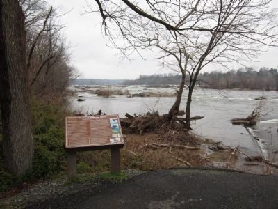
The ancient river bank is the top of the hill before you. Floodwaters have slowly carved out the valley of the James. The Hollywood Cemetery is now 80 feet above the River.
The rocks in front of you have a dome-topped, curvy, turtle shell appearance. Mud in the water grinds off the edges. Mother Nature makes things rounded.
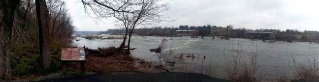
The islands in the distance are long and narrow-blunt at the upstream end and rounded at the other. The River trims the sides and carves a channel in the River beside it. But at the downstream end, where the water is blocked by the island, it slows down. It drops its load of sand and silt and creates a little sand bar. When tough trees and shrubs take root this sand is stabilized. Little at a time this becomes an extension of the island.
The straight line in front of you is a water pipe. It once served the Old Dominion Steel Plant on Belle Isle. (Behind you are what’s left of some of the buildings and a fire hydrant. It still works and disperses water that has been waiting in the pipe for over ½ a century)>
The straight line in the distance on your left is the top of a dam --- north wing
this page online
(sidebar)
The rocks you see are part of a band of granite that stretches 1000 miles from New Jersey to Georgia. Here in Richmond they are exposed for 7 miles. Where rivers run across it there are rapids. The last mile here has the biggest drop and that’s where the industries began. All other major cities in the mid-Atlantic are located along this pluton of granite … and I-95 runs along the top!
(sidebar)
This is a rich habitat for wildlife
Underneath every rock there are aquatic insects. Mayfly and stone fly larva come out at night to lick off the day’s thin growth of single celled algae. (You know it’s there even when you can’t see it --- that’s what makes the rocks so slippery!) Fish feed on these at dawn and dusk when the
Photographed by Bernard Fisher, March 31, 2013
2. The Power of Moving Water Marker
Behind every rock is a fish. Little ones eat the insects; big ones eat the little ones. When a fish is removed from one site, others come in to fill it --- a daily game of musical chairs. Because the habitat is stable and provides a constant supply of food, this is the richest concentration of life on the entire River.
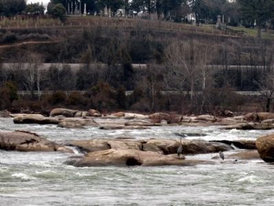
Often out of sight are animals that eat fish. In springtime look for Great Blue Herons (long necks and legs) and Cormorants (black, fish-eating duck that holds its wings out to dry). In summer Osprey (look like a little bald eagle) circle and hover overhead. On occasion you can see otters and mink.
Sponsored by St. Catherine’s Middle School - Earth Day 2012
Erected 2012 by James River Park System.
Topics. This historical marker is listed in this topic list: Natural Features.
Location. This marker has been replaced by another marker nearby. It was located near 37° 31.879′ N, 77° 27.064′ W. Marker was in Richmond, Virginia. It was in Belle and Mayo Islands. It could be reached from Tredegar
Photographed by Bernard Fisher, March 31, 2013
3. James River

Regionally, this marker was in Central Virginia. It was also in the American South and specifically in the Upper South. Globally, it was in North America, the Western Hemisphere, the Western World, and the Anglosphere. Historically, it found itself in what was once the territory of the Mississippian Culture, one of the original Thirteen Colonies, one of the Confederate States of America, and the Antebellum South.
Other nearby markers. At least 7 other markers are within walking distance of this location: James River Fall Line (here, next to this marker); Belle Isle Prison Camp Monument (within shouting distance of this marker); Welcome to Belle Isle (within shouting distance of this marker); The Civil War at Belle Isle (within shouting distance of this marker); Old Dominion Iron and Steel (about 400 feet away, measured in a direct line);
Photographed by Bernard Fisher, March 31, 2013
4. Hollywood Rapids
Great Blue Heron on the James River below Hollywood Cemetery.
Other markers no longer nearby. Historic Belle Isle (was a few steps from this marker but has been replaced with another marker now near it); Civil War POW Camp (was within shouting distance of this marker but has been replaced with another marker now near it); a different marker also named Historic Belle Isle (was within shouting distance of this marker but has been replaced with another marker now near it); Old Dominion Iron & Steel Company (was about 400 feet away but has been replaced with another marker now near it); Canons & Corpses (was about 600 feet away but has been permanently removed); Cannon over the Camp (was about 600 feet away but has been replaced with another marker now near it); Native American Fishing (was about 700 feet away but has been confirmed missing); Hollywood Rapids (was approx. 0.2 miles away but has been replaced with another marker now near it); Belle Isle Rolling Milling and Slitting Manufactory (was approx. 0.2 miles away but has been replaced with another marker now near it).
Credits. This page was last revised on April 14, 2025. It was originally submitted on April 1, 2013, by Bernard Fisher of Richmond, Virginia. This page has been viewed 675 times since then and 18 times this year. Last updated on April 13, 2025, by Evan Dwyer of Richmond, Virginia. Photos: 1, 2, 3, 4. submitted on April 1, 2013, by Bernard Fisher of Richmond, Virginia. • Devry Becker Jones was the editor who published this page.
