
Belle and Mayo Islands in Richmond, Virginia — The American South (Mid-Atlantic)
Historic Belle Isle
Photographed by Bernard Fisher, March 31, 2013
1. Historic Belle Isle Marker
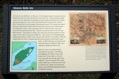
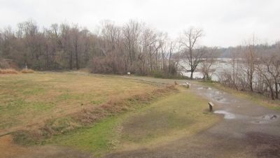
In front of you is Belle Isle. At 54 acres, it is the largest island in the James River at Richmond, and one of the most historic sites in the city. Virginia Indians fished in the river here long before the English arrived, Captain John Smith was among the first Europeans to visit in 1607, and William Byrd I acquired the island in 1676. William Byrd II, the founder of Richmond, called it “the broad rock island.” Sold by the Byrd family about 1776, the island soon became one of Richmond’s first industrial centers, with a nail factory here by 1814 and later a full-scale ironworks that operated until 1972. Granite was quarried here in the 19th and 20th centuries. During the Civil War, one of the most notorious prisoner-of-war camps in the South was located on Belle Isle. The remains of a Confederate gun emplacement still are visible on the western end of the hill. From 1904 to 1967, the Virginia Electric Power Company operated a power plant on the island’s south bank. In 1995, Belle Isle was listed on the National Register of Historic Places as a nationally significant historic site.
Belle Isle is now one of Richmond’s
this page online
Topics. This historical marker is listed in these topic lists: Industry & Commerce • Settlements & Settlers • War, US Civil. A significant historical year for this entry is 1607.
Location. This marker has been replaced by another marker nearby. It was located near 37° 31.866′ N, 77° 27.061′ W. Marker was in Richmond, Virginia. It was in Belle and Mayo Islands. It could be reached from Tredegar Street 0.3 miles west of South 5th Street. Located on Belle Isle which can be reached via a pedestrian bridge from the north bank of the river. Touch for map. Marker was at or near this postal address: 470 Tredegar Street, Richmond VA 23219, United States of America. Touch for directions.

Regionally, this marker was in Central Virginia. It was also in the American South and specifically
Photographed by Bernard Fisher, March 31, 2013
2. Historic Belle Isle Marker
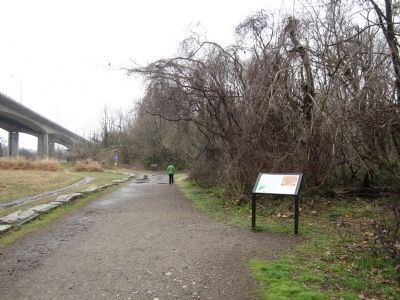
Other nearby markers. At least 7 other markers are within walking distance of this location: James River Fall Line (within shouting distance of this marker); Belle Isle Prison Camp Monument (within shouting distance of this marker); Welcome to Belle Isle (within shouting distance of this marker); The Civil War at Belle Isle (within shouting distance of this marker); Old Dominion Iron and Steel (about 400 feet away, measured in a direct line); Ironworks Oil House (about 600 feet away); a different marker also named Hollywood Rapids (approx. 0.2 miles away). Touch for a list and map of all markers in Richmond.
Other markers no longer nearby. The Power of Moving Water (was a few steps from this marker but has been replaced with another marker now near it); Civil War POW Camp (was within shouting distance
Photographed by Bernard Fisher, March 31, 2013
3. Belle Isle Prison Camp Site
More about this marker. (caption)
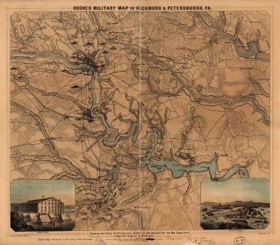
Drawn to illustrate an 1864 map of Richmond and vicinity, this image shows Belle Isle with the prisoner-of-war camp to the front and left. An artillery emplacement still stands atop the hill on the right-hand end of the island. The Old Dominion Iron and Nail Works
Photographed by William C. Hughes, 1864
4. Hughes military map of Richmond & Petersburg, Va.
Showing the Rebel fortifications drawn on the ground for the War Department by Major W.C. Hughes of Michigan Library of Congress [G3884.R5S5 1864 H8]
Also see . . .
1. Belle Isle. National Register of Historic Places (Submitted on April 1, 2013.)
2. Belle Isle. Friends of the James River Park (Submitted on November 12, 2021.)
Credits. This page was last revised on April 14, 2025. It was originally submitted on April 1, 2013, by Bernard Fisher of Richmond, Virginia. This page has been viewed 1,421 times since then and 60 times this year. Last updated on April 13, 2025, by Evan Dwyer of Richmond, Virginia. Photos: 1, 2, 3, 4. submitted on April 1, 2013, by Bernard Fisher of Richmond, Virginia. • Devry Becker Jones was the editor who published this page.
