Lima in Allen County, Ohio — The American Midwest (Great Lakes)
McLean Teddy Bear Park
Photographed by Craig Doda, May 22, 2021
1. McLean Teady Bear Park Marker
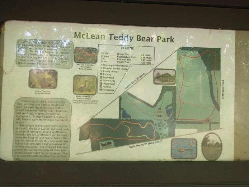
McLean Teddy Bear Park the first metro park within the Johnny Appleseed Park District, was named in memory of R.A. McLean. Mr. McLean began the tradition of giving teddy bears to children staying in Allen County hospitals. This park has grown in size from 40 acres in 1979 to approximately 131 acres in 2009.
Follow the 5 mile Braille Discovery Trail, with signage both in Braille and print, to learn about the trees of this mixed hardwood forest. Oaks, Hickories, Ash and Sugar Maples are scattered throughout. A Maple Sugaring Festival is held here in early March (even numbered years.)
The unique Braille Discovery trail connects with the Koch Nature Trail and hosts an array of spring woodland wildflowers. Summer and fall wildflowers can be seen along the Pickerell and Prairie Trails. During the months of July thru September the Prairie Trail presents a living rainbow of colorful blossoms. The Pickerell Trail meanders thru a recently planted forty acre grassland and small corner woodlot. This trail connects with the Allen County Farm Park.
Topics. This historical marker is listed in these topic lists: Charity & Public Work
this page online
Location. 40° 45.569′ N, 84° 3.491′ W. Marker is in Lima, Ohio, in Allen County. It is on North Dixie Highway 0.7 miles north of Ada Road (Ohio Route 81), on the right when traveling north. Touch for map. Marker is at or near this postal address: 2010 N Dixie Hwy, Lima OH 45801, United States of America. Touch for directions.

Regionally, this marker is in Ohio’s Till Plains. It is also in the American Midwest and in the Corn Belt. Globally, it is in North America, the Western Hemisphere, the Western World, and the Anglosphere. Historically, it finds itself in what was once the Haudenosaunee (Iroquois) Confederacy, the territory of the Mississippian Culture, and the Northwest Territory.
Other nearby markers. At least 8 other markers are within walking distance of this marker: Eastman Johnson's Maple Sugar Paintings (about 300 feet away, measured in a direct line); a different marker also named McLean Teddy Bear Park (about 300 feet away); Johnny Appleseed Apple Tree (approx. 0.4 miles away); Robert E. Lee Sweetgum
Photographed by Craig Doda, May 22, 2021
2. McLean Teady Bear Park Marker
Credits. This page was last revised on April 14, 2025. It was originally submitted on May 24, 2021, by Craig Doda of Napoleon, Ohio. This page has been viewed 643 times since then and 60 times this year. Last updated on April 14, 2025, by Ian Lefkowitz of New York, New York. Photos: 1, 2. submitted on May 24, 2021, by Craig Doda of Napoleon, Ohio. • Devry Becker Jones was the editor who published this page.
