
Death Valley National Park in Inyo County, California — The American West (Pacific Coastal)
The Racetrack
28 Miles

Photographed by Craig Baker, April 2, 2025
1. Racetrack Marker
The beauty, silence, and solitude of Racetrack Valley and its dry lakebed, or playa, are almost unworldly. Adding to its appearance is the mystery of the moving stones, which leave furrows in the dried mud of the lakebed as a record of their journeys. The playa is 2.5 miles long from north to south, and about half as wide. The elevation at each end of the dry lakebed varies by only 1.5 inches.
A word of caution: Visiting the Racetrack Valley can be a rewarding but arduous journey. The primitive road poses challenges to vehicles and passengers alike. Note the safety messages below to insure a safe visit. Check with park rangers for information about jeep rentals. Do not walk on Racetrack when it is wet because doing so leaves footprints that will last for a long time.
photo caption:
Furrows in the once slick playa trace the wind-blown journey of rocks across its surface.
Safety Information
this page online
• Check with park rangers for current road conditions and closures.
• This primitive road is 28 miles one way — allow a half day of driving time for the round-trip.
• Sharp rocks make this road exceptionally tough on tires. Heavy-duty truck tires are necessary to avoid flats. A full-size inflated spare tire is recommended. Confirm that you have tire-changing equipment before you start out.
• Start your trip with a full tank of gasoline.
• Stay with your vehicle in the event of a breakdown.
• Stay on established roads.
• Keep speed under 25 mph because the washboard surface of the road limits tire contact with the road, reduces steering control, damages tires, causes blowouts, and ruins shock absorbers.
• High-clearance vehicles are recommended.
• Flash floods can occur with heavy rains at higher elevations.
• Do not rely on cell phone service in Death Valley. Coverage is extremely limited.
• GPS is not always

Photographed by Craig Baker, April 2, 2025
2. Racetrack Marker
• Carry plenty of water.
• Watch for signs of dehydration, including dizziness, nausea and headaches. If you experience any of these symptoms, get out of the sun immediately, drink plenty of water, and dampen clothing to reduce body temperature.
• No collecting, removing, or disturbing natural features or historic artifacts.
Erected by Death Valley National Park.
Topics. This historical marker is listed in these topic lists: Natural Features • Notable Places • Parks & Recreational Areas.
Location. 37° 0.802′ N, 117° 27.455′ W. Marker is in Death Valley National Park, California, in Inyo County. It is on Ubehebe Crater Road just east of Racetrack Valley Road, on the right when traveling west. Touch for map. Marker is in this post office area: Death Valley CA 92328, United States of America. Touch for directions.

Regionally,

Photographed by Craig Baker, April 2, 2025
3. Racetrack Marker
Other nearby markers. At least 2 other markers are within 6 miles of this marker, measured as the crow flies: Ubehebe Crater (approx. ¼ mile away); Scotty’s Castle (approx. 5.2 miles away).
Related marker. Click here for another marker that is related to this marker. - The Racetrack, 26 miles to the south.
Also see . . . The Racetrack. Death Valley National Park website has recommendations for visitors, road closure notices, and information about the moving rocks. (Submitted on April 14, 2025.)

Photographed by Craig Baker, April 2, 2025
4. High Clearance 4 x 4 Recommended
$$$$ towing charges beyond this point.
Photographed by Craig Baker, April 2, 2025
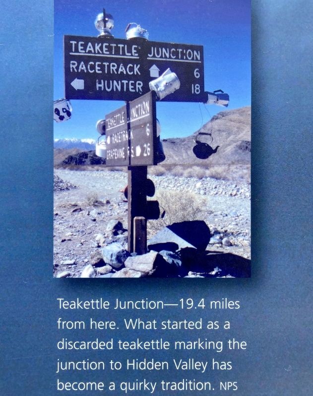
5. Teakettle Junction
19.4 miles from here. What started as a discarded teakettle marking the junction to Hidden Valley has become a quirky tradition.

Photographed by Craig Baker, April 2, 2025
6. Teakettle Junction
Credits. This page was last revised on April 16, 2025. It was originally submitted on April 14, 2025, by Craig Baker of Sylmar, California. This page has been viewed 179 times since then and 36 times this year. Photos: 1, 2, 3, 4, 5, 6. submitted on April 14, 2025, by Craig Baker of Sylmar, California.
