Cumberland in Cumberland County, Virginia — The American South (Mid-Atlantic)
John Robinson (ca. 1825-1908)
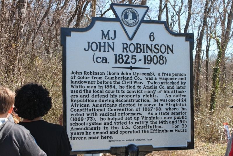
Toya Gray-Sparks courtesy of VDHR
1. John Robinson (ca. 1825-1908) Marker
Erected 2024 by Department of Historic Resources. (Marker Number MJ 6.)
Topics. This historical marker is listed in these topic lists: African Americans • Civil Rights • Education • War, US Civil.
Location. 37° 29.857′ N, 78° 14.581′ W. Marker is in Cumberland, Virginia, in Cumberland County. It can be reached from the intersection of Anderson Highway (U.S. 60)
this page online

Regionally, this marker is in the Piedmont and in Central Virginia. It is also in the American South and specifically in the Upper South. Globally, it is in North America, the Western Hemisphere, the Western World, and the Anglosphere. Historically, it finds itself in what was once the territory of the Mississippian Culture, one of the original Thirteen Colonies, one of the Confederate States of America, and the Antebellum South.
Other nearby markers. At least 8 other markers are within 6 miles of this marker, measured as the crow flies: Veterans Memorial (about 400 feet away, measured in a direct line); Confederate Memorial (about 500 feet away); Cumberland County Court House (about 500 feet away); First Call For Independence (about 600 feet away); a different marker also named Jackson Davis (about 700 feet away); Campaign of 1781 (approx. 2.6 miles away); Lucyville (approx. 3.4 miles away); Buckingham County / Cumberland County (approx. 5.9 miles away). Touch for a list and map of all markers in Cumberland.
Another marker is no longer nearby. Jackson Davis (was about 600 feet away but has been replaced with another marker now near it).
Also see . . . The life and legacy of John (Lipscomb) Robinson. Cardinal News (12/30/2024) (Submitted on April 30, 2025.)
Credits. This page was last revised on April 30, 2025. It was originally submitted on April 15, 2025, by Lew Longenecker of Appomattox, Virginia. This page has been viewed 146 times since then and 33 times this year. Photo 1. submitted on April 15, 2025, by Lew Longenecker of Appomattox, Virginia. • Bernard Fisher was the editor who published this page.
Editor’s want-list for this marker. Wide shot of marker and its surroundings. • Can you help?
