Kinston in Lenoir County, North Carolina — The American South (South Atlantic)
Cat Hole
Finishing CSS Neuse
Photographed by Craig Swain, May 7, 2010
1. Cat Hole Marker
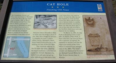
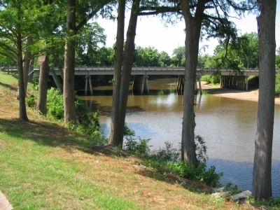
The Confederate ironclad ram Neuse was constructed at Whitehall (present-day Seven Springs) beginning in October 1862. In March 1863, having survived Union Gen. John G. Foster's raid and the engagement at Whitehall the pervious December, Neuse arrived in Kinston and moored on the Neuse River near the foot of Caswell Street to receive its iron fittings and machinery. It was later moved downriver about 100 yards to deeper water near the bridge in front of you, then into a slough for laborers to complete the work. A ship's officer, 2nd Lt. Richard H. Bacot, wrote letters home referring to the docking site here as the Cat Hole.
The riverbank adjacent to the Cat Hole was steep, allowing the ship's machinery to be lowered easily into the hull. Because of the lack of iron and men, as well as other difficulties, it was more than a year before Neuse was ready for service. On April 22, 1864, the new ship steamed out of the Cat Hole toward New Bern ready for action only to become stuck on a sandbar half a mile downriver. According to Bacot, the ship was afloat again in July of that year and returned to the Cat Hole where more
this page online
On March 12, 1865, the ship fired on advancing Union troops after the Battle of Wyse Fork. A short time later, the crew set Neuse afire to prevent its capture. An explosion in the port bow sent the ship to the bottom of the river, where it remained until salvaged early in the 1960s. The vessel's remains are displayed at the Governor Richard Caswell Memorial on West Vernon Avenue here in Kinston. (captions)
CSS Neuse under construction, drawing by Bill Ballard
Lt. Richard H. Bacot's sketches of Neuse and armor plating -Courtesy of CSS Neuse State Historic Site
Erected by North Carolina Civil War Trails.
Topics and series. This historical marker is listed in these topic lists: War, US Civil • Waterways & Vessels. In addition, it is included in the North Carolina Civil War Trails series list. A significant historical date for this entry is March 12, 1865.
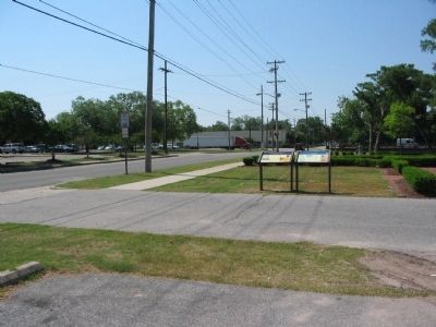
Location. This marker has been replaced by another marker nearby. It was located near 35° 15.6′ N, 77° 34.981′ W. Marker was in Kinston, North Carolina, in Lenoir County. It was at the intersection of South Heritage Street and West Caswell Street,
Photographed by Craig Swain, May 7, 2010
2. Markers at the River Overlook

Regionally, this marker was in the Coastal Plain. It was also in the American South and specifically in the Upper South. Globally, it was in North America, the Western Hemisphere, the Western World, and the Anglosphere. Historically, it found itself in what was once the territory of the Mississippian Culture, one of the original Thirteen Colonies, one of the Confederate States of America, and the Antebellum South.
Other nearby markers. At least 8 other markers are within walking distance of this location: John Taylor Wood, CSN (here, next to this marker); a different marker also named Cat Hole (here, next to this marker); Walk of Honor Memorial (a few steps from this marker); CSS Neuse Confederate Ironclad Gunboat (within shouting distance of this marker); Fire Hydrants (about 600 feet away, measured in a direct line); CSS Neuse (about 600 feet away); The Town Of Kingston (about 600
Photographed by Craig Swain, May 7, 2010
3. General Location of the Cat Hole Today
Related marker. Click here for another marker that is related to this marker. Replacement CWT Marker At This Location also titled "Cat Hole"
Photographed by Craig Swain, May 7, 2010
4. CSS Neuse II
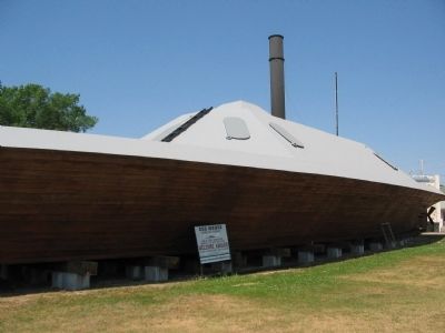
A few blocks north, at the intersection of Gordon and Heritage Streets, is a reproduction of the Neuse.
Credits. This page was last revised on April 30, 2025. It was originally submitted on May 9, 2010, by Craig Swain of Leesburg, Virginia. This page has been viewed 1,955 times since then and 41 times this year. Last updated on April 15, 2025, by Mark Parker of Hickory, North Carolina. Photos: 1, 2, 3, 4. submitted on May 9, 2010, by Craig Swain of Leesburg, Virginia. • Devry Becker Jones was the editor who published this page.
