Shiloh in Hardin County, Tennessee — The American South (East South Central)
Shiloh Indian Mounds
Shiloh Indian Mounds National Historic Park
| — | National Park Service, U.S. Department of the Interior | — |
Photographed by Sandra Hughes, September 1, 2009
1. Shiloh Indian Mounds Marker
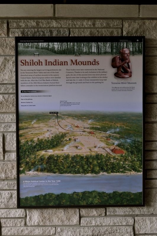
You are entering the largest surviving prehistoric site in the Tennessee River Valley and one of the least disturbed areas of earthen mounds in the eastern United States. Early European settlers were familiar with the site. After the Civil War Battle of Shiloh, members of the 28th Illinois Infantry buried their fallen comrades in the westernmost platform mound.
There bodies were later reinterred in the National Cemetery. Thanks to its early inclusion in the military park, the site of this ancient town was never plowed. Spend some time looking at the exhibits in the shelter and take the 1.1 mile (1.8-km) interpretive loop trail though the grounds and back to the parking lot.
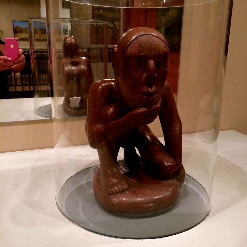
The effigy pipe and exhibits about Shiloh people may be viewed at the Tennessee River Museum nearby Savannah, Tennessee.
A Few Precautions
Do not disturb or remove any natural or historic object.
Stay on the pathway.
Beware of poison ivy.
Keep pets on a short leash.
Shiloh Trail
1.1-mile loop trail (1.8 km) 1 hour, easy interpretive exhibits are placed at key points along the trail.
Erected by National Park Service, U.S. Department of the Interior.
Topics. This historical marker is listed in these topic lists: Indigenous Peoples and Communities • War, US Civil.
Location. 35° 8.482′ N, 88° 19.424′ W. Marker is in Shiloh, Tennessee, in Hardin County. It can be reached from Riverside Drive east of Hamburg Savannah Road, on the right when traveling east. The marker is at the Interpretive Shelter. Touch for map. Marker is at or near this postal address: 275 Riverside Dr, Shiloh TN 38376, United States of America. Touch for directions.

Regionally, this marker is in West Tennessee. It is also in the American South and specifically in the Upper South. Globally,
this page online
Other nearby markers. At least 8 other markers are within walking distance of this marker: Leaving Home (within shouting distance of this marker); Borrow Pits (about 400 feet away, measured in a direct line); The Center of Town (about 400 feet away); Signs of Dwellings (about 400 feet away); 28th Illinois Infantry (about 500 feet away); Signs of Prestige (about 600 feet away); Kentucky Regiments at Battle of Shiloh (about 700 feet away); A Temporary Wall (about 800 feet away). Touch for a list and map of all markers in Shiloh.
Photographed by Sandra Hughes, September 27, 2014
2. Shiloh Indian Mounds Marker
Located at Tennessee River Museum in Savannah, TN
Credits. This page was last revised on August 13, 2025. It was originally submitted on August 14, 2017, by Sandra Hughes Tidwell of Killen, Alabama, USA. This page has been viewed 978 times since then and 93 times this year. Last updated on April 15, 2025, by David Austin of Scotts Hill, Tennessee. Photos: 1, 2. submitted on August 14, 2017, by Sandra Hughes Tidwell of Killen, Alabama, USA. • Devry Becker Jones was the editor who published this page.
