Nageezi in San Juan County, New Mexico — The American Mountains (Southwest)
Pueblo Bonito
Chaco Culture National Historical Park
| — | National Park Service, U.S.Department of the Interior | — |
Photographed by James Hulse, March 26, 2025
1. Pueblo Bonito Marker
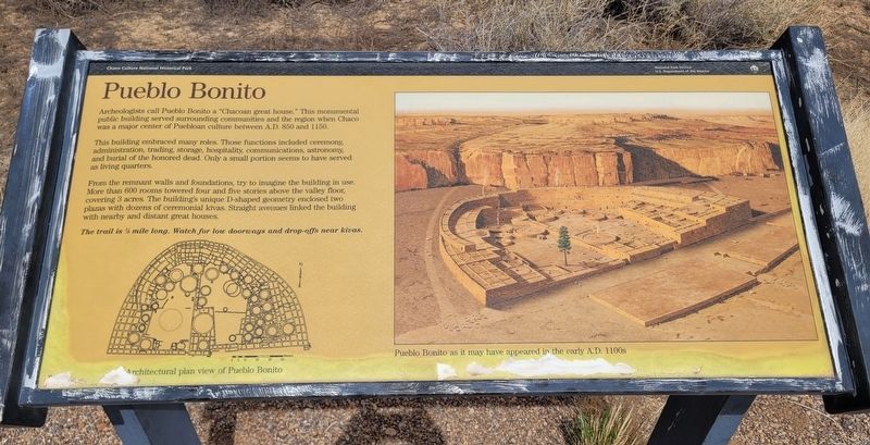
Archeologists call Pueblo Bonito a "Chacoan great house." This monumental public building served surrounding communities and the region when Chaco was a major center of Puebloan culture between A.D. 850 and 1150.
This building embraced many roles. Those functions included ceremony, administration, trading, storage, hospitality, communications, astronomy, and burial of the honored dead. Only a small portion seems to have served as living quarters.
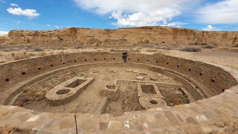
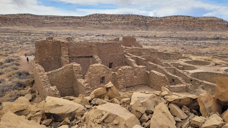
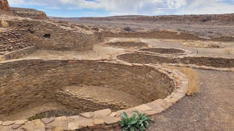
From the remnant walls and foundations, try to imagine the building in use. More than 600 rooms towered four and five stories above the valley floor, covering 3 acres. The building's unique D-shaped geometry enclosed two plazas with dozens of ceremonial kivas. Straight avenues linked the building with nearby and distant great houses.
The trail is ½ mile long. Watch for low doorways and drop-offs near kivas.
Captions
(Photo #1) Architectural plan view of Pueblo Bonito
(Photo #2) Pueblo Bonito as it may have appeared in the early A.D. 1100s
Erected by National Park Service and U.S. Department of the Interior.
Topics. This historical marker is listed
this page online
Location. 36° 3.588′ N, 107° 57.521′ W. Marker is in Nageezi, New Mexico, in San Juan County. It is at the intersection of North Side Loop Road and Navajo Service Route 14 on North Side Loop Road. The marker is located at the east trailhead to the Pueblo Bonito archeological site. Touch for map. Marker is in this post office area: Nageezi NM 87037, United States of America. Touch for directions.

Regionally, this marker is in the Navajo Nation and in the San Juan Basin. It is also in the American Southwest, in the Mountain West, on the Colorado Plateau, and at the Four Corners. Globally, it is in North America, the Rocky Mountains, the Western Hemisphere, the Western World, and the Anglosphere. Historically, it finds itself in what was once New Spain and also the territory of the Ancestral Puebloans.
Other nearby markers. At least 8 other markers are within 4 miles of this marker, measured as the crow flies: Chetro Ketl (within shouting distance of this

Photographed by James Hulse, March 26, 2025
2. The view of the Pueblo Bonito and Marker along the trail
Also see . . . The Center of an Ancient World. National Park Service, U.S. Department of the Interior
Explore the monumental structures and breathtaking landscape at Chaco, a thriving regional center for the ancestral Pueblo people from 850 to 1250 CE (Common Era), through guided tours, hiking & biking trails, evening campfire talks, night sky programs, and more. Chaco Canyon is a sacred and deeply personal place for many Indigenous peoples throughout the Southwest. Please visit with respect.(Submitted on April 17, 2025, by James Hulse of Medina, Texas.)
Photographed by James Hulse, March 26, 2025
3. Great Kiva at Pueblo Bonito
Photographed by James Hulse, March 26, 2025
4. A view from above Pueblo Bonito
Photographed by James Hulse, March 26, 2025
5. Multiple Kivas at Pueblo Bonito
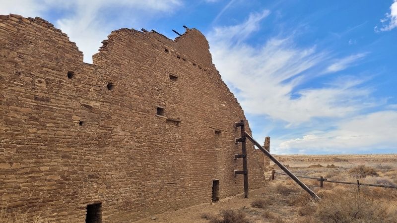
Photographed by James Hulse, March 26, 2025
6. Back wall at Pueblo Bonito
Credits. This page was last revised on July 14, 2025. It was originally submitted on April 15, 2025, by James Hulse of Medina, Texas. This page has been viewed 281 times since then and 26 times this year. Photos: 1, 2, 3, 4, 5, 6. submitted on April 17, 2025, by James Hulse of Medina, Texas.
