Wilmington in New Hanover County, North Carolina — The American South (South Atlantic)
Navigating At Sea
U.S.S. North Carolina

Photographed by Brandon D Cross
1. Navigating At Sea Marker
Keeping Time
The Quartermasters maintained the Ship's three chronometers, a clock for keeping accurate time at sea. Knowing the exact time of day at the Prime Meridian (Greenwich Mean Time, Greenwich, England) was essential for determining the Ship's longitude by celestial navigation. GMT was compared with local time, where one hour of difference is equivalent to 15° longitude. Once a week the Ship received a time check from Washington D.C. and the Quartermasters compared it to the chronometers. They also checked and wound all of the Ship's clocks and made sure they were in synch with the chronometers.
Weather Reporting
A Quartermaster's duties included weather observations. He recorded data on temperature, relative humidity, atmospheric pressure, wind, clouds, sea condition and other phenomena and sent
this page online
Crew Memories
We were coming out of Majuro one afternoon while Captain Thomas was commanding. This was quite a narrow entrance or exit from the harbor with a strong current. Consequently, we needed speed to maintain our course, An LST was patrolling outside the entrance and was on a collision course with us. The captain had to stop engines much to his distress to let the LST clear. He indignantly sent a message to the LST saying, 'Are you familiar with the rules of the road?' The answer came back, 'NEGATIVE.'"
— Commander T.J. Van Metre, Navigator
(captions)
Commander Tolley, Navigator, is using a sextant which measures the angle between two objects such as the sun or a star and the visible horizon. It can be extremely accurate in determining the ship's location. While Tolley is "shooting the sun," Chief Quartermaster Joe Ringhoffer records the time and sights.
The sailor, far left, is holding a stadimeter. It is a device for estimating the range to an object of known height such as a mast of another ship. It was used to keep ships at the proper distance from each other when steaming in formation.
Erected by Friends
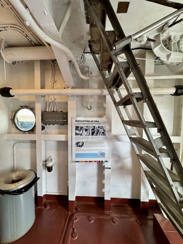
Photographed by Brandon D Cross
2. Navigating At Sea Marker
Topics. This memorial is listed in these topic lists: Communications • Environment • War, World II • Waterways & Vessels.
Location. 34° 14.196′ N, 77° 57.267′ W. Memorial is in Wilmington, North Carolina, in New Hanover County. It can be reached from Battleship Road NE 0.2 miles south of U.S.S. North Carolina Road, on the left when traveling north. It is on the bridge deck. Touch for map. Memorial is at or near this postal address: 1 Battleship Road NE, Wilmington NC 28401, United States of America. Touch for directions.

Regionally, this memorial is in the Coastal Plain and on the Cape Fear Coast. It is also in the American South, specifically in the Upper South, in the Tidewater, and on the Eastern Seaboard. Globally, it is in the North Atlantic Region, North America, the Western Hemisphere, the Western World, and the Anglosphere. Historically, it finds itself in what was once the territory of the Mississippian Culture, one of the original Thirteen Colonies, one of the Confederate States of America, and the Antebellum

via Naval History and Heritage Command, 1944
3. USS North Carolina (BB-55), 1941-1961
Naval History and Heritage Command website entry
Click for more information.
Click for more information.
Other nearby markers. At least 8 other markers are within walking distance of this marker: The Navigators (here, next to this marker); Chart House (here, next to this marker); Captain’s Sea Cabin (here, next to this marker); Battle Ribbons and Kill Board (a few steps from this marker); Magnetic Compass (a few steps from this marker); Sky II (a few steps from this marker); The Captains of the USS North Carolina (a few steps from this marker); In the Beginning: 15 Boats (a few steps from this marker). Touch for a list and map of all markers in Wilmington.
Also see . . . Navigation at War. Smithsonian Magazine website entry (Submitted on April 16, 2025, by Brandon D Cross of Flagler Beach, Florida.)
Credits. This page was last revised on April 23, 2025. It was originally submitted on April 16, 2025, by Brandon D Cross of Flagler Beach, Florida. This page has been viewed 115 times since then and 17 times this year. Photos: 1, 2. submitted on April 16, 2025, by Brandon D Cross of Flagler Beach, Florida. 3. submitted on April 23, 2025, by Larry Gertner of New York, New York. • J. J. Prats was the editor who published this page.
