Wilmington in New Hanover County, North Carolina — The American South (South Atlantic)
The Navigators
U.S.S. North Carolina

Photographed by Brandon D Cross
1. The Navigators Marker
The Navigator was the third highest ranking officer on the Ship after the Captain and the Executive Officer. The Captain and Navigator were often on the bridge for many hours on end, day and night, in dangerous areas. When they could leave to rest, their sea cabins were nearby and they could be back on the Bridge in seconds.
Crew Memories
When we first got out to the Pacific our charts were so inefficient and so out of date that we would be ordered to go to a certain place and have a hard time finding it on a chart.
Finally they came around to a good name that was on all the charts but for a year or two...if you didn't have your files up to date and they told you to go somewhere you weren't quite sure where you were going.
— Commander
this page online
As Navigator I generally conned the Ship in battle while the Captain was in overall command. While at the slit in the Conning Tower one night I decided to try a pair of binoculars with big rubber eye pieces while turret #2 was firing a salvo. Sure enough, the concussion knocked me clear across the Conning Tower. I immediately screamed I was eligible for a Purple Heart but the Captain wouldn't cooperate.
I had been Navigator for the North Carolina two years. I felt that was long enough for any one job during wartime. It was a gentleman's job and I thoroughly enjoyed it.
— Commander Thaddeus Johnson Van Merre
As Navigator I was always on call. It was an exhausting year. I was up an hour before sunrise normally with the crew, the same in the evening at sunset. We had General Quarters until an hour after sunset. I would have to take star sights, morning, evening, and at noon - sun sight at noon - but the worst part of it was that the skipper...was out there on deck practically all night and he got lonesome. He would nab me out there and I was a conversation piece for him...."
— Commander Kemp Tolley
Erected by Friends

Photographed by Brandon D Cross
2. The Navigators Marker
Topics. This memorial is listed in these topic lists: Communications • Environment • War, World II • Waterways & Vessels.
Location. 34° 14.195′ N, 77° 57.266′ W. Memorial is in Wilmington, North Carolina, in New Hanover County. It can be reached from Battleship Road Northeast 0.2 miles south of U.S.S. North Carolina Road, on the left when traveling north. It is on the bridge deck. Touch for map. Memorial is at or near this postal address: 1 Battleship Road NE, Wilmington NC 28401, United States of America. Touch for directions.

Regionally, this memorial is in the Coastal Plain and on the Cape Fear Coast. It is also in the American South, specifically in the Upper South, in the Tidewater, and on the Eastern Seaboard. Globally, it is in the North Atlantic Region, North America, the Western Hemisphere, the Western World, and the Anglosphere. Historically, it finds itself in what was once the territory of the Mississippian Culture, one of the original Thirteen Colonies, one of the Confederate States of America, and the Antebellum
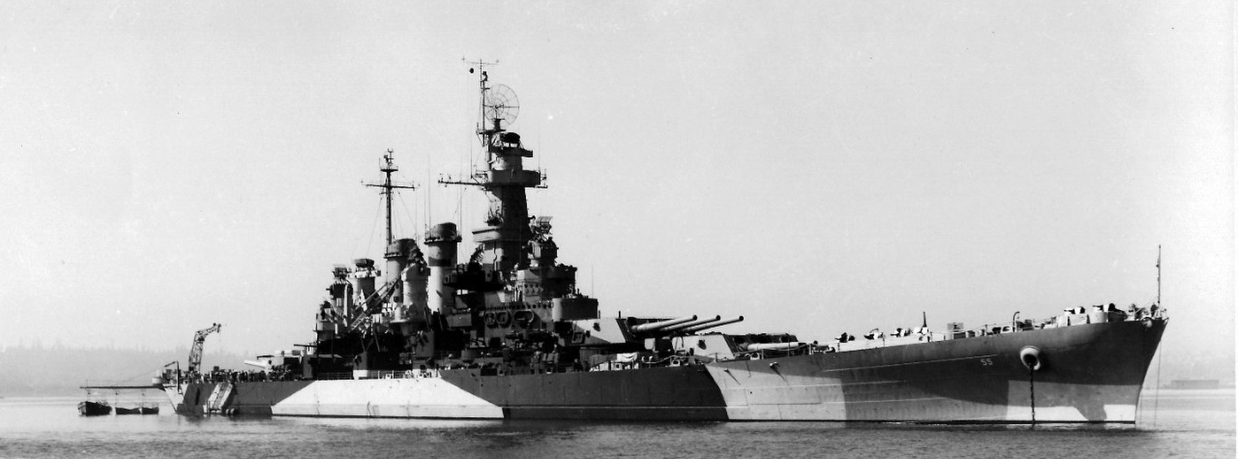
via Naval History and Heritage Command, 1944
3. USS North Carolina (BB-55), 1941-1961
Naval History and Heritage Command website entry
Click for more information.
Click for more information.
Other nearby markers. At least 8 other markers are within walking distance of this marker: Navigating At Sea (here, next to this marker); Chart House (here, next to this marker); Captain’s Sea Cabin (here, next to this marker); Magnetic Compass (a few steps from this marker); Battle Ribbons and Kill Board (a few steps from this marker); Sky II (a few steps from this marker); In the Beginning: 15 Boats (a few steps from this marker); Friendly Fire (a few steps from this marker). Touch for a list and map of all markers in Wilmington.
Also see . . . Navigation at War. (Submitted on April 16, 2025, by Brandon D Cross of Flagler Beach, Florida.)
Credits. This page was last revised on April 30, 2025. It was originally submitted on April 16, 2025, by Brandon D Cross of Flagler Beach, Florida. This page has been viewed 162 times since then and 17 times this year. Photos: 1, 2. submitted on April 16, 2025, by Brandon D Cross of Flagler Beach, Florida. 3. submitted on April 30, 2025, by Larry Gertner of New York, New York. • J. J. Prats was the editor who published this page.
