Westchester Township near Chesterton in Porter County, Indiana — The American Midwest (Great Lakes)
Protecting the Park Since 1925
The long legacy of protecting Indiana Dunes State Park's natural resources continues today.

Photographed by Daniel Barriball, April 18, 2025
1. Protecting the Park Since 1925 Marker
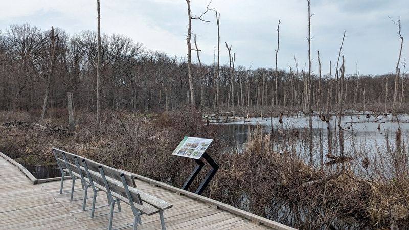
Fluctuating water levels in the marsh repeatedly damaged portions of an earlier ground-level boardwalk. Hikers trampled sensitive vegetation as they navigated the damaged trail.
To remedy the problem, an elevated boardwalk was completed in 2020. This allows water levels to change without damaging the boardwalk.
Several factors may cause water level changes, including: The presence of beaver dams. The death of ash trees leaving fewer roots to absorb water. Cyclical water level changes in Lake Michigan. Man-made structures like ditches and culverts.
Things to look for on this portion of the trail: Marsh marigold, Red-headed woodpecker
Thanks to Kenneth and Mary Hill and the Friends of Indiana Dunes for making this observation platform possible.
Erected 2020 by Indiana Department of Natural Resources, Indiana State Parks.
Topics. This historical marker is listed in these
this page online
Location. 41° 39.92′ N, 87° 1.861′ W. Marker is near Chesterton, Indiana, in Porter County. It is in Westchester Township. It is on Trail 2, on the right when traveling north. This marker is on the Trail 2 boardwalk in Indiana Dunes State Park. Touch for map. Marker is at or near this postal address: Trail 2, Chesterton IN 46304, United States of America. Touch for directions.

Regionally, this marker is in Northwest Indiana, specifically on the Indiana Dunes and Lake Michigan Shore, and in the Calumet Region. It is also in the American Midwest and in the Corn Belt. Globally, it is in North America, on the Great Lakes, in the Western Hemisphere, in the Western World, and in the Anglosphere. Historically, it finds itself in what was once the territory of the Mississippian Culture and also the Northwest Territory.
Other nearby markers. At least 8 other markers are within 2 miles of this marker, measured as the crow flies: The Great Marsh (about 300 feet away, measured in a direct line); The Prairie Club Fountain
Photographed by Daniel Barriball, April 18, 2025
2. Protecting the Park Since 1925 Marker in context
Another marker is no longer nearby. The J.D. Marshall (was approx. 1.1 miles away but has been permanently removed).
More about this marker. Photos by Ken Hill, USFWS Public Domain, Ed Schools, and Scott Namestnik.
Credits. This page was last revised on April 19, 2025. It was originally submitted on April 18, 2025, by Daniel Barriball of Chesterton, Indiana. This page has been viewed 113 times since then and 13 times this year. Photos: 1, 2. submitted on April 18, 2025, by Daniel Barriball of Chesterton, Indiana. • Andrew Ruppenstein was the editor who published this page.
