
Ashtabula in Ashtabula County, Ohio — The American Midwest (Great Lakes)
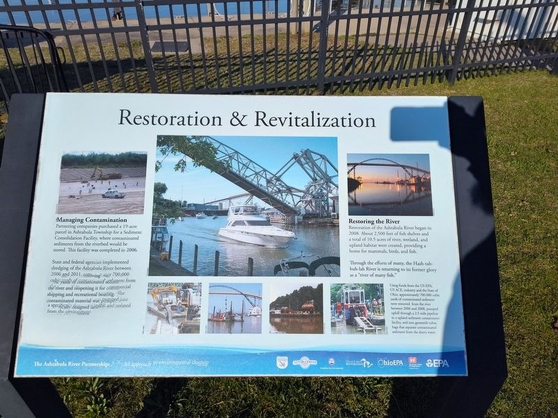
Restoration & Revitalization
Photographed by Craig Doda, April 12, 2025
1. Restoration & Revitalization Marker
Managing Contamination
Partnering companies purchased a 19-acre parcel in Ashtabula Township for a Sediment Consolidation Facility, where contaminated sediments from the riverbed would be stored. This facility was completed in 2006.
State and federal agencies implemented dredging of the Ashtabula River between 2006 and 2011, removing over 700,000 cubic yards off contaminated sediment from the river and reopening it for commercial shipping and recreational boating. The contaminated material was pumped into a specially designed laHulfill and isolated from the environment.
Restoring the River
Restoration of the Ashtabula River began in 2008. About 2,500 feet of fish shelves and a total of 10.5 acres of river, wetland, and upland habitat were created, providing a home for mammals, birds, and fish.
Through the efforts of many, the Hash-tah-buh-lah River is returning to its former glory as a "river of many fish."
Using funds from the US EPA, US ACE, industry and the State of Ohio, approximately 700,000 cubic yards of contaminated sediment were removed from the river between 2006 and 2008, pumped uphill through a 2.5 mile
this page online
Erected by The Ashtabula River Partnership.
Topics. This historical marker is listed in these topic lists: Environment • Industry & Commerce • Waterways & Vessels. A significant historical year for this entry is 2006.
Location. 41° 54.026′ N, 80° 47.892′ W. Marker is in Ashtabula, Ohio, in Ashtabula County. It is at the intersection of Bridge Street and Morton Drive, on the right when traveling west on Bridge Street. Touch for map. Marker is at or near this postal address: 983 Bridge St, Ashtabula OH 44004, United States of America. Touch for directions.

Regionally, this marker is on Ohio’s Lake Erie Shore and in the Western Reserve. It is also in the American Midwest. Globally, it is in North America, on the Great Lakes, in the Western Hemisphere, in the Western World, and in the Anglosphere. Historically, it finds itself in what was once the Haudenosaunee (Iroquois) Confederacy, the territory of the Mississippian Culture, and the Northwest Territory.
Other nearby markers. At

Photographed by Craig Doda, April 12, 2025
2. Restoration & Revitalization Marker
Credits. This page was last revised on May 11, 2025. It was originally submitted on April 19, 2025, by Craig Doda of Napoleon, Ohio. This page has been viewed 96 times since then and 15 times this year. Photos: 1, 2. submitted on April 19, 2025, by Craig Doda of Napoleon, Ohio. • Devry Becker Jones was the editor who published this page.
