Bethlehem in Lehigh County, Pennsylvania — The American Northeast (Mid-Atlantic)
Dye House
1771
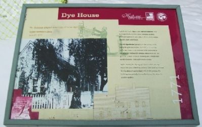
“Br. Schenk began erection of new dye shop.”
Single Brethren's Diary
June 27, 1771
Early Bethlehem's dyers used natural materials such as indigo (blue), madder (red), logwood (purple), and fustic (yellow) to add color to linen, wool, cotton, and silk cloth and thread.
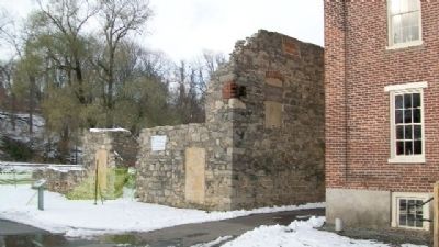
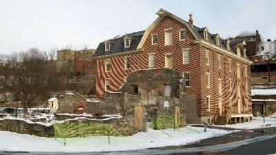
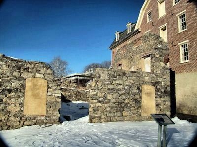
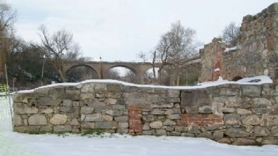
The first dye house opened in 1746 and was built along the grist mill tailrace. In 1752, a second dye house was built as an addition to the west side of the grist mill-fulling mill complex adjacent to the site. In 1771, a third, separate building was constructed on this location. Only walls remain today.
By the 1830s, the dyeing operation ended. The dye house became a dwelling and was later used as storage for the adjacent Luckenbach Mill. In the 1930s, the building was partially dismantled to use the stone for another project.
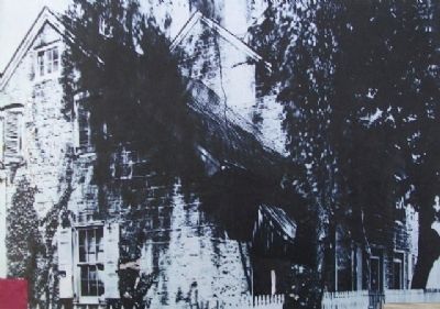
[Caption for photo on marker - damaged]
Between the ___ and 1900, the dye house was used as a dwelling.
Erected by Historic Bethlehem, HistoryWorks!, and Delaware & Lehigh National Heritage Corridor.
Topics. This historical marker is listed in these topic lists: Colonial Era • Industry & Commerce • Man-Made Features • Natural Resources • Notable Buildings. A significant historical month for this entry is June 1825.
Location. 40° 37.222′ N, 75° 23.021′ W. Marker is in Bethlehem, Pennsylvania, in Lehigh County. Marker is in the Colonial Industrial Quarter of Historic Bethlehem, along the former Old York Road, immediately west of the Luckenbach Mill, and about 100 feet east of the old stone bridge over the Monocacy Creek. Touch for map. Marker is in this post office area: Bethlehem PA 18018, United States of America. Touch for directions.
Other nearby markers. At least 8 other markers are within walking distance of this marker. Luckenbach Mill (a few steps from this marker); Butchery (within shouting distance of this marker); Miller's House (within shouting distance of this marker); Tannery (within shouting distance of this marker); Springhouse (within shouting distance of this marker); Tawery (within shouting distance of this marker); Bark Shed (about 400 feet away, measured in a direct line); First House of Moravian Settlement (about 400 feet away). Touch for a list and map of all markers in Bethlehem.
Also see . . . Colonial Industrial Quarter. (Submitted on February 1, 2010, by William Fischer, Jr. of Scranton, Pennsylvania.)
Credits. This page was last revised on October 6, 2020. It was originally submitted on February 1, 2010, by William Fischer, Jr. of Scranton, Pennsylvania. This page has been viewed 1,051 times since then and 48 times this year. Photos: 1, 2, 3. submitted on February 1, 2010, by William Fischer, Jr. of Scranton, Pennsylvania. 4. submitted on August 16, 2015, by Carolyn Martienssen of West Hazleton, Pennsylvania. 5, 6, 7. submitted on February 1, 2010, by William Fischer, Jr. of Scranton, Pennsylvania.
