Hamilton Township in Mercer County, New Jersey — The American Northeast (Mid-Atlantic)
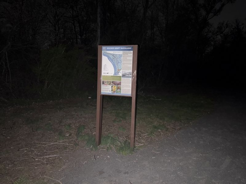
Discover Abbott Marshlands
D&R Canal State Park
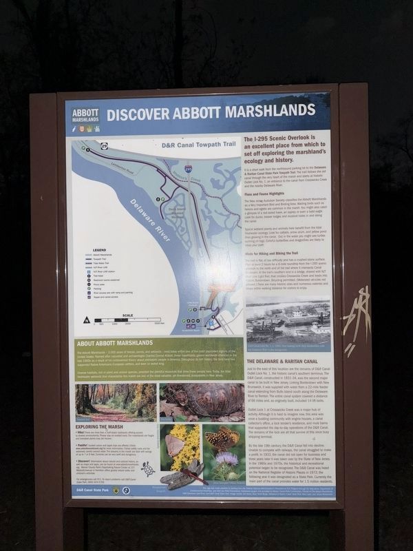
The I-295 Scenic Overlook is an excellent place from which to set off exploring the marshland's ecology and history.
It is a short walk from the northbound parking lot to the Delaware & Raritan Canal State Park Towpath Trail. The trail follows the old canal through the very heart of the marsh and starts at historic Outlet Lock No. 1, an entrance to the canal from the Crosswicks Creek and the nearby Delaware River.
Flora and Fauna Highlights
The New Jersey Audubon Society classifies the Abbott Marshlands as a Very Important Bird and Birding Area. Wading birds such as herons and egrets are common in the marsh. You might also catch a glimpse of a red-tailed hawk, an osprey or even a bald eagle. Look for ducks, beaver lodges and muskrat holes in and along the canal.
Hints for Hiking and Biking the Trail
The trail is flat, of low difficulty and has a crush-stone surface Plan at least 2 hours for the 6-mile roundtrip from the I-295 scenic overlook to the north end of the trail where it intersects Canal Boulevard. At the trail's southern end is a bridge, shared with NJT River Line Light Rail, that crosses Crosswicks
this page online
About Abbott Marshlands
The Abbott Marshlands — 3,000 acres of forests, ponds, and wetlands — exist today within one of the most populated regions of the United States. Named after naturalist and archaeologist Charles Conrad Abbott; these marshlands gained worldwide attention in the late 1800s as a result of his controversial theory about the prehistoric people in America. Throughout its rich history, the land here has supported Native Americans, European Settlers, and even an exiled king.
Diverse habitats, rich in plant and animal spaces, provided the plentiful resources that drew these people here. Today, the tidal freshwater wetlands that characterize this marsh are one of the most valuable, yet threatened, ecosystems in New Mexico.
Exploring the Marsh
• Hike! There are more than a half-dozen trailheads offering access to diverse environments. Please stay on marked trails. The marshlands are fragile and trampled plantsmay not recover.
• Paddle! Guided canoe and kayak trips are offered. Check www.abbottmarshlands.org for more information. Follow safety rules and be extremely careful around water. The streams in the Marsh are tidal with swings of up to 7 or 9 feet. Currents can be very swift and dangerous.
• Discover! Information about natural and cultural history, as well as maps and apps, can be found at www.abbottmarshlands.org. Mercer County Park's Tulpenaking Nature Center at 157 Westcott Avenue in Hamilton offers guided nature walks and children's activities.
The Delaware & Raritan Canal
Just to the east of this location are the remains of D&R Canal Outlet Lock No. 1, the historic canal's southern Terminus. The D&R Canal, constructed in 1831-34, was the second major canal to be built in New Jersey. Lincoing Bordentown with New Brunswick, it was supplied with water from a 22-mile feeder canal extending from Bulls Island South along the Delaware River to Trenton. The entire canal system covered a distance of 66 miles and, as originally built, included 14 lift locks.
Outlet Lock 1 at Crosswicks Creek was a major hub of activity. Although it is hard to imagine now, this area was once a bustling community with engine houses, a canal collector's office, a lock tender's residence, and mule barns that supported the day-to-day operations of the D&R Canal. The remains of the lock are all that survive of this once busy shipping terminal.
By the late 19th century, the D&R Canal fell into decline. Unable to complete with railways, the canal struggled to make a profit. In 1933, the canal did not open for business and three years alter it was taken over by the State of New Jersey. In the 1960s and 1970s, the historical and recreational potential began to be recognized. The D&R Canal was listed on the National Register of Historic Places in 1973; the following year it was designated as a State Park. Currently the main part of the canal provides water for 1.5 million residents.
Topics. This historical marker is listed in these topic lists: Industry & Commerce • Parks & Recreational Areas • Waterways & Vessels. A significant historical year for this entry is 1933.
Location. 40° 9.236′ N, 74° 43.022′ W. Marker is in Hamilton Township, New Jersey, in Mercer County. It is on Delaware and Raritan Canal State Park Trail 0.1 miles south of Interstate 295, on the left when traveling south. The marker may be accessed on foot from the Delaware and Raritan Canal State Park Trail, with parking available from I-295. Touch for map. Marker is at or near this postal address: Delaware and Raritan Canal State Park Trail, Trenton NJ 08611, United States of America. Touch for directions.

Regionally, this marker is in Central Jersey and in Greater Princeton. It is also in the American Northeast and in the Mid-Atlantic. Globally, it is in North America, the Western Hemisphere, the Western World, and the Anglosphere. Historically, it finds itself in what was once New Netherland and also one of the original Thirteen Colonies.
Other nearby markers. At least 8 other markers are within walking distance of this marker: The Crosswicks Creek "Trestle Vessel" (approx. ¼ mile away); Franklin Carr (approx. ¼ mile away); British Raid on Crosswicks Creek (approx. 0.3 miles away); Thomas Paine Monument (approx. 0.3 miles away); Home of Thomas Buchanan Read (approx. 0.3 miles away); Home of Stephen Sayre (approx. 0.4 miles away); The "Wye" and the Lower Bordentown Station (approx. 0.4 miles away); Home of Col. Joseph Borden 2nd (approx. 0.4 miles away).
Credits. This page was last revised on April 20, 2025. It was originally submitted on April 20, 2025, by Devry Becker Jones of Washington, District of Columbia. This page has been viewed 182 times since then and 65 times this year. Photos: 1, 2. submitted on April 20, 2025, by Devry Becker Jones of Washington, District of Columbia.
Editor’s want-list for this marker. Clear, daylight photos of the marker and its context. • Can you help?
