Near Sabbath Day Point in Warren County, New York — The American Northeast (Mid-Atlantic)
Lake George
Historic New York
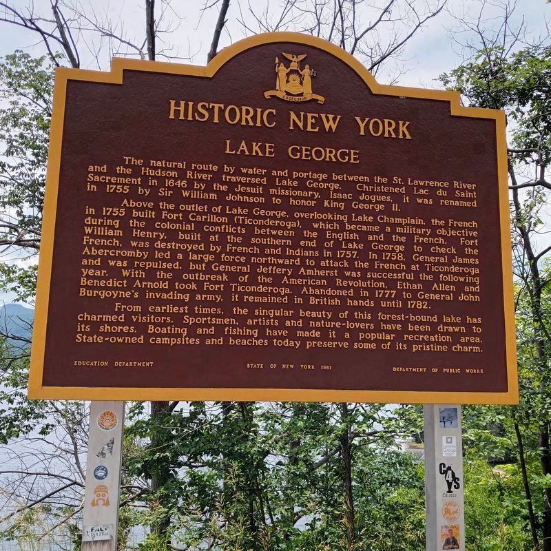
Photographed by Judith Elizabeth Pearson, June 14, 2024
1. Lake George Marker
Above the outlet of Lake George, over-looking Lake Champlain, the French in 1755 built Fort Carillon (Ticonderoga), which became a military objective during the colonial conflicts between the English and the French. Fort William Henry, built at the southern end of Lake George to check the French, was destroyed by French and Indians in 1757. In 1758 General James Abercromby led a large force northward to attack the French at Ticonderoga and was repulsed, but General Jeffery Amherst was successful the following year. With the outbreak of the American Revolution, Ethan Allen and Benedict Arnold took Fort Ticonderoga. Abandoned in 1777 to General John Burgoyne's invading army, it remained in British hands until 1782.
From earliest times, the singular beauty of this forest-bound lake has charmed visitors. Sportsmen, artists, and nature-lovers have been drawn
this page online
Erected 1966 by Education Department, State of New York 1966, Department of Public Works.
Topics and series. This historical marker is listed in these topic lists: Religion & Religious Structures • War, French and Indian • War, US Revolutionary • Waterways & Vessels. In addition, it is included in the Historic New York State series list. A significant historical year for this entry is 1646.
Location. 43° 39.759′ N, 73° 31.252′ W. Marker is near Sabbath Day Point, New York, in Warren County. It is on Lake Shore Drive (New York State Route 9N) just north of Spring Hill Lane, on the left when traveling south. It is at Sabbath Day Point overlook, which is south of Sabbath Day Point itself. Touch for map. Marker is in this post office area: Silver Bay NY 12874, United States of America. Touch for directions.

Regionally, this marker is in Upstate New York and in the Capital District. It is also in the American Northeast and in the Mid-Atlantic. Globally, it is in North

Photographed by Judith Elizabeth Pearson, June 14, 2024
2. Lake George Marker
The marker is shown at its new location and in its new colors. Lake George is in the background.
Other nearby markers. At least 8 other markers are within 6 miles of this marker, measured as the crow flies: A different marker also named Lake George (within shouting distance of this marker); Battles at Sabbath Day Point (approx. 0.4 miles away); Old School House / Kibby’s Kamp (approx. 4.2 miles away); The Alma Farm Park (approx. 4½ miles away); Rogers' Rangers Trek (approx. 5.1 miles away); Hague Heritage Cemetery (approx. 5.3 miles away); The Wreck of the Steamboat John Jay (approx. 5.8 miles away); The Working Side of Hague (approx. 5.8 miles away).
More about this marker. This marker was originally located near 43° 25.692′ N, 73° 43.33′ W, at a rest area located at Exit 22 of the Adirondack Northway (I-87). It was on the west side of the highway and was most easily accessed by south bound traffic. It was in the Lake George zip code.
Also see . . . Lake George Historical Association.
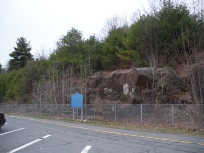
Photographed by John Farrell, April 20, 2009
3. Lake George Marker
Marker at its old location in its original colors.
Additional commentary.
1.
The relocated marker for Lake George is now on Route 9N, at Sabbath Day Point Overlook, in upstate New York.
— Submitted June 18, 2024, by Judith Elizabeth Pearson of Burke, Virginia.
Credits. This page was last revised on May 2, 2025. It was originally submitted on April 20, 2009, by John Farrell of Lake George, New York. This page has been viewed 3,627 times since then and 186 times this year. Last updated on April 22, 2025, by Carl Gordon Moore Jr. of North East, Maryland. Photos: 1, 2. submitted on June 15, 2024, by Judith Elizabeth Pearson of Burke, Virginia. 3. submitted on April 20, 2009, by John Farrell of Lake George, New York. • Bill Pfingsten was the editor who published this page.
