Galway in County Galway, Connacht, Ireland — Irish West ((Éire) North Atlantic Ocean)
The Eglinton Canal/Canáil Eglinton
The Earl of Eglinton/Wolfe Tone Bridge • Iarla Eglinton/Droichead Wolfe Tone
| — | Galway Waterway Trails/ | — |

Photographed by William Fischer, Jr., April 7, 2025
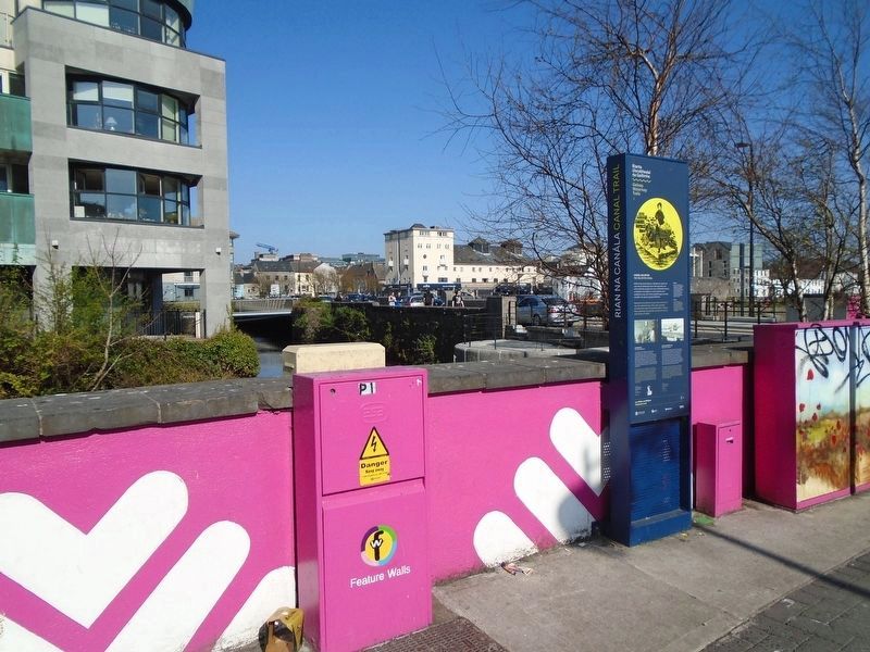
1. The Eglinton Canal/Canáil Eglinton Marker

Welcome to the Eglinton Canal. Once a link to the sea, the canal had many other uses, including providing fresh water for washing clothes. Today it flows peacefully through the city and is home to a wide variety of wildlife.
The Earl of Eglinton
The canal was opened in 1852 by the Earl of Eglinton, who was Lord Lieutenant of Ireland at the time. It was regarded as one of the most important engineering projects of the 19th century. The canal was built to connect Lough Corrib to the sea, so that goods could be transported in both directions avoiding the strong currents of the river, to provide reliable power to the many mills along the city's waterways, and as a fresh water supply.
[Portrait caption reads] Archibald William Montgomerie, 13th Earl of Eglinton and Winton, 1812-1861. Artist Edward Burton, after John Graham Gilbert.
Bridges
Originally there were five bascule, or moveable bridges along the length of the canal, which could be drawn to one side to allow boats to pass through. As the use of the canal declined, they were replaced by fixed bridges.
Wolfe Tone Bridge
The bridge behind you opened in 1934. It is the Wolfe Tone Bridge, named after a leading Irish revolutionary figure, who founded the United Irishmen and led the ill-fated 1798 Rebellion against British rule in Ireland. It replaced an iron bridge that had been built in 1887. Originally there was a temporary wooden bridge at this point, which was used by the women of the Claddagh to cross to the Fishmarket.
[Photo caption reads] Claddagh Foot Bridge.
this page online
Iarla Eglinton
Is sa bhliain 1852 a osclaíodh an chanáil agus ba é larla Eglinton, Fear ionaid an Rí an tráth sin, a d'oscail í. Measadh go raibh sí i measc na dtionscadal innealtóireachta ba thábhachtaí de chuid an 19ú haois. Tógadh an chanáil chun Loch Coirib a nascadh leis an bhfarraige le go bhféadfaí earraí a iompar sa dá threo, agus sruthanna tréana na habhann á seachaint, chun cumhacht iontaofa a sholáthar don líon mór muilte feadh uiscebhealaí na cathrach agus chun soláthar fionnuisce a chur ar fáil.
[Léann fotheideal portráide] Archibald William Montgomerie, 13ú Iarla Eglinton agus Winton, 1812-1861. Ealalontóir Edward Burton: de réir ata John Graham Gilbert.
Droichid
Ar dtús, bhi cúig dhroichead luascacha, ar a dtugtar droichid inaistrithe freisin, ann feadh na habhann, agus bhíothas in ann iad a tharraingt ar leataobh chun ligean do bháid dul tharstu. De réir mar a tháinig meath ar úsáid a bhaint as an gcanáil cuireadh droichid sheasta ina n-ionad.
Droichead Wolfe Tone
Osclaíodh an droichead atá taobh thiar díot sa bhliain 1934. Tugtar
Photographed by William Fischer, Jr., April 7, 2025
2. The Eglinton Canal/Canáil Eglinton Marker
[Léann fotheideal grianghraf] Droichead Coisithe an Chladaigh.
Erected by Government of Ireland, Fáitle Ireland, Galway City Council, and Wild Atlantic Way.
Topics. This historical marker is listed in these topic lists: Bridges & Viaducts • Colonial Era • Industry & Commerce • Waterways & Vessels. A significant historical year for this entry is 1852.
Location. 53° 16.19′ N, 9° 3.401′ W. Marker is in Galway, Connacht, in County Galway. It is on Raven Terrace just north of the Wolfe Tone Bridge, on the right when traveling north. Touch for map. Marker is at or near this postal address: 5 Raven Terrace, Galway, Connacht H91 XP73, Ireland. Touch for directions.

Regionally, it is on
Photographed by William Fischer, Jr., April 7, 2025
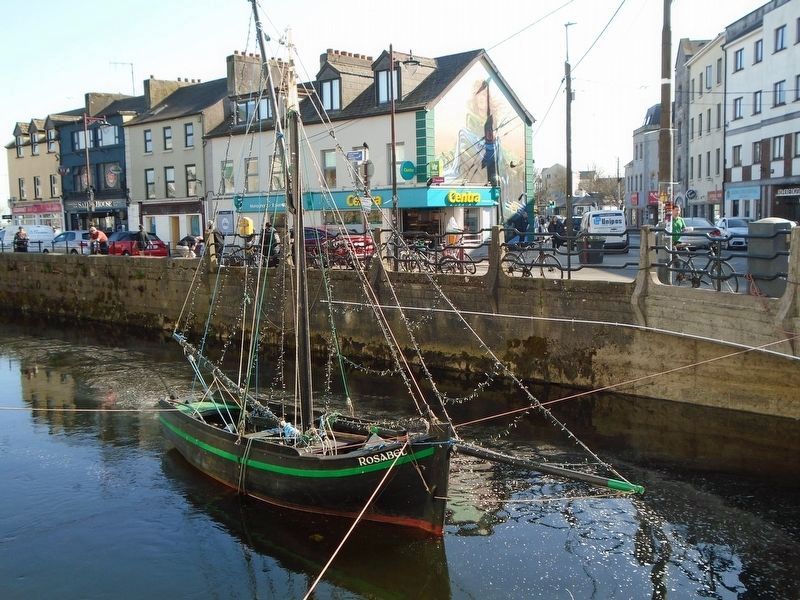
3. Galway Hooker in the Eglinton Canal
Other nearby markers. At least 8 other markers are within walking distance of this marker:
Also see . . . Eglinton Canal (National Built Heritage Service). (Submitted on April 22, 2025, by William Fischer, Jr. of Reynoldsburg, Ohio.)
Credits. This page was last revised on December 3, 2025. It was originally submitted on April 22, 2025, by William Fischer, Jr. of Reynoldsburg, Ohio. This page has been viewed 152 times since then and 23 times this year. Photos: 1, 2, 3. submitted on April 22, 2025, by William Fischer, Jr. of Reynoldsburg, Ohio.
