Lockville in Fairfield County, Ohio — The American Midwest (Great Lakes)
Ohio's Canal System
Photographed by William Fischer, Jr., March 15, 2009
1. Ohio's Canal System Marker
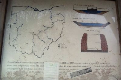
Ohio's 1000-mile network of navigable canals, constructed between 1825 and 1847, provided a system of economical transportation where none had previously existed. The canals opened many markets for its agriculture and industrial products, and attracted thousands of immigrants to the state. Today only a few of the deep excavations, the high earthen embankments and the massive structures of timber and cut stone are left to remind us of our debt to those who built Ohio's first transportation system.
Erected 1994 by Fairfield County Park District.
Topics. This historical marker is listed in these topic lists: Industry & Commerce • Man-Made Features • Waterways & Vessels. A significant historical year for this entry is 1825.
Location. Marker has been permanently removed. It was located near 39° 49.032′ N, 82° 44.181′ W. Marker was in Lockville, Ohio, in Fairfield County. It could be reached from Pickerington Road Northwest (County Road 20) south of Broad Street Northwest, on the right when traveling south. Marker is in Lockville Park, about 100 feet south of the intersection of Pickerington
this page online
We have been informed that this marker is no longer there and will not be replaced. This page is an archival view of what was.
Regionally, this marker was in the Hocking Hills and in the Columbus Metropolitan Area. It was also in the American Midwest and in the Corn Belt. Globally, it was in North America, the Western Hemisphere, the Western World, and the Anglosphere. Historically, it found itself in what was once the Haudenosaunee (Iroquois) Confederacy, the territory of the Mississippian Culture, and the Northwest Territory.

Other nearby markers. At least 8 other markers are within 3 miles of this location, measured as the crow flies: Life in Lockville (within shouting distance of this marker); Welcome to Lockville Canal Park (within shouting distance of this marker); Carroll (approx. 2 miles away); Bell From Schoolhouse on High Street (approx. 2.2 miles away); Bessie Benson Memorial Park History
Photographed by William Fischer, Jr., March 15, 2009
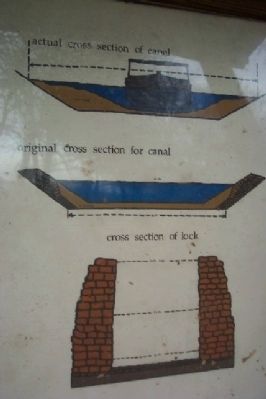
2. Canal and Lock Cross Section
Also see . . .
1. Lockville Park Along the Ohio Erie Canal. Visit Fairfield County website entry:
For more information on canals in Fairfield County. Lockville Park contains remnants of three canal locks. (Submitted on March 20, 2009, by William Fischer, Jr. of Reynoldsburg, Ohio.)
2. Ohio's Historic Canals. (Submitted on March 20, 2009, by Keith L of Wisconsin Rapids, Wisconsin.)
Additional keywords. Ohio and Erie Canal
Photographed by William Fischer, Jr., March 15, 2009
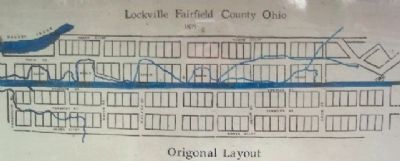
3. Original Layout of Lockville
Photographed by William Fischer, Jr., March 15, 2009
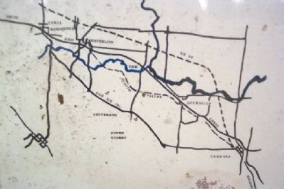
4. Map Showing Paths of Canal and the Scioto Valley Traction Interurban
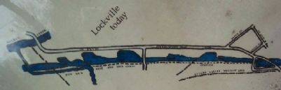
Photographed by William Fischer, Jr., March 15, 2009
5. Lockville Today
Photographed by William Fischer, Jr., March 15, 2009
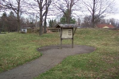
6. Ohio's Canal System Marker
Lock #11 behind marker kiosk.
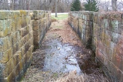
Photographed by William Fischer, Jr., March 15, 2009
7. Lock #11 of the Ohio and Erie Canal
Looking southeast.
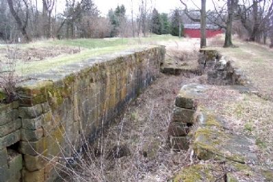
Photographed by William Fischer, Jr., March 15, 2009
8. Lock #12 of the Ohio and Erie Canal
Looking southeast toward the Hartman Covered Bridge.
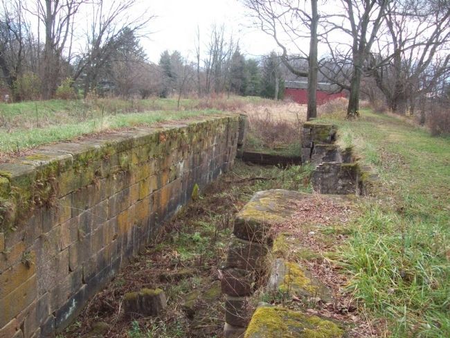
Photographed by Joe Todd Fraker, December 1, 2009
9. Ohio's Canal System Marker
There are actually three locks at this location. This is a photo of the second lock looking back toward the covered bridge.
Photographed by William Fischer, Jr., March 15, 2009
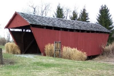
10. Hartman Covered Bridge
Photographed by William Fischer, Jr., March 15, 2009
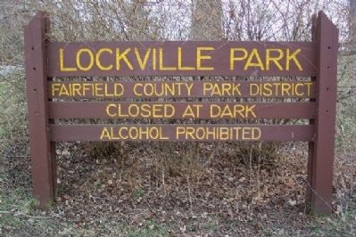
11. Lockville Park
Credits. This page was last revised on April 20, 2026. It was originally submitted on March 17, 2009, by William Fischer, Jr. of Reynoldsburg, Ohio. This page has been viewed 1,804 times since then and 39 times this year. Last updated on April 23, 2025, by Craig Doda of Napoleon, Ohio. Photos: 1, 2, 3, 4, 5, 6, 7, 8. submitted on March 17, 2009, by William Fischer, Jr. of Reynoldsburg, Ohio. 9. submitted on December 2, 2009, by Joe Todd Fraker of Lancaster, Ohio. 10, 11. submitted on March 17, 2009, by William Fischer, Jr. of Reynoldsburg, Ohio. • Devry Becker Jones was the editor who published this page.
