Penn Township near Jeannette in Westmoreland County, Pennsylvania — The American Northeast (Mid-Atlantic)
Pathways for Commerce and Conquest:
Exploring the Frontier
Photographed by Bradley Owen, April 9, 2025
1. Pathways for Commerce and Conquest: Marker
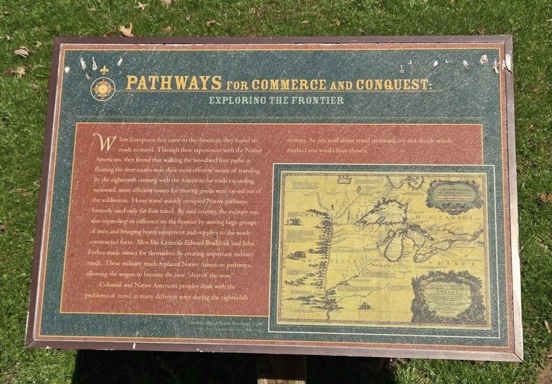
When Europeans first came to the Americas, they found no roads to travel. Through their experiences with the Native Americans, they found that walking the woodland foot paths or floating the river routes were their most effective means of traveling. By the eighteenth century with the American fur trade expanding westward, more efficient routes for moving goods were carved out of the wilderness. Horse travel quickly occupied Native pathways formerly used only for foot travel. By mid-century, the military was also expanding its influence on the frontier by moving large groups of men and bringing heavy equipment and supplies to the newly constructed forts. Men like Generals Edward Braddock and John Forbes made names for themselves by creating important military roads. These military roads replaced Native American pathways allowing the wagon to become the new "ship of the west."
Colonial and Native American peoples dealt with the problems of travel in many different ways during the eighteenth century. As you read about travel westward, try and decide which method you would have chosen.
(Caption):
Coronelli's Map of
this page online
Courtesy National Archives of Canada, Ottawa, Ontario, Canada
Topics. This historical marker is listed in these topic lists: Indigenous Peoples and Communities • Military • Roads & Vehicles. A significant historical year for this entry is 1688.
Location. 40° 21.275′ N, 79° 37.275′ W. Marker is near Jeannette, Pennsylvania, in Westmoreland County. It is in Penn Township. It is on Bushy Run Road (Pennsylvania Route 993) 0.1 miles west of Chestnut Lane, on the left when traveling west. Marker is located at a parking area south of Bushy Run Battlefield. Touch for map. Marker is in this post office area: Jeannette PA 15644, United States of America. Touch for directions.

Regionally, this marker is in the Laurel Highlands and in Greater Pittsburgh. It is also in the American Northeast, in the Mid-Atlantic, in Appalachia, and specifically in Northern Appalachia. Globally, it is in North America, the Western Hemisphere, the Western World, and the Anglosphere. Historically, it finds itself in what was once the Viceroyalty of New France, the Haudenosaunee (Iroquois) Confederacy, and one of the original

Photographed by Bradley Owen, April 9, 2025
2. Pathways for Commerce and Conquest: Marker
Other nearby markers. At least 8 other markers are within walking distance of this marker: A different marker also named Pathways for Commerce and Conquest: (a few steps from this marker); Pathways For Commerce and Conquest: (a few steps from this marker); a different marker also named Pathways for Commerce and Conquest: (within shouting distance of this marker); a different marker also named Pathways For Commerce and Conquest: (within shouting distance of this marker); Rescue (about 400 feet away, measured in a direct line); Flour Bag Fort (about 600 feet away); The Site of the "Flour Bag Fort" (about 600 feet away); Strategic Attack (about 700 feet away). Touch for a list and map of all markers in Jeannette.
Credits. This page was last revised on April 26, 2025. It was originally submitted on April 25, 2025, by Bradley Owen of Morgantown, West Virginia. This page has been viewed 96 times since then and 13 times this year. Photos: 1, 2. submitted on April 26, 2025, by Bradley Owen of Morgantown, West Virginia.
