Gravesend in Brooklyn in Kings County, New York — The American Northeast (Mid-Atlantic)
Calvert Vaux Park
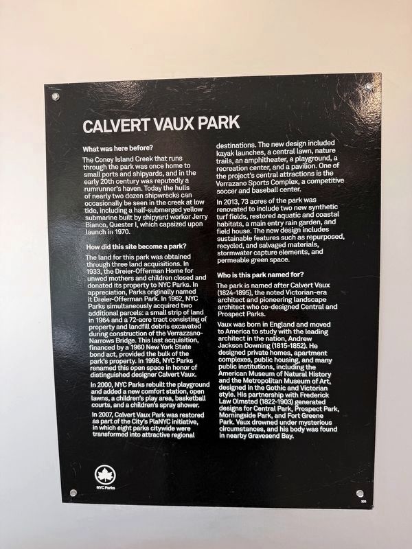
What was here before?
The Coney Island Creek that runs through the park was once home to small ports and shipyards, and in the early 20th century was reputedly a rumrunner's Haven. Today the hulls of nearly two dozen Shipwrecks can occasionally be seen in the creek at low tide, including a half-submerged yellow submarine built by Shipyard worker Jerry Bianco, Quester I, which capsized upon launch in 1970.
How did this site become a park?
This land for this park was obtained through three land acquisitions. In 1933, the Dreier-Offerman Home for unwed mothers and children closed and donated its property to NYC Parks. In appreciation, Parks originally named it Dreier-Offerman Park. In 1962, NYC Parks simultaneously acquired two additional parcels: a small strip of land in 1964 and a 72-acre tract consisting of property and landfill debris excavated during construction of the Verrazzano-Narrows Bridge. This last acquisition financed by a 1960 New York State bond act, provided the bulk of the park's property. In 1998, NYC Parks renamed this open space in honor of distinguished designer Calvert Vaux.
In 2000, NYC Parks
this page online
In 2007, Calvert Vaux Park was restored as part of the City's PlaNYC initiative in which eight Parks citywide were transformed into attractive regional destinations. The new design included kayak launches, a central lawn, nature trails, an amphitheater, a playground, a recreation center, and a pavilion. One of the project's central attractions is the Verrazano Sports Complex, a competitive soccer and baseball center.
In 2013, 73 acres of the park was renovated to include two new synthetic turf fields, restored aquatic and coastal habitats, a main entry rain garden, and field house. The new design included sustainable features such as repurposed, recycled, and salvaged materials, stormwater capture elements, and permeable green space.
Who is this park named for?
The park is named after Calvert Vaux (1824-1895), the noted Victorian-era architect and pioneering landscape architect who co-designed Central and Prospect Parks.
Vaux was born in England and moved to America to study with
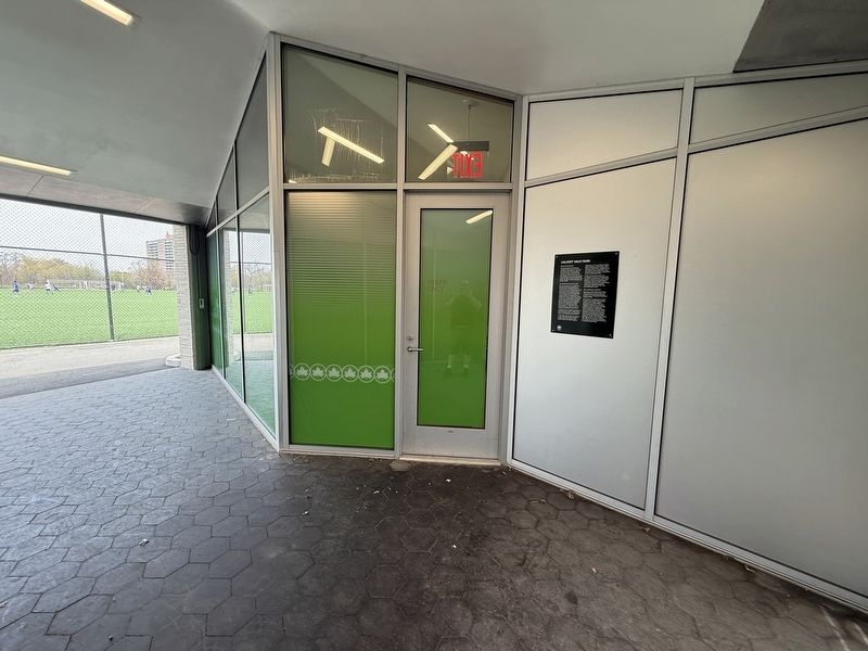
Erected by NYC Parks. (Marker Number 301.)
Topics and series. This historical marker is listed in these topic lists: Architecture • Industry & Commerce • Parks & Recreational Areas • Waterways & Vessels. In addition, it is included in the NYC Parks series list. A significant historical year for this entry is 1970.
Location. 40° 35.123′ N, 73° 59.52′ W. Marker is in Brooklyn, New York, in Kings County. It is in Gravesend. It can be reached from Shore Parkway south of Bay 44th Street, on the right when traveling south. Touch for map. Marker is at or near this postal address: 1990 Shore Pkwy, Brooklyn NY 11214, United States of America. Touch for directions.

Regionally, this marker is in New York City and on Long Island. It is also in the American Northeast, in the Mid-Atlantic, and on the Eastern Seaboard. Globally, it is in the North Atlantic Region, North America, the Western Hemisphere, the Western World, and the Anglosphere. Historically, it finds itself in what was once New Netherland and also one of the original Thirteen Colonies.
Other nearby markers. At least 8 other markers are within walking distance of this marker: Fishing the Creek (approx. 0.4 miles away); Sand Dunes (approx. 0.4 miles away); Battle of Brooklyn (approx. 0.4 miles away); Yellow Submarine (approx. 0.4 miles away); Shipwrecks (approx. 0.4 miles away); Gene Ritter Way (approx. 0.4 miles away); a different marker also named Fishing the Creek (approx. 0.4 miles away); Egrets and Swans (approx. 0.4 miles away). Touch for a list and map of all markers in Brooklyn.
Credits. This page was last revised on April 25, 2025. It was originally submitted on April 25, 2025, by Devry Becker Jones of Washington, District of Columbia. This page has been viewed 186 times since then and 35 times this year. Photos: 1, 2. submitted on April 25, 2025, by Devry Becker Jones of Washington, District of Columbia.
