Penn Township near Jeannette in Westmoreland County, Pennsylvania — The American Northeast (Mid-Atlantic)
After The Battle
Bushy Run Battlefield
Photographed by Bradley Owen, April 9, 2025
1. After The Battle Marker
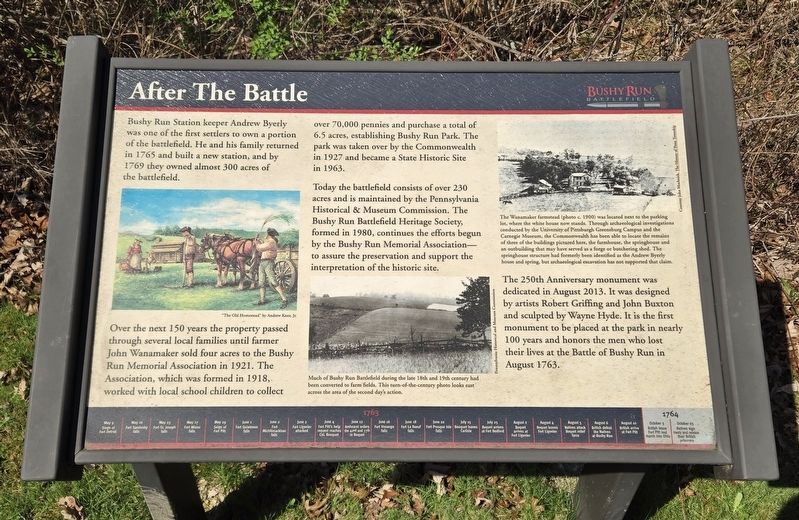
Bushy Run Station keeper Andrew Byerly was one of the first settlers to own a portion of the battlefield. He and his family returned in 1765 and built a new station, and by 1769 they owned almost 300 acres of the battlefield.
Over the next 150 years the property passed through several local families until farmer John Wanamaker sold four acres to the Bushy Run Memorial Association in 1921. The Association, which was formed in 1918, worked with local school children to collect over 70,000 pennies and purchase a total of 6.5 acres, establishing Bushy Run Park. The park was taken over by the Commonwealth in 1927 and became a State Historic Site in 1963.
Today the battlefield consists of over 230 acres and is maintained by the Pennsylvania Historical & Museum Commission. The Bushy Run Battlefield Heritage Society, formed in 1980, continues the efforts begun by the Bushy Run Memorial Association-to assure the preservation and support the interpretation of the historic site.
The 250th Anniversary monument was dedicated in August 2013. It was designed by artists Robert Griffing and John Buxton and sculpted by Wayne Hyde.
this page online
(Captions):
"The Old Homestead" by Andrew Knez, Jr.
Much of Bushy Run Battlefield during the late 18th and 19th century had been converted to farm fields. This turn-of-the-century photo looks east across the area of the second day's action.
Pennsylvania Historical and Museum Commission
The Wanamaker farmstead (photo c. 1900) was located next to the parking lot, where the white house now stands. Through archaeological investigations conducted by the University of Pittsburgh Greensburg Campus and the Carnegie Museum, the Commonwealth has been able to locate the remains of three of the buildings pictured here, the farmhouse, the springhouse and an outbuilding that may have served as a forge or butchering shed. The springhouse structure had formerly been identified as the Andrew Byerly house and spring, but archaeological excavation has not supported that claim.
Courtesy John Mochnick. The History of Penn Township
(Timeline at the bottom of the marker)
• May 16 Fort Sandusky falls
• May 25 Fort St. Joseph falls
• May 27 Fort Miami falls
• May 29 Siege of Fort Pitt
• June 1 Fort Ouiatenon falls
• June 2 Fort Michilimackinac falls
• June 2 Fort Ligonier attacked
• June 4 Fort Pitt’s help request reaches Col. Bouquet
• June 12 Amhearst orders the 42nd and 77th to Bouquet
• June 16 Fort Venango falls
• June 18 Fort Le Boeuf falls
• June 22 Fort Pesque Isle falls
• July 15 Bouquet leaves Carlisle
• July 25 Bouquet arrives at Fort Bedford
• August 2 Bouquet arrives at Fort Ligonier
• August 4 Bouquet leaves Fort Ligonier
• August 5 Natives attack Bouquet relief forces
• August 6 British defeat the Natives at Bushy Run
• August 10 British arrive at Fort Pitt
• October 25 Natives sign treaty and release their British prisoners
Topics.
Photographed by Bradley Owen, April 9, 2025
2. After The Battle Marker
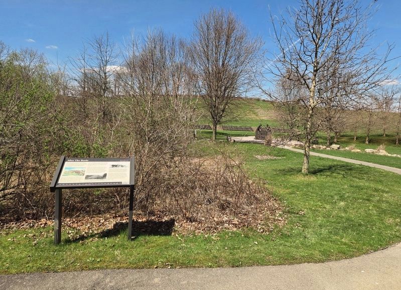
The 250th Anniversary Monument can be seen in the distance at the right of the marker at the end of the walkway.
Location. 40° 21.418′ N, 79° 37.672′ W. Marker is near Jeannette, Pennsylvania, in Westmoreland County. It is in Penn Township. It can be reached from Bushy Run Road (Pennsylvania Route 993) 0.6 miles east of Gongaware Road, on the left when traveling east. Marker is located on the grounds of Bushy Run Battlefield. Touch for map. Marker is at or near this postal address: 1253 Bushy Run Road, Jeannette PA 15644, United States of America. Touch for directions.

Regionally, this marker is in the Laurel Highlands and in Greater Pittsburgh. It is also in the American Northeast, in the Mid-Atlantic, in Appalachia, and specifically in Northern Appalachia. Globally, it is in North America, the Western Hemisphere, the Western World, and the Anglosphere. Historically, it finds itself in what was once the Viceroyalty of New France, the Haudenosaunee (Iroquois) Confederacy, and one of the original Thirteen Colonies.
Other nearby markers. At least 8 other markers are within walking distance of this marker: Bushy Run Station (within shouting distance of this marker); Bushy Run Battle 250th Anniversary Monument (within shouting distance of this marker); Welcome to Bushy Run Battlefield (about 600 feet away, measured in a direct line); Aftermath (about 600 feet away); Ambushed (about 600 feet away); Bushy Run Battlefield (about 800 feet away); Andrew Byerly's Spring (approx. 0.2 miles away); The Central Fire (approx. 0.2 miles away). Touch for a list and map of all markers in Jeannette.
Credits. This page was last revised on April 29, 2025. It was originally submitted on April 28, 2025, by Bradley Owen of Morgantown, West Virginia. This page has been viewed 373 times since then and 88 times this year. Photos: 1, 2. submitted on April 28, 2025, by Bradley Owen of Morgantown, West Virginia.
