Del Ray in Alexandria, Virginia — The American South (Mid-Atlantic)
Kettle Park
Richmond Hwy. & E. Bellefonte Ave.
| — | City of Alexandria, Virginia | — |
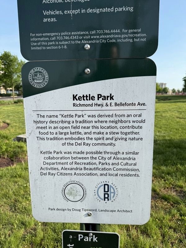
The name "Kettle Park" was derived from an oral history describing a tradition where neighbors would meet in an open field near this location, contribute food to a large kettle, and make a stew together. This tradition embodies the spirit and giving nature of the Del Ray community.
Kettle Park was made possible through a similar collaboration between the City of Alexandria Department of Recreation, Parks and Cultural Activities, Alexandria Beautification Commission, Del Ray Citizens Association, and local residents.
Park design by Doug Tispword, Landscape ARchitect
Erected by City of Alexandria Department of Recreation, Parks and Cultural Activities, Alexandria Beautification Commission, Del Ray Citizens Association, and local residents.
Topics and series. This historical marker is listed in these topic lists: Anthropology & Archaeology • Parks & Recreational Areas. In addition, it is included in the Virginia, The City of Alexandria series list.
Location. 38° 49.425′ N, 77° 3.033′ W. Marker is in Alexandria, Virginia. It is in Del Ray. It is on East Bellefonte
this page online

Regionally, this marker is in the Washington Metropolitan Area and in Northern Virginia. It is also in the American South, specifically in the Upper South, in the Mid-Atlantic, and on the Eastern Seaboard. Globally, it is in the North Atlantic Region, North America, the Western Hemisphere, the Western World, and the Anglosphere. Historically, it finds itself in what was once the territory of the Mississippian Culture, one of the original Thirteen Colonies, one of the Confederate States of America, and the Antebellum South.
Other nearby markers. At least 8 other markers are within walking distance of this marker: Potomac Yard in Transition (about 600 feet away, measured in a direct line); The Rail Yard Hump (about 700 feet away); Crossroads of Transportation (about 800 feet away); All Aboard for Alexandria (approx. 0.2 miles away); The Alexandria Almshouse (approx. ¼ mile away); The People of Potomac Yard (approx. ¼ mile


Photographed by Devry Becker Jones (CC0), April 29, 2025
3. Adjacent temporary signage
Eugene Simpson Park Ball Field Renovations
Design: 2021 to 2024 ➡ Construction: 2024 to 2025
Tell the City, plan your Park!
The Simpson Park Ball Field Renovation Project's guiding principal is to increase to usability of the ball fields during the sports season. The project intends to deliver many of the remaining recommendations of the 2014 Citywide Park Improvement Plan, which are listed below and identified on concept plan. Please mark your thoughts and comments on this board or take the public web survey linked below. A public meeting will be held this Spring to present the design and gather additional feedback.
Project Goals:
#1 Plant Trees along the northern alleyway
#2 Provide hardscape trails in the east half of the park
#3 Provide new ADA access from Monroe Ave.
#4 Install new bleachers, equipment storage and concessions
#5 Create a picnic area near the concessions
#6 Expand the parking lot and improve circulations
#7 Improve the turf at Big Simpson with option for synthetic turf
#8 Improve natural turf drainage at Little Simpson
Design: 2021 to 2024 ➡ Construction: 2024 to 2025
Tell the City, plan your Park!
The Simpson Park Ball Field Renovation Project's guiding principal is to increase to usability of the ball fields during the sports season. The project intends to deliver many of the remaining recommendations of the 2014 Citywide Park Improvement Plan, which are listed below and identified on concept plan. Please mark your thoughts and comments on this board or take the public web survey linked below. A public meeting will be held this Spring to present the design and gather additional feedback.
Project Goals:
#1 Plant Trees along the northern alleyway
#2 Provide hardscape trails in the east half of the park
#3 Provide new ADA access from Monroe Ave.
#4 Install new bleachers, equipment storage and concessions
#5 Create a picnic area near the concessions
#6 Expand the parking lot and improve circulations
#7 Improve the turf at Big Simpson with option for synthetic turf
#8 Improve natural turf drainage at Little Simpson
Credits. This page was last revised on May 1, 2025. It was originally submitted on May 1, 2025, by Devry Becker Jones of Washington, District of Columbia. This page has been viewed 168 times since then and 37 times this year. Photos: 1, 2, 3. submitted on May 1, 2025, by Devry Becker Jones of Washington, District of Columbia.
