
Pinson in Madison County, Tennessee — The American South (East South Central)
Ozier Mound
Pinson Mounds State Archaeological Park
Photographed by David Austin
1. Ozier Mound Marker
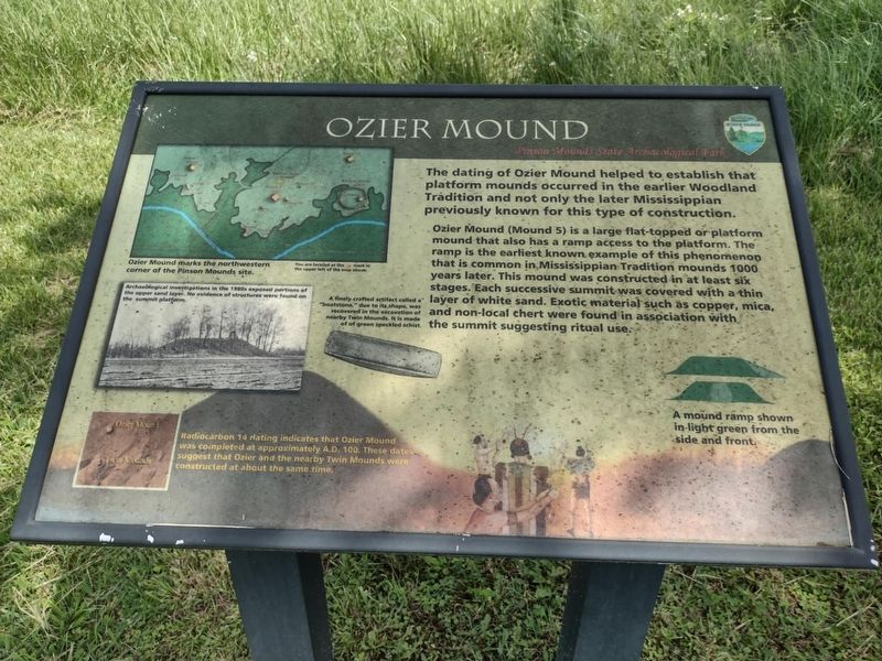
The dating of Ozier Mound helped to establish that platform mounds occurred in the earlier Woodland Tradition and not only the later Mississippian previously known for this type of construction.
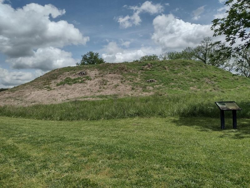
Ozier Mound (Mound 5) is a large flat-topped or platform mound that also has a ramp access to the platform. The ramp is the earliest known example of this phenomenon that is common in Mississippian Tradition mounds 1000 years later. This mound was constructed in at least six stages. Each successive summit was covered with a thin layer of white sand. Exotic material such as copper, mica, and non-local chert were found in association with the summit suggesting ritual use.
Topics. This historical marker is listed in these topic lists: Anthropology & Archaeology • Indigenous Peoples and Communities • Religion & Religious Structures.
Location. 35° 29.94′ N, 88° 41.671′ W. Marker is in Pinson, Tennessee, in Madison County. It can be reached from Pinson Mound Road south of Ozier Road (Tennessee Route 197), on the left when traveling north. The marker stands on the southwest
this page online

Regionally, this marker is in West Tennessee. It is also in the American South, specifically in the Deep South, and specifically in the Upper South. Globally, it is in North America, the Western Hemisphere, the Western World, and the Anglosphere. Historically, it finds itself in what was once the territory of the Mississippian Culture, one of the Confederate States of America, and the Antebellum South.
Other nearby markers. At least 8 other markers are within walking distance of this marker: A different marker also named Ozier Mound (a few steps from this marker); Mound 12 (approx. 0.6 miles away); Mound 14 Sector (approx. 0.7 miles away); Latter Mississippian Presence (approx. 0.7 miles away); Pinson Mounds in the Mississippi Delta (approx. 0.7 miles away); Pinson Mounds in the Mid South (approx. 0.7 miles away); Mound 11 Sector (approx. 0.7 miles away); The Middle Woodland Tradition (approx. 0.7 miles away). Touch for a list and map of all markers in Pinson.
Regarding Ozier Mound. Date
Photographed by David Austin
2. Ozier Mound Marker
Credits. This page was last revised on May 15, 2025. It was originally submitted on May 1, 2025, by David Austin of Scotts Hill, Tennessee. This page has been viewed 116 times since then and 28 times this year. Photos: 1, 2. submitted on May 1, 2025, by David Austin of Scotts Hill, Tennessee. • Devry Becker Jones was the editor who published this page.
