
Fruita in Wayne County, Utah — The American Mountains (Southwest)
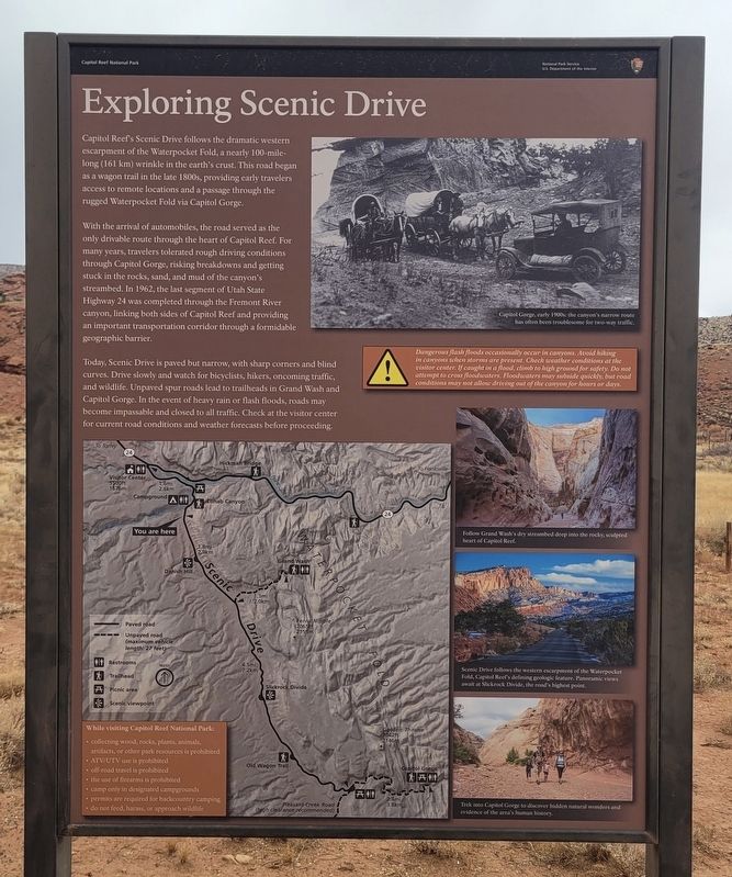
Exploring Scenic Drive
Photographed by James Hulse, April 2, 2025
1. Exploring Scenic Drive Marker
With the arrival of automobiles, the road served as the only drivable route through the heart of Capitol Reef. For many years, travelers tolerated rough driving conditions through Capitol Gorge, risking breakdowns and getting stuck in the rocks, sand, and mud of the canyon's streambed. In 1962, the last segment of Utah State Highway 24 was completed through the Fremont River canyon, linking both sides of Capitol Reef and providing an important transportation corridor through a formidable geographic barrier.
Today, Scenic Drive is paved but narrow, with sharp corners and blind curves. Drive slowly and watch for bicyclists, hikers, oncoming traffic, and wildlife. Unpaved spur roads lead to trailheads in Grand Wash and Capitol Gorge. In the event of heavy rain or flash floods, roads may become
this page online
Dangerous flash floods occasionally occur in canyons. Avoid hiking in canyons when storms are present. Check weather conditions at the visitor center. If caught in a flood, climb to high ground for safety. Do not attempt to cross floodwaters. Floodwaters may subside quickly, but road conditions may not allow driving out of the canyon for hours or days.
While visiting Capitol Reef National Park:
• collecting wood, rocks, plants, animals, artifacts, or other park resources is prohibited
• ATV/UTV use is prohibited
• off-road travel is prohibited
• the use of firearms is prohibited
• camp only in designated campgrounds
• permits are required for backcountry camping
• do not feed, harass, or approach wildlife
Captions
(Photo #1) Capitol Gorge, early 1900s: the canyon's narrow route has often been troublesome for two-way traffic.
(Photo #2) Follow Grand Wash's dry streambed deep into the rocky, sculpte heart of Capitol Reef.
(Photo #3) Scenic Drive follows the western escarpment of the Waterpocket Fold, Capitol Reef's defining geologic feature. Panoramic views await at Slickrock Divide, the road's highest point.
(Photo #4) Trek into Capitol Gorge to discover hidden natural wonders and evidence of the area's human history,
Erected by Capital
Photographed by James Hulse, April 2, 2025
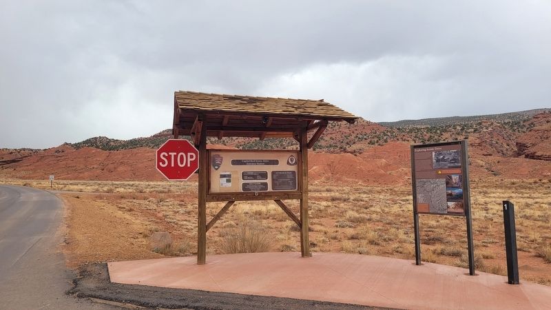
2. The Exploring Scenic Drive Marker along Scenic Drive
Topics. This historical marker is listed in these topic lists: Parks & Recreational Areas • Roads & Vehicles. A significant historical year for this entry is 1962.
Location. 38° 16.674′ N, 111° 14.982′ W. Marker is in Fruita, Utah, in Wayne County. It is on Scenic Drive 1.6 miles south of Utah Road 24, on the right when traveling south. The marker is located along the street at a stop sign. Touch for map. Marker is at or near this postal address: Scenic Dr Pullout, Torrey UT 84775, United States of America. Touch for directions.

Regionally, this marker is in Canyon Country. It is also in the American Mountain West, on the Colorado Plateau, and at the Four Corners. Globally, it is in North America, the Western Hemisphere, the Western World, and the Anglosphere. Historically, it finds itself in what was once New Spain and also Mexico’s Alta California.

Other nearby markers. At least 8 other markers are within walking distance of this marker: Pendleton-Jorgenson-Gifford Barn Story (approx. 0.4 miles away); Living Off the Land (approx. 0.4 miles away); Silent Sentinels (approx. 0.6 miles away); It's Alive! (approx. 0.6 miles away); The Giving Groves (approx. 0.6 miles away); A Community's Cornerstone (approx. 0.7 miles away); Holt Orchard (approx. 0.8 miles away); Mott Orchard (approx. 0.8 miles away). Touch for a list and map of all markers in Fruita.
Credits. This page was last revised on May 3, 2025. It was originally submitted on May 1, 2025, by James Hulse of Medina, Texas. This page has been viewed 133 times since then and 12 times this year. Photos: 1, 2. submitted on May 3, 2025, by James Hulse of Medina, Texas.
