
Fruita in Wayne County, Utah — The American Mountains (Southwest)
Passage Through Time
Photographed by James Hulse, April 2, 2025
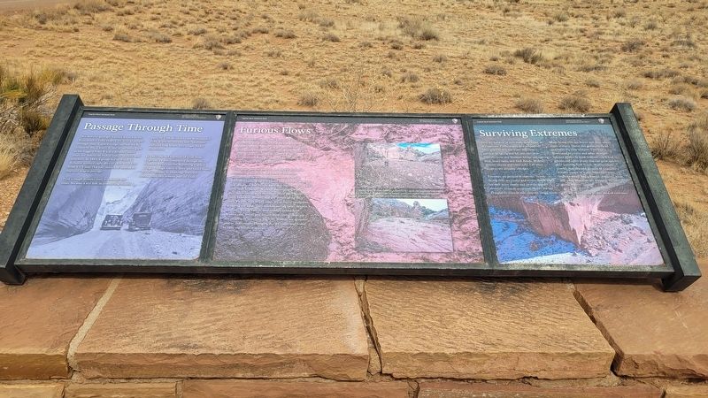
1. Passage Through Time Marker
First a rough frontier trail, eventually the route became a key link in connecting isolated parts of Utah divided by the Waterpocket Fold. It was no smooth ride. Motorists suffered long hours over rough, rocky conditions.
In 1962, the last segment of Utah State Highway 24 was completed through the Fremont River canyon, bypassing Capitol Gorge. Though travel is safer and easier today, floods continue to challenge travelers throughout this remote part of Utah.
Furious Flows
Nearly 100 miles long (161 km), this fortress of stone known as the Waterpocket Fold was sculpted by water. The rock barrier and the presence of water determine where plants, animals, and humans will exist. With less than
this page online
This quiet, narrow canyon can quickly present a thundering hazard for all forms of life when summertime monsoonal, thunderstorms bring torrential rains. With few plants and little soil, water is not absorbed, but rapidly runs downstream, giving life little time to escape. Without warning, dry washes become overrun with sediment-filled flash floods that carry boulders, shrubs, and any debris along their path. Floods with heavy loads act as liquid sandpaper, scouring the land. They wash materials away, deepen canyons, widen yalleys, and reshape landscapes. Winter rain, snow, and freeze-thaw cycles continue. the process of sculpting the reef. Washes are dynamic places, continually changing due to water, and home to only the hardiest species.
Captions
(Photo #1) During times of ramy weather, a peaceful dry wash can suddenly turn into a dangerous, raging torrent of muddy water and debris. Always know the weather forecast before entering desert canyons and dry washes.
Surviving Extremes
Only the hardiest of lives make
Photographed by James Hulse, April 2, 2025
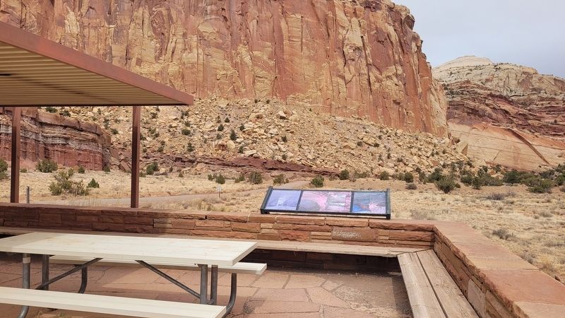
2. The view of the Marker at the rest stop
Extremes are present in canyons. North-facing cliffs are cooler and wetter. Snow and ice melt more slowly and provide more moisture to needy creatures. Notice the tall Douglas-fir trees in side canyons facing north.
South-facing cliffs are, hotter and drier where water is scarce. Direct sun glares overhead and bakes the rock surfaces. This area is dominated by cactus and other drought-tolerant plants. In wash bottoms you'll find grasses and other plants that can grow quickly after scouring flash floods. Waterpockets provide that rare and greatest of treasures: a reliable source of water. Mountain lions, bighorn sheep, and a myriad of insects, birds, and small mammals are drawn to the life-giving waters.
Please tread lightly on this land of extremes.
Erected by Capital Reef National Park, National Park Service, U.S. Department of the Interior.
Topics. This historical marker is listed in these topic lists: Parks & Recreational Areas • Roads & Vehicles. A significant historical year for this entry is 1883.
Location. 38° 12.519′ N, 111° 11.644′ W. Marker is in Fruita, Utah, in Wayne County. It is on Scenic Drive 8 miles south of Utah Road 24. The marker is located at the small rest area. Touch for map. Marker is at or near this postal address: 3076 Scenic Dr, Torrey UT 84775, United States of America. Touch for directions.

Regionally, this marker is in Canyon Country. It is also in the American Mountain West, on the Colorado Plateau, and at the Four Corners. Globally, it is in North America, the Western Hemisphere, the Western World, and the Anglosphere. Historically, it finds itself in what was once New Spain and also Mexico’s Alta California.

Other nearby markers. At least 8 other markers are within 6 miles of this marker, measured as the crow flies: The Price of a Promise (approx. 4 miles away); Behunin Cabin (approx. 5.3 miles away); Exploring Scenic Drive (approx. 5.7 miles away); Pendleton-Jorgenson-Gifford Barn Story (approx. 5.9 miles away); Living Off the Land (approx. 6 miles away); Farming the Fremont (approx. 6 miles away); Silent Sentinels (approx. 6 miles away); Holt Orchard (approx. 6.1 miles away). Touch for a list and map of all markers in Fruita.
Credits. This page was last revised on May 3, 2025. It was originally submitted on May 2, 2025, by James Hulse of Medina, Texas. This page has been viewed 137 times since then and 17 times this year. Photos: 1, 2. submitted on May 3, 2025, by James Hulse of Medina, Texas.
