
Fort Snelling in Hennepin County, Minnesota — The American Midwest (Upper Plains)
The Upper Post at Fort Snelling
Photographed by McGhiever, October 21, 2024
1. The Upper Post at Fort Snelling Marker
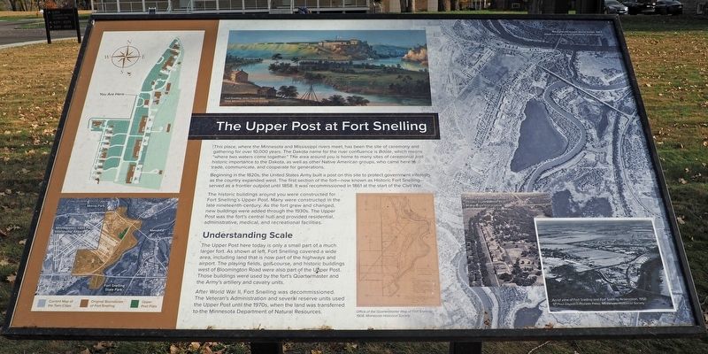
This place, where the Minnesota and Mississippi rivers meet, has been the site of ceremony and gathering for over 10,000 years. The Dakota name for the river confluence is Bdote, which means "where two waters come together." The area around you is home to many sites of ceremonial and historic importance to the Dakota, as well as other Native American groups, who came here to trade, communicate, and cooperate for generations.
Beginning in the 1820s, the United States Army built a post on this site to protect government interests as the country expanded west. The first section of the fort—now known as Historic Fort Snelling—served as a frontier outpost until 1858. It was recommissioned in 1861 at the start of the Civil War.
The historic buildings around you were constructed for Fort Snelling's Upper Post. Many were constructed in the late nineteenth-century. As the fort grew and changed, new buildings were added through the 1930s. The Upper Post was the fort's central hub and provided residential, administrative, medical, and recreational facilities.
Understanding Scale
The Upper Post here today is only a small
this page online
After World War II, Fort Snelling was decommissioned. The Veteran's Administration and several reserve units used the Upper Post until the 1970s, when the land was transferred to the Minnesota Department of Natural Resources.
Office of the Quartermaster Map of Fort Snelling, 1908, Minnesota Historical Society
Aerial of Fort Snelling Officers Houses Taylor Avenue, 1936 Minneapolis Star Journal, Minnesota Historical Society
Aerial view of Fort Snelling and Fort Snelling Reservation, 1958, St. Paul Dispatch-Pioneer Press, Minnesota Historical Society
Topics. This historical marker is listed in these topic lists: Forts and Castles • Indigenous Peoples and Communities • Waterways & Vessels. A significant historical year for this entry is 1820.
Location. 44° 53.234′ N, 93° 11.427′ W.
Photographed by McGhiever, October 21, 2024
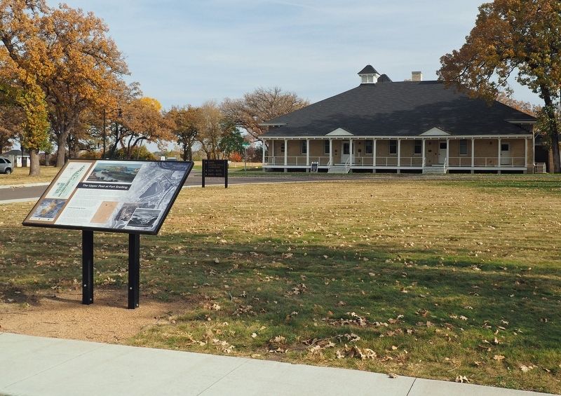
2. The Upper Post at Fort Snelling Marker in front of the Upper Post Flats main office

Regionally, this marker is in the Twin Cities Metropolitan Area. It is also in the American Midwest, in the Corn Belt, and in the Great River Road Region. Globally, it is in North America, the Western Hemisphere, the Western World, and the Anglosphere. Historically, it finds itself in what was once Rupert’s Land, the territory of the Mississippian Culture, and the Louisiana Purchase.
Other nearby markers. At least 8 other markers are within walking distance of this marker: Military Intelligence Service Language School (within shouting distance of this marker); Quartermaster Shops (about 300 feet away, measured in a direct line); Getting Around at the Fort (about 400 feet away); Women at Work (about 500 feet away); Fun at the Fort (about 500 feet away); Military Units of Fort Snelling (about 500 feet away); Military Training at Fort Snelling (about 700 feet away); Medicine at the Fort (approx. 0.2 miles away). Touch for a list and map of all markers in Fort Snelling.
Credits. This page was last revised on May 3, 2025. It was originally submitted on May 3, 2025, by McGhiever of Minneapolis, Minnesota. This page has been viewed 146 times since then and 17 times this year. Photos: 1, 2. submitted on May 3, 2025, by McGhiever of Minneapolis, Minnesota.
