Sparrows Point in Baltimore County, Maryland — The American Northeast (Mid-Atlantic)
Join the Adventure
Captain John Smith Chesapeake National Historic Trail
| — | National Park Service, U.S. Department of the Interior | — |
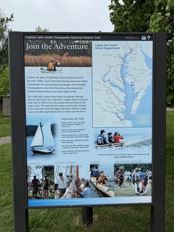
Explore the places Englishman John Smith traveled in the early 1600s. Learn about the thriving American Indian communities he encountered and imagine the bountiful Chesapeake he observed. Experience the natural and cultural richness that exists in the region today.
The 3,000-mile Captain John Smith Chesapeake National Historic Trail traces the exploratory voyages Smith conducted from 1607 to 1609 on the Chesapeake Bay and along several major rivers. The trail includes parks, museum sites, driving tours, and water trails that align with Smith’s historic voyage routes and offer opportunities for recreation and discovery.
Experience the Trail
• Explore rivers, coves, and open water by kayak, sailboat, or motor craft.
• Bicycle or hike along woodland trails and shoreline paths.
• Follow winding back roads through rural landscapes and historic villages.
• Visit places that celebrate American Indian heritage.
• See birds and other wildlife foraging in marshes1 waterways and forests
• Attend festivals and demonstrations, or join a guided tour.
Erected by National Park Service, U.S. Department of the Interior.
this page online
Topics. This historical marker is listed in these topic lists: Colonial Era • Exploration • Indigenous Peoples and Communities. A significant historical year for this entry is 1607.
Location. 39° 12.476′ N, 76° 25.435′ W. Marker is in Sparrows Point, Maryland, in Baltimore County. It can be reached from Old Bay Shore Road south of Beaver Pond Trail, on the right when traveling east. Touch for map. Marker is at or near this postal address: 9000 Bay Shore Rd, Sparrows Point MD 21219, United States of America. Touch for directions.

Regionally, this marker is in the Baltimore Metro Region and in Central Maryland. It is also in the American Mid-Atlantic, in the Chesapeake Bay Region, and on the Eastern Seaboard. Globally, it is in the North Atlantic Region, North America, the Western Hemisphere, the Western World, and the Anglosphere. Historically, it finds itself in what was once one of the original Thirteen Colonies and also the Antebellum South.
Other nearby markers. At least 8 other markers are within walking distance of this marker: Hard Travel (a few steps from this marker); John Smith Explores the Chesapeake
Another marker is no longer nearby. The Trolley Station at Bayshore Park (was about 600 feet away, measured in a direct line but has been confirmed missing).
Credits. This page was last revised on May 4, 2025. It was originally submitted on May 4, 2025, by Devry Becker Jones of Washington, District of Columbia. This page has been viewed 99 times since then and 7 times this year. Photos: 1, 2. submitted on May 4, 2025, by Devry Becker Jones of Washington, District of Columbia.
