
Fort Howard in Edgemere in Baltimore County, Maryland — The American Northeast (Mid-Atlantic)
Fire Control Towers
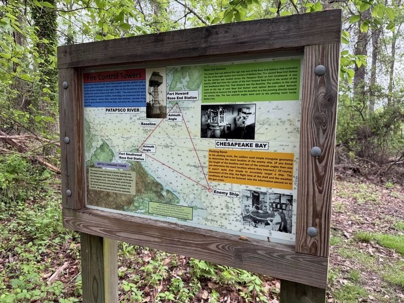
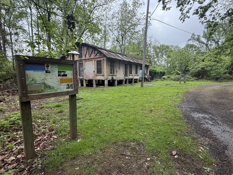
In the trees behind this sign you'll find a square concrete platform with a circular pillar in the center. There is another one just like it on the far side of the derelict buildings to your right. They are the foundations of coast artillery fire control towers built here in 1907. They were essential parts of a system of personnel, facilities, technology and procedures that were used to observe enemy ships, estimate their positions, calculate firing data for guns directed to hit those ships, and assess the effectiveness of such fire.
Base End Stations
The tower that was behind this sign was one of the Base End Stations that controlled the fire of eight twelve inch mortars of Battery Key. The second Base End Station for the mortars was located
this page online
Plotting Room
In the plotting room, the soldiers used simple triangular geometry to determine the exact location of the enemy ship. (If you know the length of the baseline and two of the azimuth angles then you can determine the exact location where they intersect.) Of course, it wasn't quite that simple to accurately target a ship. The movement of the ship, the flight time of the shell and the weather conditions all had to be factored into the information passed on to the gun crews.
Erected by Jacob Lure, Eagle Scout, Troop 427; The Edgemere Sparrows Point Recreation Coucnil; The Dundalk Patapsco Neck Historical Society; The Coast Defense Study Group.
Topics.

Photographed by Evan Dwyer, March 7, 2026
2. Fire Control Towers Marker
The base plinth for one of the towers is visible on a concrete pad just west of the marker, visible in late fall and winter.
Location. 39° 11.933′ N, 76° 26.451′ W. Marker is in Edgemere, Maryland, in Baltimore County. It is in Fort Howard. It can be reached from Patsco Street east of Fort Howard Park Road, on the left when traveling east. Touch for map. Marker is in this post office area: Fort Howard MD 21052, United States of America. Touch for directions.

Regionally, this marker is in the Baltimore Metro Region and in Central Maryland. It is also in the American Mid-Atlantic, in the Chesapeake Bay Region, and on the Eastern Seaboard. Globally, it is in the North Atlantic Region, North America, the Western Hemisphere, the Western World, and the Anglosphere. Historically, it finds itself in what was once one of the original Thirteen Colonies and also the Antebellum South.
Other nearby markers. At least 8 other markers are within walking distance of this marker: Civilian Contractors at Fort Howard (a few steps from this marker); Battery Clagett (within

Photographed by Evan Dwyer, March 7, 2026
3. Fire Control Tower Base
The tower was bolted in place on this base. The sheared-off mounting bolts are visible as short grey stubs around the exterior of the indention ringing the base plinth. The cut down pipe and wire tubes shown once held electrical wiring and telephone lines for communications between the tower and batteries.
Another marker is no longer nearby. Battery Clagett (was within shouting distance of this marker but has been replaced with another marker now near it).
Credits. This page was last revised on March 18, 2026. It was originally submitted on May 5, 2025, by Devry Becker Jones of Washington, District of Columbia. This page has been viewed 134 times since then and 17 times this year. Photos: 1. submitted on May 5, 2025, by Devry Becker Jones of Washington, District of Columbia. 2, 3. submitted on March 8, 2026, by Evan Dwyer of Richmond, Virginia. 4. submitted on May 5, 2025, by Devry Becker Jones of Washington, District of Columbia.
