
Appomattox in Appomattox County, Virginia — The American South (Mid-Atlantic)
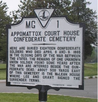
Appomattox Court House Confederate Cemetery
Photographed by Bill Coughlin, April 26, 2007
1. Appomattox Court House Confederate Cemetery Marker
Erected 1950 by Virginia Conservation Commission. (Marker Number MG-1.)
Topics and series. This historical marker is listed in these topic lists: Cemeteries & Burial Sites • War, US Civil. In addition, it is included in the Virginia Department of Historic Resources (DHR) series list. A significant historical month for this entry is April 1865.
Location. 37° 22.548′ N, 78° 48.188′ W. Marker is in Appomattox, Virginia, in Appomattox County. It is on Old Courthouse Road (Virginia Route 24), on the right when traveling west. Marker is in the Appomattox Court House National Historical Park, at the Confederate Cemetery wayside. Touch for map. Marker is in this post office area: Appomattox VA 24522, United States of America. Touch for directions.

Regionally, this marker is in the Piedmont
this page online
Other nearby markers. At least 8 other markers are within walking distance of this marker: A Strategic Delay (a few steps from this marker); Appomattox (within shouting distance of this marker); Confederate Cemetery (within shouting distance of this marker); Appomattox Confederate Cemetery Memorial (within shouting distance of this marker); The First African American School in Appomattox (about 300 feet away, measured in a direct line); Slave Cemetery (about 300 feet away); Wartime Landscape (about 300 feet away); Raine Memorial (about 300 feet away). Touch for a list and map of all markers in Appomattox.
Another marker is no longer nearby. Sears Lane (was about 300 feet away but has been permanently
Photographed by Bill Coughlin, April 26, 2007
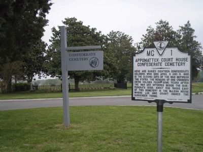
2. Confederate Cemetery Marker
The Confederate Cemetery is located a short distance from the village of Appomattox Court House.
Also see . . . Appomattox Court House National Historical Park. (Submitted on March 5, 2008, by Bill Coughlin of Woodland Park, New Jersey.)
Photographed by Craig Swain, April 18, 2010
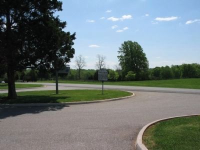
3. Appomattox Court House Confederate Cemetery Marker
Photographed by Bill Coughlin, April 26, 2007
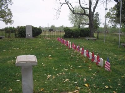
4. Civil War Graves
A Union soldier is laid to rest beside his former adversaries in the Confederate Cemetery at Appomattox Court House.
Photographed by Bill Coughlin, April 26, 2007
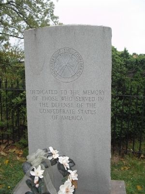
5. DOC Monument in the Confederate Cemetery
Dedicated to the memory of those who served in the defense of the Confederate States of America.
Photographed by Bill Coughlin, April 26, 2007
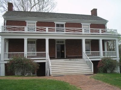
6. McLean House
In this house, Gen. Robert E. Lee surrendered the Army of Northern Virginia to Gen. Ulysses S. Grant.
Credits. This page was last revised on May 7, 2025. It was originally submitted on March 5, 2008. This page has been viewed 2,567 times since then and 68 times this year. Last updated on May 7, 2025. Photos: 1, 2. submitted on March 5, 2008, by Bill Coughlin of Woodland Park, New Jersey. 3. submitted on April 25, 2010, by Craig Swain of Leesburg, Virginia. 4, 5, 6. submitted on March 5, 2008, by Bill Coughlin of Woodland Park, New Jersey. • Bernard Fisher was the editor who published this page.
