Marker Logo HMdb.org THE HISTORICAL
MARKER DATABASE
“Bite-Size Bits of Local, National, and Global History”
Near Newgrange in County Meath, Leinster, Ireland — Mid-East (and Dublin)
 

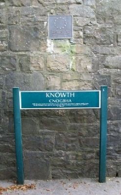
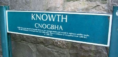
Knowth / Cnogbha


Knowth / Cnogbha Marker image. Click for full size.
September 21, 2009
1. Knowth / Cnogbha Marker
Inscription.

Within the great mound of Knowth there are two passage-tombs and around it, eighteen satellite tombs. The site remained a focal point for over 4,000 years. There is evidence of occupation from 3,000 B.C. to 1,200 A.D.

This project has been part-financed by the European Regional Development Fund
 
Erected by Office of Public Works / Oifig na nOibreacha Poiblí.
 
Topics. This historical marker is listed in these topic lists: Anthropology & ArchaeologyCemeteries & Burial SitesLandmarksMan-Made FeaturesSettlements & Settlers.
 
Location. 53° 42.105′ N, 6° 29.45′ W. Marker is near Newgrange, Leinster, in County Meath. Marker is at the access gate to the Knowth Megalithic Tombs, on the road between the villages of Newgrange and Crewbane. Entrance to this World Heritage Site is by guided tour from the Brú na Bóinne Visitors Centre (at 53° 41.674′ N, 6° 26.778′ W), about 1.5 miles west of the village of Donore. Touch for map. Touch for directions.
 
Other nearby markers. At least 8 other markers are within 8 kilometers of this marker, measured as the crow flies. The Woodhenge/Pit circle / The Winter Soltice (approx. 1.4 kilometers away); Saint Patrick on the Hill of Slane (approx. 3.8 kilometers away); Slane Abbey
Paid Advertisement
Click on the ad for more information.
Please report objectionable advertising to the Editor.
Click or scan to see
this page online
(approx. 3.8 kilometers away); Duleek 1916 - 1981 Hunger Strike Monument (approx. 6.6 kilometers away); St Mary's Abbey (approx. 7 kilometers away); Connell's House (approx. 7.1 kilometers away); Parochial House (approx. 7.1 kilometers away); The Lime Tree (approx. 7.1 kilometers away).
 
Also see . . .  Knowth Megalithic Passage Tomb. (Submitted on February 6, 2010.)
 
Knowth / Cnogbha Marker image. Click for full size.
September 21, 2009
2. Knowth / Cnogbha Marker
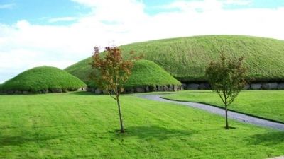
Knowth Great and Lesser Mounds image. Click for full size.
September 21, 2009
3. Knowth Great and Lesser Mounds
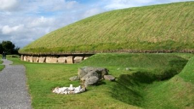
Knowth Great Mound image. Click for full size.
September 21, 2009
4. Knowth Great Mound
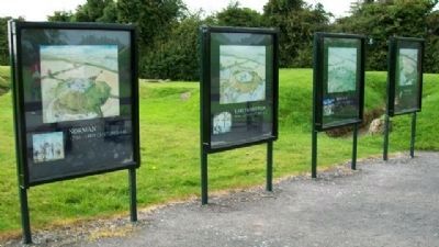
Evolution of the Knowth Great Mound Markers image. Click for full size.
September 21, 2009
5. Evolution of the Knowth Great Mound Markers
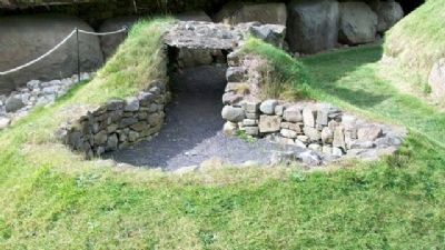
Adjacent to Great Mound; guide provides history using the markers.
Structure Adjacent to Great Mound image. Click for full size.
September 21, 2009
6. Structure Adjacent to Great Mound
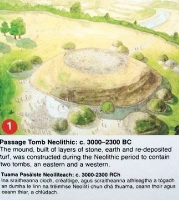
Passage Tomb Neolithic: c.3000-2300 BC image. Click for full size.
September 21, 2009
7. Passage Tomb Neolithic: c.3000-2300 BC
[on Structure Marker inside Great Mound]

The mound, built in layers of stone, earth and re-deposited turf, was constructed during the Neolithic period to contain two tombs, an eastern and a western.
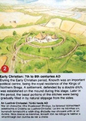
Early Christian: 7th to 8th centuries AD image. Click for full size.
September 21, 2009
8. Early Christian: 7th to 8th centuries AD
[on Structure Marker inside Great Mound]

During the Early Christian period, Knowth was an important political centre, being the royal residence of the Kings of Northern Brega. A settlement, defended by a double ditch, was established on the mound during this stage. Later in the period, the basal portions of the ditches were being gradually filled in by natural slippage from the sides.
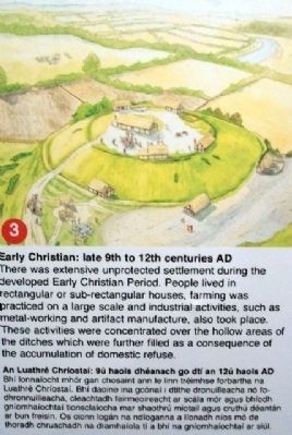
Early Christian: late 9th to 12th centuries AD image. Click for full size.
September 21, 2009
9. Early Christian: late 9th to 12th centuries AD
[on Structure Marker inside Great Mound]

There was extensive unprotected settlement during the developed Early Christian Period. People lived in rectangular or sub-retangular houses, farming was practiced on a large scale and industrial activities , such as metal-working and artifact manufacture, also took place. These activities were concentrated over the hollow areas of the ditches which were further filled as a consequence of the accumulation of domestic refuse.
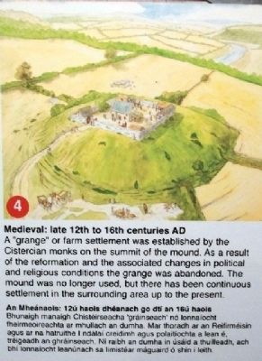
Medieval: late 12th to 16th centuries AD image. Click for full size.
September 21, 2009
10. Medieval: late 12th to 16th centuries AD
[on Structure Marker inside Great Mound]

A "grange" or farm settlement was established by the Cisterican monks on the summit of the mound. As a result of the reformation and the associated changes in political and religious conditions the grange was abandoned. The mound was no longer used, but there has been continuous settlement in the surrounding area up to the present.
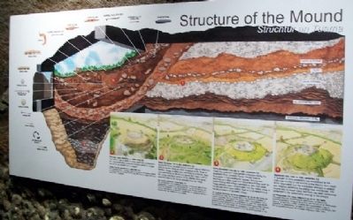
Structure of the Mound Marker image. Click for full size.
September 21, 2009
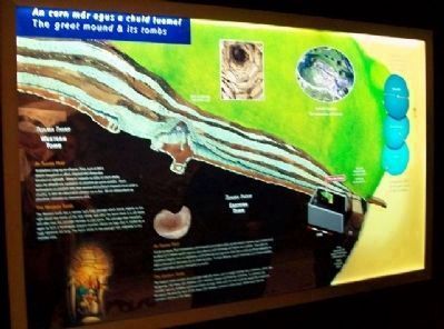
11. Structure of the Mound Marker
[Inside Great Mound]

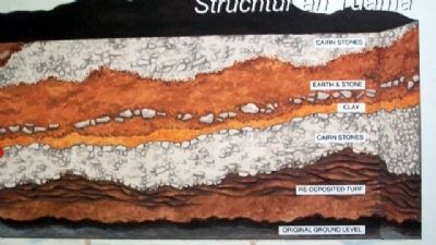
Structure of the Mound Marker Detail image. Click for full size.
September 21, 2009
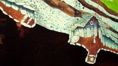
12. Structure of the Mound Marker Detail
[on Structure Marker inside Great Mound]

Showing mound layers
The great mound & its tombs Marker image. Click for full size.
September 21, 2009
13. The great mound & its tombs Marker
[Inside Great Mound]

The Eastern Tomb
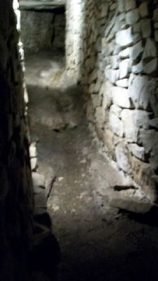
The Eastern tomb consists of a passage originally about 35m in length leading into a chamber, which, like Newgrange, has three side recesses and a beehive shaped roof built by corbelling. To construct the chamber roof the builders overlapping layers of large rocks until the roof could be sealed by a capstone 6m above the ground. Each of the three side recesses contains a stone basin which once held the cremated reamins of the dead.

The Western Tomb
The Western tomb has a narrow 34m long passage which bends slightly to the right about two thirds of the way along. Just after the bend there is a sill stone and after that the passage narrows to just 40cm. The passage then broadens again to form a rectangular shaped chamber about 2m high that is roofed by a huge capstone 2m long. The basin stone in the passage was originally in the chamber area.
The great mound & its tomb Marker Detail image. Click for full size.
September 21, 2009
14. The great mound & its tomb Marker Detail
[Inside Great Mound]

Drawing showing the Western Tomb (left) and the Eastern Tomb (right).
Comparative Plans of the Great Tumuli of Brú na Bóinne image. Click for full size.
September 21, 2009
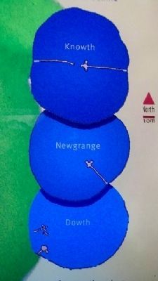
15. Comparative Plans of the Great Tumuli of Brú na Bóinne
On "The great mound & its tombs Marker" inside Great Mound.
Knowth Eastern Passage image. Click for full size.
September 21, 2009
16. Knowth Eastern Passage
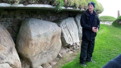
Neolithic Design on Great Mound Rock Base image. Click for full size.
September 21, 2009
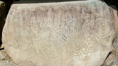
17. Neolithic Design on Great Mound Rock Base
Guide Explaining Neolithic Designs on Great Mound Base image. Click for full size.
September 21, 2009
18. Guide Explaining Neolithic Designs on Great Mound Base
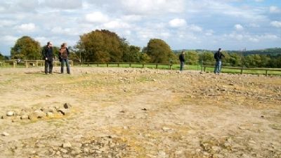
Flat Area on Top of Knowth Great Mound image. Click for full size.
September 21, 2009
19. Flat Area on Top of Knowth Great Mound
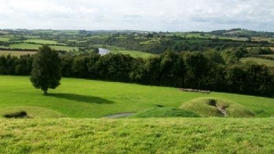
View of Boyne River Valley From Top of Knowth Great Mound image. Click for full size.
September 21, 2009
20. View of Boyne River Valley From Top of Knowth Great Mound
Looking west.
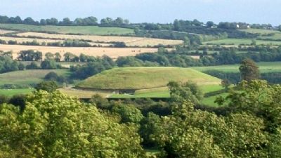
Newgrange Megalithic Mound image. Click for full size.
September 21, 2009
21. Newgrange Megalithic Mound
From top of Knowth Great Mound. Looking southeast.
 
 
Credits. This page was last revised on July 24, 2018. It was originally submitted on February 6, 2010, by William Fischer, Jr. of Scranton, Pennsylvania. This page has been viewed 1,213 times since then and 5 times this year. Photos:   1, 2, 3, 4, 5, 6, 7, 8, 9, 10, 11, 12, 13, 14, 15, 16, 17, 18, 19, 20, 21. submitted on February 6, 2010.
Share this page.  
Share on Tumblr
m=27219

CeraNet Cloud Computing sponsors the Historical Marker Database.
This website earns income from purchases you make after using our links to Amazon.com. We appreciate your support.
Paid Advertisement
Apr. 24, 2024