The St. Marys River
The Canadian Heritage Rivers System
⎯⎯⎯
La rivière Sainte-Marie
Le Réseau de rivières du patrimoine canadien
| — | February / Février 2000 | — |


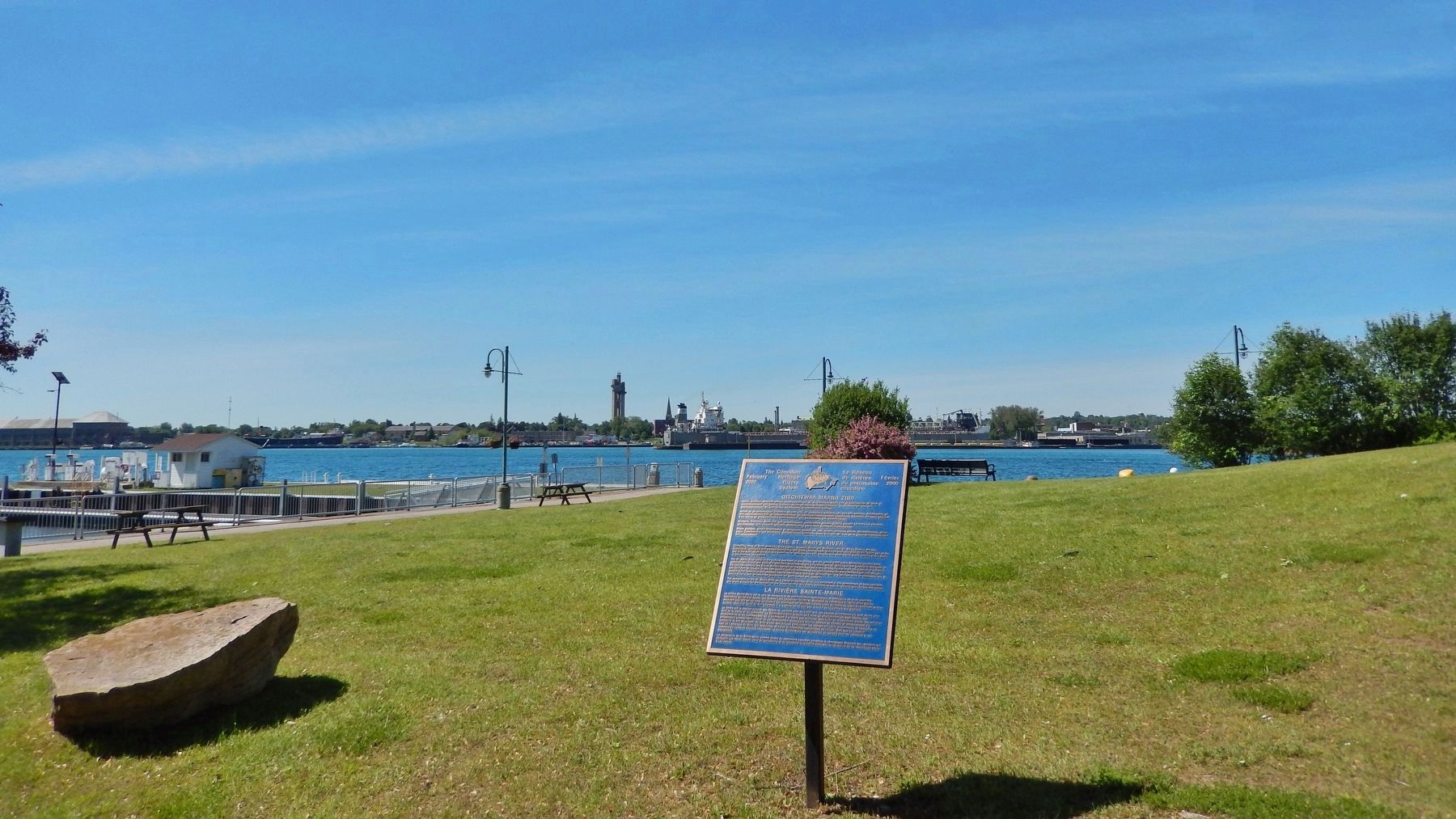
The St. Marys River valley is the cultural heartland of the Ojibwe, and for almost 5,000 years Aboriginal peoples have gathered here to fish and trade. For explorers, missionaries and fur traders, the St. Marys was the gateway to the west. In the late 18th century, the British military recognized the value of the river’s strategic location for the defence of Canada, and built Fort St. Joseph. In the 19th century, locks circumventing the rapids connected the commerce and industry of eastern North America to the untapped natural resources to the west. Although still a significant route of commerce, the St. Marys River is now an important playground for sport fishers and boaters.
The designation of the St.
this page online
La rivière est le bastion culturel des Ojibwe et, pendant près de 5000 ans, les peuples autochtones s’y sont réunis pour faire de la pêche et du commerce. La Sainte-Marie était la route de l’ouest qu’empruntaient les explorateurs, les missionnaires et les commerçants qui s’adonnaient à la traite des fourrures. Vers la fin du dix-huitième siècle, les militaires britanniques comprennent l’intérêt de cet emplacement stratégique pour la défense
La désignation de la Sainte-Marie comme rivière du patrimoine canadien constitue le témoignage éloquent des résidants qui partagent une même vision, celle de reconnaître et de préserver la vocation culturelle et récréative de ce magnifique cours d’eau naturel.
Topics. This historical marker is listed in these topic lists: Forts and Castles • Indigenous Peoples and Communities • Industry & Commerce • Waterways & Vessels.
Location. 46° 30.495′ N, 84° 20.194′ W. Marker is in Sault Ste. Marie, Ontario, in Algoma District. It can be reached from Foster Drive just north of Spring Street, on the left when traveling north. The marker is located in front of the Roberta Bondar Marina, near the Hub Trail, and overlooking the St. Mary's River. Touch for map. Marker is at or near this postal address: 99 Foster Drive, Sault Ste Marie ON P6A 5X6, Canada. Touch for directions.

Regionally, this marker is in the Sault Ste. Marie and Algoma Area and in Northern Ontario. It is also in Central Canada. Globally, it is in North America, in the Great North Woods, on the Great Lakes, on Lake Superior’s North Shore, in the Western Hemisphere, in the Western World, and in the Anglosphere. Historically, it finds itself in what was once a British colony, the Viceroyalty of New France, the Haudenosaunee (Iroquois) Confederacy, and Rupert’s Land.
Other nearby markers. At least 8 other markers are within walking distance of this marker: Roberta Bondar Park (within shouting distance of this marker); Passenger and Packet Freighters on the Upper Great Lakes (about 90 meters away, measured in a direct line); Dr. Roberta Bondar (about 120 meters away); Gathering Place (about 150 meters away); Edison Sault Electric Building (approx. 0.2 kilometers away); William Henry “Bill” Orazietti (approx. 0.3 kilometers away); Spirits Rising (approx. 0.3 kilometers away); Anna Jameson (approx. 0.3 kilometers away). Touch for a list and map of all markers in Sault Ste. Marie.
Also see . . .
1. The St. Marys River: Cultural Heritage.
Excerpt: As early as 2,500 BCE the Ojibwe people had established settlements on islands and along the shore of the river to harvest the abundant whitefish. The Métis people of Canada originated in the valley, and the Batchewana and Garden River First Nations still live along the river’s shores.(Submitted on May 9, 2025, by Cosmos Mariner of Cape Canaveral, Florida.)After its exploration in 1621 by Étienne Brule, the St. Marys became a key part of the fur trade route. Fort St. Joseph was built in 1796 in part for traffic control on this busy route, as well as for its crucial strategic location, which ensured the area remained under British control during the War of 1812.
The first commercial lock around the rapids was built on the American side of the river in 1855. In 1895, the Canadian Sault Ship Canal — at the time the most advanced in the world — was completed. For many years, the combined American and Canadian “Soo Locks” were the busiest such systems in the world.
2. The Great Lakes of America: Saint Marys River.
Excerpt: The Saint Marys River begins at the downstream end of Whitefish Bay in Lake Superior. Over its course, the river runs approximately 77 nautical miles before passing through De Tour Passage into Lake Huron. At Sault Ste. Marie, the Soo locks allow ships to bypass an otherwise unnavigable stretch of the river.(Submitted on May 9, 2025, by Cosmos Mariner of Cape Canaveral, Florida.)The Saint Marys River is designated as a Canadian Heritage River by the Canadian Heritage Rivers System (CHRS). The river forms part of the International Boundary separating Canada and the United States.
Credits. This page was last revised on May 9, 2025. It was originally submitted on May 8, 2025, by Cosmos Mariner of Cape Canaveral, Florida. This page has been viewed 232 times since then and 69 times this year. Photos: 1, 2. submitted on May 8, 2025, by Cosmos Mariner of Cape Canaveral, Florida.
